Download
1 / 2
20 likes | 267 Views
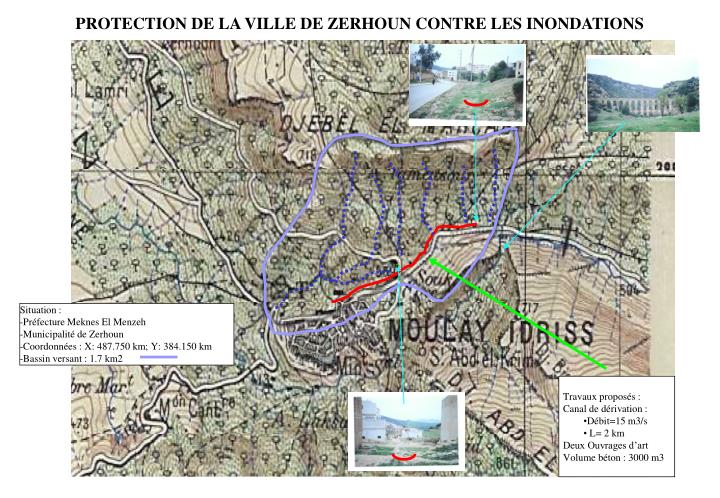
Situation : Préfecture Meknes El Menzeh Municipalité de Zerhoun Coordonnées : X: 487.750 km; Y: 384.150 km Bassin versant : 1.7 km2. PROTECTION DE LA VILLE DE ZERHOUN CONTRE LES INONDATIONS. ". ". Travaux proposés : Canal de dérivation : Débit=15 m3/s L= 2 km Deux Ouvrages d’art

E N D
Situation : • Préfecture Meknes El Menzeh • Municipalité de Zerhoun • Coordonnées : X: 487.750 km; Y: 384.150 km • Bassin versant : 1.7 km2 PROTECTION DE LA VILLE DE ZERHOUN CONTRE LES INONDATIONS " " • Travaux proposés : • Canal de dérivation : • Débit=15 m3/s • L= 2 km • Deux Ouvrages d’art • Volume béton : 3000 m3
Protection du centre Nzala de Bni Ammar contre les inondations Nzala de Bni Ammar • Travaux proposés : • Surélévation de la route sur 700 ml • Réalisation de deux ouvrages d'art • Curage et recalibrage du lit des chaabats • Situation : • Préfecture Meknes El Menzeh • Commune (CR): Bni Ammar • - Coordonnées : X: 496.700 km; Y: 391.550 km