Download
1 / 14
180 likes | 535 Views
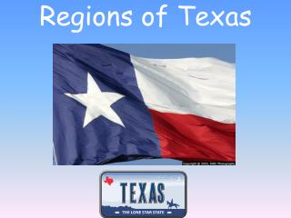
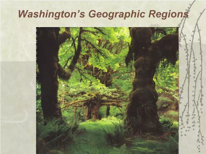
Washington’s Geographic Regions. Washington can be divided into 5 geographic regions. On the west Western Lowlands and the Coastal Region and the Cascade Mountains running down the center of the state

E N D
Washington can be divided into 5 geographic regions • On the westWestern Lowlands and the Coastal Regionand the Cascade Mountains running down the center of the state • The Rocky Mountain Gateway in the interior which consists of the Okanogan Highlandsin the northeast and the Columbia Plateau
Western Lowlandsand theCoastal Regionon the west Puget Sound Basin Puget Sound Basinis the economic and demographic nucleus of Washington. It contains the Seattle Metropolitan Area and further south, the state capital of Olympia.
Western Lowlandsand theCoastal Regionon the west Seattle/King County The Puget Soundregion is the economic center of Washington. Settlement began in the 1840's, starting from the Oregon Territory then gradually moving north. Small communities developed along the shores of Puget Sound, beginning with Tumwater and then to Seattle and beyond. The region goes from the crest of the Cascades on the east to the Kitsap Peninsulaon west. Thurston County, contains the state capital Olympia, at the southern edge. Many people use the term "Puget Sound" to include the waters all the way to Canada, but north of Whidbey Island is not really part of Puget Sound. The other major cities are Tacoma, Everett, Bellevue, and Federal Way.
Western Lowlandsand theCoastal Regionon the westOlympic and Kitsap Peninsulas The Olympic Peninsula is sparsely populated but important to Washington for its natural resources and for its attractiveness for visitors. Most of the peninsula belongs to the federal government and is contained in either the Olympic National Park or Olympic National Forest. Most of the population is at the northern edge in: • Port Angeles • Port Townsend • Forks • Sequim Grays Harbor is in the southwest corner, with its twin cities of Hoquiam and Aberdeen. Shelton is in the southeast corner.
Puget Sound Lowlandsand theCoastal Regionon the westTemperate Rainforest • The most famous temperate rainforest in the United States is in the Olympic National Park of Washington State. • It is locates on the western slope of an Olympic Mountainswhere it gets about 200 inches of rain per year. • Olympic National Parkis remote and difficult to access, but it is heaven for backcountry enthusiasts willing to make the effort. The peninsula is sparsely populated except for coastal cities such as Port Townsend.
Western Lowlandsand theCoastal Regionon the westSan Juan Islands • North of Puget Soundlie the Emerald Coast and the San Juan Islands. The San Juans, which are accessible by ferry, are known for their unspoiled beauty and their wildlife, particularly orcas. On the west lies the Olympic Peninsula, whose rain forests see as much as 150 inches of annual precipitation.
Washington's Cascade Mountains running down the center of the stateCascade Mountain Range The Washington Cascadesare part of the Cascade Mountain Rangewhich extends from British Columbia to California. They separate the moist and mild coastal side from the drier interior of Eastern Washington. Offering hundreds of miles of hiking, snow-shoeing and cross-country skiing trails; many ski resorts; and countless opportunities for camping, backpacking and mountain climbing in one of the world's most beautiful and accessible mountain ranges. The Cascade Mountainsare a young range whose volcanoes are still active. There are five volcanoes in the Washington Cascades: • Glacier Peak • Mount St Helens • Mount Adams • Mount Rainier • Mount Baker
Washington's Cascade Mountains running down the center of the stateMount Rainier • Mount Rainier, the tallest peak in the Cascades, is officially dormant but may explode one day in a similar manner as did before Mount Saint Helens. Nevertheless, most scientists believe that the two million annual visitors to Mount Rainier National Park with be safe for at least another 5 centuries.
Washington's Cascade Mountains running down the center of the stateMount Saint Helens • Mount St Helens, in the south of the state, lost 1,300 feet in height when it blew its top on May 18, 1980.
Rocky Mountain Gateway Deserts of the Columbia River turn to rolling wheat fields of the Palouseas you move farther east. Spokane as the major city center. • Most of the irrigation, comes from the Grand Coulee Dam; even the dry parts have become important agriculturally where they grow apples, wheat and major food products. Other cities are Walla Wallaand the tri-cities of Richland, Kennewick and Pasco. Pullman, which is the home of Washington State University.
the Okanogan Highlandsin the northeast and the Columbia PlateauColumbia Plateau • The Columbia Plateau is a major agricultural region. It receives less rainfall than the rest of the state, but there is adequate water from the rivers which run through it to irrigate the crops. The dry climate also proves attractive to residents from Western Washington looking for a respite during the long rainy season.
the Okanogan Highlandsin the northeast and the Columbia PlateauGrand Coulee Dam • Harnessing the Columbia Riverfor irrigation, power and flood control, the dam is said to be the most massive concrete structure in the world.The dam is 550 feet high, 500 feet wide at its base and 5,223 feet long. It is also the 3rd largest producer of electricity in the world. The reservoir impounded by the dam is called Franklin D Roosevelt Lake. Communities sprang up during construction and have remained during the operation of the dam, including Electric City, Grand Coulee, and the town of Coulee Dam.