Download
1 / 24
240 likes | 361 Views
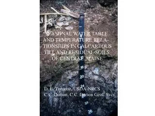
“SEASONAL WATER TABLE AND TEMPERATURE RELA- TIONSHIPS IN CALCAREOUS TILL AND RESIDUAL SOILS OF CENTRAL MAINE” . D. E. Turcotte, USDA-NRCS C.C. Dorion, C.C. Dorion Geol. Svcs. . Coarse-Loamy Sebasticook Catena (introduced in 2008).

E N D
“SEASONAL WATER TABLE AND TEMPERATURE RELA- TIONSHIPS IN CALCAREOUS TILL AND RESIDUAL SOILS OF CENTRAL MAINE” D. E. Turcotte, USDA-NRCS C.C. Dorion, C.C. Dorion Geol. Svcs.
Coarse-Loamy SebasticookCatena (introduced in 2008) * Series yet to be established (typical pedon yet to be decided on) ** Comparable to well drained, very deep Lombard series out of NH Series in bold are the basis of water table study in Central Maine
TypicalCharacteristicsofSebasticookCatenasoils → Strongly acid to neutral till and/or moderately acid to slightly alkaline residuum of Waterville (and presumably Sangerville) Formation lime- interbedded phyllite, calcareous metasiltstone and pelitic limestone → Mapped thus far in towns of Exeter, Corinth, Corinna, Stetson, Newport, Garland and Bradford in Southern Penobscot County → Parachanners or decayed rock fragments in till, or paralithic materials or saprolite as residuum → Negligible podzolization (even in late successional to climax forest) → Minimal O horizon in deciduous or northern white cedar forests → Blocky structure and more friable consistence in substratums and/or deeper sola
1985 Bedrock Geologic Map of Maine Maine Geological Survey
Objectives of Central Maine Water Table Study 1o : testing for moisture regime, pedon classification, and apparent versus perched water tables 2o: a) define each soil’s drainage class; b) evaluate soil temperature early and late in the growing season in the Ap horizons of Wassookeag soils; c) compare the start and end of the growing season based on -2.2 o C or 0 o C frost-free season thresholds, soil temperature @ 10 cm, water temperature in wells, and soil temperature @ 50 cm; and d) compare daytime air temperatures between spring and fall seasons and between field and forest settings
ExperimentalDesignofCentralMaineWaterStudy > 3 forested somewhat poorly drained Kenduskeag soils on 2-4% slope 3 cropped moderately well drained Wassookeag soils on 1-3% slope > 2/3rds of sites in the town of Corinth & 1/3rd in the town of Exeter > pedons described and sampled (for NSSL analyses) in 2002 and sites monitored during spring & fall 2002 - 2005 (two lost in 2004) > PVC well with perforations @ 15 to 100 cm and PVC piezometer with perforations @ 85 to 100 cm installed at each site > sites monitored weekly for water tables in wells and piezometers, soil temperature @ 10 cm and 50 cm, water temperature in well, air temperature, and precipitation (via rain guages) > wet soil at Kenduskeag sites tested with a, a-dipyridyl in 2003
Co-author C.C. Dorion assisting in the description and sampling of Wassookeag pedon on till plain at monitoring site by Countryside Restaurant off Rt. 15 in Corinth
Wells and Piezometers(courtesy of Dr. Jay Bell, Univ. of Minn.) Well Water Enters Entire Length Piezometers Water Enters End Only
PiezometerInstallation Piezometer Mound Bentonite Clay Seal Soil Backfill (courtesy of Dr. Jay Bell, Univ. of Minn.) Sand
Bentonite being poured around upper portion of well or piezometer (installed per Sprecher, S.W. 2000. Installing monitoring wells / piezometers in wetlands. U.S. Tech. Note ERDC TN-WRAP-00-02, Army Corps of Eng)
Page 179 of the 11th edition of the Keys to Soil Taxonomy KGEJ. Other Eutrudepts that meet both of the following: 1. In one or more horizons within 60 cm of the mineral soil surface, have redox depletions with chroma of 2 or less and also aquic conditions for some time in normal years (or artificial drainage); and 2. Do not have free carbonates throughout any horizon within 100 cm of the mineral soil surface. Aquic Dystric Eutrudepts KGEL. Other Eutrudepts that in normal years are saturated with water in one or more layers within 100 cm of the mineral soil surface for either or both: 1. 20 or more consecutive days; or 2. 30 or more cumulative days. Oxyaquic Eutrudepts
CorinnaDailyNOAAClimaticStation ANNUAL 1 ABNORMALLY 3 ABNORMALLY 3 PRECIPI- WET OR DRY WET OR DRY TATION NORMAL MONTHS MONTHS YEAR (millimeters) YEAR? 2 (DEC. – JULY) (AUG. – NOV.) __________________________________________________________________________________ 1based on sum of December – November monthly totals 2 Soil Survey Staff, 2010 3 Outside of the standard deviation of the 30 year mean for that month
Water tables in monitoring wells above 100 cm during normal precipitation seasons at Wassookeag sites during growing season based on soil temperatures above biological zero (5o C) @ 50 cm * water table was present within 100 cm when growing season commenced ** water table was present within 100 cm before growing season commenced *** water table was present within 100 cm at least 13-15 days after growing season concluded
Wassookeag pedon at Exeter cropland site off of Route 43 (described and sampled on May 21, 2002) 2C1 saprolite: 61-73 cm 2C2 saprolite: 73-119 cm (increase in < 2 chroma lithochromic in nature)
Water tables in monitoring wells at the Kenduskeag sites that rose above 40 cm depth during normal precipitation seasons when well water was > 5o C * Out of 48 applications in this season and in the following (abnor- (mally wet) fall, on only one occasion was there a positive reaction to alpha,alpha-dipyridyl (as a test for an aquic moisture regime)
Redoximorphic features in clod from Kenduskeag pedon >>> Decayed fragments in clod from Kenduskeag pedon >>>
Perched Water Table (courtesy of Dr. Jay Bell, Univ. of Minn.) Soil Saturated ? Aquitard (Unsaturated) Substratum (Unsaturated)
* In one instance (5% frequency) there was water in the well (at 92 cm) below the top of the substratum while there was no water in the piezometer.
Growing season comparisons based on Corinna air temperature lows (and soil or water temperatures from averaged Kenduskeag or Wassookeag sites) * Exeter sites not monitored in Fall 2004 and 2005 (Wassookeag) or just 2005 (Kenduskeag)
CONCLUSIONS 1) water table and soil temperature data support moderate well to well drainage and the oxyaquic subgroup for the Wassookeag series 2) water table and soil temperature data and negative a, a-dipyridyl reactions support somewhat poor drainage and the aquic dystric subgroup for the Kenduskeag series 3) though the upper site was flatter, heavier textured and close to a hydric map unit, the lower landscape position Kenduskeag site in Corinth was consistently wetter 4) water table observations in the wells and piezometers at the Corinth Kenduskeag sites suggest that water tables are apparent 5) growing seasons based on air temperature or plow layer temperature were comparable to those based on soil temperature @ 50 cm or well water temperature in the spring, but not so in the fall when they ended much sooner 6) afternoon air temperatures were significantly cooler in the fall seasons than in the spring seasons, but forested sites were not cooler than field sites