Download
1 / 18
180 likes | 253 Views
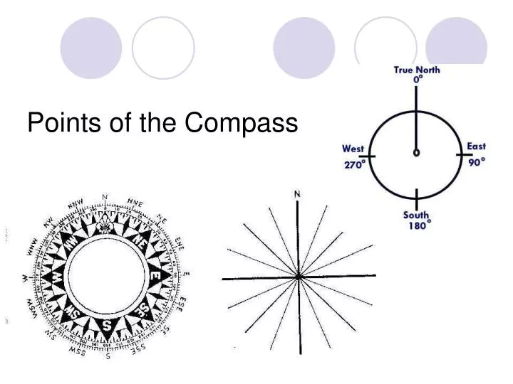
Points of the Compass. Degrees, Minutes, Seconds. There are 360 o degrees around a circle Each degree can be divided into 60’ minutes Each minute can be divided into 60” seconds. X. Global Positioning.

E N D
Degrees, Minutes, Seconds • There are 360o degrees around a circle • Each degree can be divided into 60’ minutes • Each minute can be divided into 60” seconds
Global Positioning • We can use lines parallel to the equator and lines between the poles to position objects on the surface 30oN Lat 60oW Long
Latitude 90 degrees North Latitude 0 degrees Latitude (Equator) 90 degrees South Latitude
0 degrees Longitude at Greenwich, England
500 Use the scale to measure distance UNITS MUST MATCH Contour Interval, Scale, Series, Sectors • Every point on a contour line represents the exact same elevation • Contour lines can never cross one another. • Moving from one contour line to another always indicates a change in elevation. • On a hill with a consistent slope, there are always four intermediate contours for every index contour. • The closer contour lines are to one another, the steeper the slope http://geology.isu.edu/geostac/Field_Exercise/topomaps/topo_interp.htm
Making a Topo Map • Suppose you measured elevations and positions with your GPS • Use the Latitudes and Longitudes you measured and lay out the elevations • Pick an elevation you will draw
Making a Topo Map • Pick an elevation you will draw • Find a place with two nearby elevations, one larger, one smaller
Making a Topo Map • Pick an elevation you will draw • Find a place with two nearby elevations, one larger, one smaller • Place a X where the elevation would lie
Making a Topo Map • Pick an elevation you will draw • Find a place with two nearby elevations, one larger, one smaller • Place a X where the elevation would lie • Repeat and connect the X’s
Drawing a Cross-Section • (Elevation Profile) • Hold a sheet of paper along line • Mark contours • Write elevation next to each
Make a vertical scale (usually exaggerated) • Make a dot at each contour at its elevation
Connect the dots for your elevation profile • Later we will use these to make geologic cross sections • Topo Maps, Air Photo Pairs, GPS, etc