Understanding the GPS System: Global Navigation and Positioning Technology
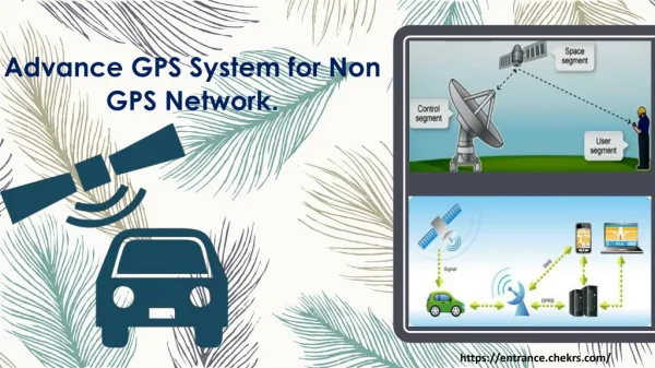
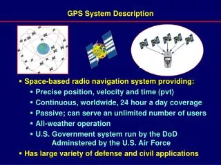
The GPS (Global Positioning System) is a space-based radio navigation system that provides precise position, velocity, and time (PVT) information anywhere on Earth, 24 hours a day. It operates continuously, is passive, and can serve an unlimited number of users under all weather conditions. Managed by the U.S. Department of Defense and the Air Force, GPS supports numerous defense and civil applications. Users calculate their positions by measuring pseudoranges to satellites, utilizing a constellation of satellites that ensures global coverage.

Understanding the GPS System: Global Navigation and Positioning Technology
E N D
Presentation Transcript
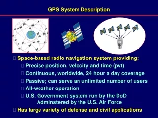
GPS System Description • Space-based radio navigation system providing: • Precise position, velocity and time (pvt) • Continuous, worldwide, 24 hour a day coverage • Passive; can serve an unlimited number of users • All-weather operation • U.S. Government system run by the DoD Adminstered by the U.S. Air Force • Has large variety of defense and civil applications
~ ~ ~ ~ GPS Position Determination Technique X2, Y2, Z2 t2 t3 Time for S1 X3, Y3, Z3 X1, Y1, Z1 t1 t4 GPS S3 X4, Y4, Z4 GPS S2 (P2) (P3) GPS S4 S1 Position (P1) GPS S1 (P4) R2 R3 R1 R4 User measures pseudoranges to satellites (R1, R2, R3, R4) User receives and stores data on satellite locations (P1, P2, P3, P4) and their motion P0 User tu 135.1-1 A504f
Space Segment GPS System Segments User Segment Monitor/ Uplink Stations Colorado Springs ¹Hawaii Kwajalein Ascension Island Diego Garcia ²Cape Canaveral, FL Control Segment Headquarters Colorado Springs Schriever AFB Backup OCS Vandenberg AFB ¹ Monitor station only ² Uplink station only Backup OCS Gaithersburg, MD 135.1-1/111-1 V006g
The Navstar GPS Operational Constellation(24 Satellite Baseline Configuration) Note: As of 2004-05, there are about 28-30 S/C in the constellation. 135.1-1/111-1 A401f
Garmin iQue GPS Palm OS