Download
1 / 64
650 likes | 973 Views
Earthquakes. 6.1 Earthquakes and Plate Tectonics 6.2 Recording Earthquakes 6.3 Earthquake Damage. Earthquake images from Japan. Earthquakes.

E N D
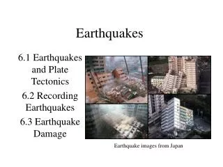
Earthquakes 6.1 Earthquakes and Plate Tectonics 6.2 Recording Earthquakes 6.3 Earthquake Damage Earthquake images from Japan
Earthquakes • Earthquakes can be caused by a variety of events – volcanic eruptions, meteor impacts, caverns collapsing, but most are due to the movement of the Earth’s tectonic plates • About 3 million occur each year (about one every 10 seconds) – but most are too small to be noticed
Earthquakes • They are part of the natural process of rocks moving past each other as plates move over the Earth’s surface • It’s when the plates can’t move, that the little ones don’t happen, and pressure builds towards a large earthquake
Elastic Rebound Theory • Earthquakes occur when rocks under stress suddenly shift along a fault • Rocks along a fault rub together as plates pass but when they can’t they become “locked” and pressure – stress- increases until the point where the stress is so great they fracture and slip past each other at their weakest point • The “slippage” is what causes the ground to vibrate • After slipping the rocks rebound or return to their original shape (but at different locations than before)
Elastic Rebound Theory • The energy that has built up in the stressed rocks is quickly released in vibrations called seismic waves • These waves often increase stress in other areas of the fault that then also fracture and rebound in a series of aftershocks • The point where slippage first occurs is the focus of the earthquake, the point directly above this on the surface is the epicentre
Note: the focus in some documents is also called the hypocenter
Elastic Rebound Theory • Seismic waves move out in all directions from the epicentre • 90% of earthquakes have a shallow focus of 70 km or less such as along mid ocean ridges and transform boundaries • These are the ones that cause the most damage
Elastic Rebound Theory • Intermediate focus earthquakes occur between 70-300 km • Deep focus earthquakes occur between 300-650 km • For example, as found in subduction zones
Earthquake zones • Most earthquakes are associated with the edges of tectonic plates where the moving plates exert the greatest strain on the rock • The largest earthquake zone is the Pacific Ring of Fire (mainly convergent boundaries) • The next major zone is along mid ocean ridges (at divergent boundaries) or along rifts • The third zone is along the Eurasian Mountain belt (which is a collision boundary)
Seismic zones in India – zone V is the highest risk area for earthquakes of magnitude 8 or more.
Earthquakes in Lebanon occur as a result of the African Rift Valley, which extends from Lebanon in the north in Middle East to Mozambique in the south in Africa. The Rift valley is the result of normal fault in which two tectonic plates moving away from each other, forcing the uplifting of one of the two plates. As a result of tensional forces beneath, earthquakes can occur. An earthquake struck Lebanon in A.D. 551 destroying everything from terrestrial to marine creatures. The tremor was so severe that it resulted in a tsunami, drowning major coastal cities from Tripoli to Tyr to Berytus (Beirut). A major tremor is possible in the Middle East
Fault zones • Groups of interconnected faults are often found at plate boundaries • The San Andreas fault is a good example of this, with new faults being uncovered all the time • Sometimes ancient fault zones are the cause of earthquakes even though they are no longer part of a current plate boundary
Fault zones • This explains why areas such as Eastern North America sometimes experience earthquakes along what were once the edges of ancient plates, or where terranes were forced onto other continents in the past • Examples • New Madrid 1812, Tennessee and Kentucky and along the Appalachians • Ontario and Quebec along the Laurentian and Gatinaeu hills
Recoding Earthquakes • Seismic waves are recorded using a seismograph and are recorded on a seismogram • Three motions are monitored – vertical movements of the ground, motion in an east-west direction and motion in north-south directions • Each of these motions travel at different speeds, mover differently through different types of rock and have different effects on the crust
Primary waves • Also known as P waves or compressionwaves and are the first to be recorded • This means they move the rock particles together and apart in the direction of the wave • Move the fastest and are the first to be recorded • Travel through solids and liquids • The more ridged the material the faster the waves move through it
Secondary waves • Also known as S waves or shear waves • Cause rock particles to move are right angles to the direction in which the wave is traveling • These are the second waves to be recorded • These can travel only through solid material • Therefore these cannot be detected on the opposite side of the Earth because they cannot travel through the Earth’s liquid outer core
Surface waves • These are the combined effects of the P and S waves when they reach the surface • These are the slowest moving waves, the last to be recorded and the most destructive • They move slowly over the surface like an ocean wave (causing the surface to rise and fall) • These are particularly destructive in loose earth
S-P lag time allows the calculation of distance from your location to the epicenter
Locating the Epicentre • The difference in arrival times of the P and S waves allows triangulation of the earthquake’s epicentre • P waves travel about 1.7 times faster than S waves • The greater or smaller the time the S waves are recorded the closer the epicentre is • Recording from three stations at different locations allows the epicentre to be located (triangulated) • There are over 2500 stations in the United States alone
P waves travel faster and arrive at the station first S waves arrive later Since the speed at which wave travels is known, the time lag lets you calculate how far away the epicentre is
Each station knows the distance to the epicentre but not it’s direction. When the data from three stations are plotted, the point where they intersect locates the epicentre.
Measuring Earthquakes • Magnitude is a measure of the energy released but an earthquake • This also describes the amount of ground motion • The Richter scale is one type of moment magnitude scale • This is a logarithmic scale where each magnitude is 31 times more powerful than the previous one • Because it only measures the intensity of ground movements this scale has limitations, especially for large earthquakes
Measuring Earthquakes • Moment Magnitude scales • This type of scale more accurately indicates the total energy involved with an earthquake • For example, comparing the scales: 1906 San Francisco Richter 8.3 / MM 7.9 1965 Alaska Richter 8.5 / MM 9.2 because it was along a larger fault plane
Measuring Earthquakes • The Mercalli scale expresses the intensity of the quake based on the amount of damage it causes
Earthquake damage • Most injuries and damage are caused not by the earth moving but by the collapse of buildings/structures and falling objects • Dams can be destroyed resulting in floods, gas lines are cut resulting in fires • Tsunamis often result from sea floor quakes
The Hawaiian Islands are especially vulnerable to destructive tsunamis generated by major earthquakes in the circum-Pacific Ring of Fire. Travel times (in hours) are shown for the tsunamis produced by the 1960 Concepción, Chile, earthquake (purple curves) and by the 1964 Good Friday, Valdez (Anchorage), Alaska earthquake (red curves). The 1960 tsunamis killed 61 people and caused about $24 million in damage.
PTWC • Pacific Tsunami Warning Centre • A network of seismograph stations around the Pacific Ocean that locates and issues warnings of magnitude of earthquakes and where tsunamis may hit
Earthquake damage • The time a quake lasts also affects the amount of damage that occurs • The type of ground through which the waves pass also affects the damage • Liquefaction can occur when loose soil takes on some of the properties of a liquid • A building on this type of soil will more easily collapse
Predicting Earthquakes • Scientists monitor movement in the Earth constantly, especially in areas prone to experiencing earthquakes • Along the San Andreas fault there are hundred of detectors • Areas called seismic gaps (areas where the fault is locked and can’t move) can be identified and located as possible future sites of earthquakes


