Download
1 / 1
20 likes | 97 Views
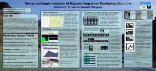
Research Objective. Through the use of historical images and current photos of the Jail Branch river this poster will recommend mitigation strategies for this impaired stream. Image source: http://www.fisheries.nsw.gov.au/__data/assets/image/5761/df92-fig1.gif.

E N D
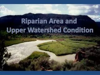
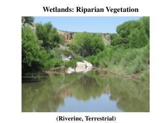
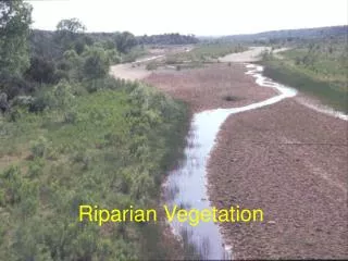
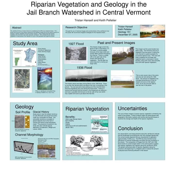
Research Objective Through the use of historical images and current photos of the Jail Branch river this poster will recommend mitigation strategies for this impaired stream. Image source: http://www.fisheries.nsw.gov.au/__data/assets/image/5761/df92-fig1.gif Riparian Vegetation and Geology in the Jail Branch Watershed in Central Vermont Tristan Hansell and Keith Pelletier Tristan Hansell Keith Pelletier Geology 151 December 07, 2005 Abstract The Jail Branch River in Central Vermont is classified by the EPA as an impaired stream. This poster lists sources of the streams impairment and displays images that can be used to assess the change in riparian vegetation along the stream channel. These images show that riparian vegetation has returned to two areas along the Jail Branch. We conclude that the riparian vegetation is instrumental in the reduction of some of the pollutants that impair the stream. Study Area Past and Present Images 1927 Flood This historic image is from the flood of 1927 in East Barre, VT. The water is moving rapidly because of the large rocks and woody debris present throughout the channel. There is a steep cliff on the right side of the stream with barely any vegetation. The left side has some trees but is mainly just large rocks. 23 km Stream 124.58 km2 Watershed Public Drinking Supply Pollutants: Urban Runoff Sedimentation Channelization Nutrients Heavy Metals Data Source: http://oaspub.epa.gov/pls/tmdl/ enviro_v2.wcontrol?p_id305b=VT08-15 This image is at the same location but taken today. The immense amount of vegetation that has grown in along this river channel is a good example of a successful riparian zone. This zone will help to stabilize this hill slope and hopefully lead to a decrease in future flooding, along with many other benefits that come with riparian vegetation. 1936 Flood This is more recent view of the same area we can see during the 1936 flood. The amount of vegetation has changed tremendously on the hill slopes and even on the riparian zone, as we are not even able to see the river in this photo. The historic photo was taken during March of the 1936 flood. There is one low river terrace which we believe the river is occupying in the picture. You can see some trees poking out of the river that have become engulfed by this river during this flood event. There is a second river terrace that the houses in the foreground are sitting on, and even a possible third terrace on the far side of the river which has a lighter tone and is just above the tree line. Photo of Jail Branch at bankfull flow in Spring of 2005 (Photo: Stefan Hard) Geology Uncertainties The use of these images to assess riparian vegetation is limited by the extent of the photos. Further analysis might use aerial photos with geographic information systems and remote sensing techniques to examine the change and health of the riparian vegetation. Riparian Vegetation Soil Profile Glacial History Study area is near the eastern terminus of Lake Winooski and would have been under the Laurentide Ice Sheet. The soil profile could be an example of glacial deposits due to the lack of sorting and various sized subangular clasts. The presence of eractics in the study area also indicate glacial deposition of sediments. (Wright and Larsen, 2004). Benefits: Adds Large Woody Debris Bank Stability Shade Habitat Reducing runoff and sedimentation (Booth 1991) 4.6 m Conclusion Our observations and measurements along the Jail Branch indicate that the landscape surrounding the river has changed significantly. Our soil pit reveals deposits that are characteristic of glaciation approximately 15,000 y.b.p. The EPA has documented human alterations to channel morphology and other sources of pollution in the stream. The comparison of images from the 1927 and 1936 flood events to current images taken in the same location suggest that riparian vegetation has regrown along the Jail Branch River. The growth and preservation of riparian vegetation along the channel is the beginning of a mitigation plan to reduce the amount of physical and chemical pollutants in the stream. GPS Coordinates of Soil Pits: 0704451E 4893273N Channel Morphology Image Source: http://www.agr.gc.ca/pfra/land/stream/1d13.gif Mixed bed with Pool and Riffle Topography Manning’s n=.063 Velocity 1.15m/s Area 4.13 m2 Discharge 4.74 m3/s GPS Coordinates of cross section: 0703654E 4893224N Photo of cross section area of stream