CIT 255 Engineering Surveying
130 likes | 450 Views
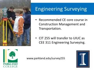
CIT 255 Engineering Surveying. Excellent class for students in Construction Management or Transportation. CIT 255 will transfer as CEE 311 Engineering Surveying. www.parkland.edu/survey255. CIT 255 Engineering Surveying. Hybrid course Online lectures and quizzes

CIT 255 Engineering Surveying
E N D
Presentation Transcript
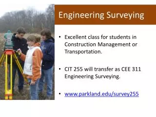
CIT 255 Engineering Surveying • Excellent class for students in Construction Management or Transportation. • CIT 255 will transfer as CEE 311 Engineering Surveying. • www.parkland.edu/survey255
CIT 255 Engineering Surveying • Hybrid course • Online lectures and quizzes • Lab exercises at Parkland • Friday, 1:15 – 4:15 PM • Starts August 31, 2012 • Instructor: Todd Horton • Professional Land Surveyor • Professional Engineer
CIT 255 Engineering Surveying • Topics and labs include: • Construction plan reading • Leveling • Topographic surveys • Total station methods • Construction layout • GPS surveying • Boundary surveys • Photogrammetry
Estimated cost $448 tuition + $120 fees + $130 books only $698 UIUC students pay Parkland's in-district tuition!
Testimonial: Tyler James “CIT 255 Engineering Surveying (CEE 311) is the most valuable 300-level core course that I have taken while at the University of Illinois. Learning to perform level circuits, topographical surveys, construction layout , and basic GPS surveys has been invaluable to my development as a young project engineer. The skills that I gained in CIT 255 were essential to completing many of the challenges that I have faced in my professional career. Thanks, Todd, for getting me out into the field during class time.” Tyler James, E.I.T. Civil Engineering Graduate Student – Class of 2012 Global Leaders in Construction Management University of Illinois at Urbana-Champaign
ASCE on LinkedIn.com • If a civil engineering student asked "Why should I take a surveying course?", how would you answer? • I am currently studying to take the Massachusetts PLS exam because I feel that being a Professional Land Surveyor goes hand in hand with being a PE. It used to be commonplace that Civil Engineers obtained both licenses but that seems to have fallen out of fashion. Having a good understanding of Land Surveying and what is involved will greatly enhance the skills of any Civil Engineer. • Peter M. Blaisdell, Jr., P.E. • If you do not know surveying and or have surveying skills as a Civil Engineer you will have a handicap. This will become apparent as your chances of making errors in design and construction will increase. This is a fundamental course and should be always part of the curricula. I have had problems with young engineers that lack this skill as it takes longer to train them to visualize the finish product and how it fits. • Jose M. Ramirez P.E., M.ASCE
ASCE on LinkedIn.com • I would probably suggest that the civil engineer who doesn't understand survey will invariably experience errors, omissions, claims, and litigation from some of, but not limited to, the following real-world blunders: • choosing the wrong coordinate system for a project • choosing the wrong foot for a project • not knowing whether or not the survey file you just paid the sub for is any good • messing up a corridor alignment as it goes from one state plane zone to another • co-mingling low accuracy and high accuracy data in the same DTM file • creating a design to 0.01 foot from a DTM file that was only surveyed accurate to 0.5 foot. • not knowing how to determine if something that is built in the field is actually constructed where the plans said it was supposed to go • putting all of the wrong callout information on the plans sheet because they don't know what the construction surveyor needs to lay it out • blindly trusting Geopak or InRoads One of a contractor's greatest sources of winnable claims are designs and plans done by civil engineers who don't understand the fundamentals of survey and location. Any civil engineers who don't believe this should spend a week out on site with a contractor survey and layout crew. Religion will follow. • Danny Kahler, PE
ASCE on LinkedIn.com • Surveying is a math fundamental. An engineer without basic surveying skills is a law suit waiting to happen for a company. I've seen where a development company sued their engineering company when the houses were laid out and built in the front set back. The government inspector made the developer tear down all of the houses! No variance! It took years to build up this engineering company, in the end the engineering company was back to the owner and one CAD person! And a reputation to live down. • Cheryl McDonald • A surveying class will provide the basics and a foundation for learning how to layout a site, take advantage of terrain characteristics, provide effective communication of the design and construction requirements. If nothing else, knowing the lingo will avoid the embarrassment of visiting a job site and not understanding what the professionals are talking about. As an owner's representative, I wouldn't want a civil engineer on my team that did not understand the basics of surveying. I would not expect a firm that is providing engineer and architect services to put such a person on the team. • Rick Marrs
Professional Licensure • In Illinois, the three design professions are: • Engineering • Land Surveying • Architecture • Possessing more than one professional license can make you more marketable. • Consider becoming dual-licensed.
Go to Parkland & Get Licensed • Parkland College offers 24 credit hours of surveying courses approved for the LSIT license. • Take CIT 255 while at UIUC. • After graduation, take the remaining surveying courses in one year. • Apply for the LSIT exam upon completion at Parkland.
Land Surveying Licensure • Applicants for the examination for Land Surveyor‑in‑Training shall have: • (1) a baccalaureate degree in Land Surveying from an accredited college or university program; or • (2) a baccalaureate degree in a related science including at least 24 semester hours of land surveying courses from a Department approved curriculum of an accredited institution. • (225 ILCS 330/13) (from Ch. 111, par. 3263)
Definition of Related Science • The following subjects all may be completed prior to, concurrent with, or subsequent to receiving the baccalaureate degree. • a) Mathematics (College Algebra and beyond) – 15 semester hours • b) Basic Sciences (Physics and/or Chemistry) – 8 semester hours • c) Additional Basic Sciences (including, but not limited to: Geology, Geography, Dendrology, Astronomy, Biology, Soil Mechanics, and engineering sciences) – 20 semester hours • d) Land Surveying courses (including, but not limited to: fundamentals of land surveying, boundary surveying, route surveying, topographic surveying, descriptions, legal aspects, subdivision design, data computations and adjustments, map projections and geometric geodesy and photogrammetry) – 24 semester hours • (Source: Amended at 28 Ill. Reg. 15297, effective November 10, 2004) • www.ilga.gov/commission/jcar/admincode/068/068012700000150R.html
www.parkland.edu/survey255 Todd W. Horton, PE, PLS Parkland College thorton@parkland.edu (217) 373-3785