Download
1 / 39
390 likes | 732 Views
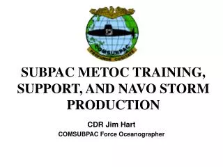
SUBPAC METOC TRAINING, SUPPORT, AND NAVO STORM PRODUCTION. CDR Jim Hart COMSUBPAC Force Oceanographer. UNCLASSIFIED. OPERATIONAL OCEANOGRAPHY TRAINING. Submarine School SONAR formal schools Submarine Officer Basic Course Submarine Officer Advanced Course On board OJT Attack Centers

E N D
SUBPAC METOC TRAINING, SUPPORT, AND NAVO STORM PRODUCTION CDR Jim Hart COMSUBPAC Force Oceanographer
UNCLASSIFIED OPERATIONAL OCEANOGRAPHY TRAINING • Submarine School • SONAR formal schools • Submarine Officer Basic Course • Submarine Officer Advanced Course • On board • OJT • Attack Centers • IMAT modules • STORM’s • Submarine Training Center • Operational Oceanography Course (2 days) • IMAT on request (1 day)
UNCLASSIFIED MISSION The mission of NAVMETOCCOM is to provide Navy, Marine Corps and Department of Defense forces relevant and integrated full-spectrum weather, ocean, charting, precise time, and astrometric knowledge to minimize risk and optimize operational success anytime, anywhere
UNCLASSIFIED METOC ASHORE • SUBPAC support • CSP Oceanographer • CTF74 Oceanographer • NPMOD Bangor
UNCLASSIFIED My #1 concern is getting reliable and useful METOC information to deployed submarines • Obstructions/Limitations • Communications • Classification • Multiple software products • Training
UNCLASSIFIED SUBMARINE SUPPORT Grey: existing support 10/00 Black: initiated after 10/00
UNCLASSIFIED MODAS Support Satellite Data * altimetry * temperature Basin /Regional Ocean Analyses and Forecasts FTP In Situ Measurements: Temperature, Salinity Raw Data Flow Local Analyses Messages Regional METOC Centers On Scene Analyses
SSH + SST + Clim UNCLASSIFIED MODAS Synthetic Profiles Extending Remote Sensed Measurements to Depth Climatological Temp MODAS results AXBT Survey Cold core eddy revealed by altimetry
UNCLASSIFIED MODAS Support • Balance between message length and resolution • One section messages • Usually 0.2 degree resolution (.1 degree max) • testing new compaction routines (wavelet) • Submarine MODAS will allow the user to: • Ingest thread data from CTD • Interpolate local BT’s into the database
UNCLASSIFIED BCST MODAS Support
UNCLASSIFIED INDIRECT SUPPORT • Various Working Groups and IPT’s • Submarine Tactical Oceanography Review Group (STORG) • Submarine Tactical Environmental Display System (STEDS) • MODAS Lite/SubMODAS • STED/SubCTD • BQN-17 Acoustic Sediment Classification System (ASCS) • PUMA • ALS SVP • N87 Precision Environmental Requirements Study • MODAS Steering Group • STORM Working Group • ONR ‘Capturing Uncertainty in the Common Tactical Environmental Picture’ DRI • PUMA-TEDS Integration Product Team • Overlaps • Tactical Control Development Working Group (TCDWG) • Sensor Optimization Working Group (SOWG) • Stealth Management Working Group (SMWG) • Tactical Environmental Data Server (TEDS)
STEDPlug & Play Replacement for BQH-1 UNCLASSIFIED SubMODAS Continuous onboard oceanographic data fusion Analog SV Digital Temp, Salinity, SV UNCLASSIFIED BQN-17/ASCP SEDIMENT PROPS. Density, Grain, Size Strength, Etc. Determine bottom composition and structure through bottom sounder echoes PUMA ALS SVP Determine SVP ahead of ship through HF Sonar echo returns Precision bottom mapping and map merger through HF Sonar
UNCLASSIFIED Submarine MODAS Alexandria Field Test ‘Architecture’ INPUTS MODAS LAPTOP OUTPUTS STED “CTD” profiles Other CTD profiles Thread data MODAS2 first guess in EOF or (preferably) wavelet message format MODAS field in various formats EOF / WAVELET JJYY / Byte netCDF / others... Sneaker net (floppy, LS120) Sneaker net (floppy, LS120) Serial Line for real-time? Linux (Slackware 7.1) LS-120 disk drive OAML MODAS-Lite 2.1 EOF based assimilation module Full MODAS2 development s/w PC-IMAT 4.1 Beta (Wavelet-enabled) 20 Sep DEVRON12: CTD (STED) reader IMAT wavelet ingest
UNCLASSIFIED Sub MODAS: STED Real World Example,Vertical Excursions Only Horizontal Section at 200 m 340x330 km region Vertical Section to 500 m Summer 2000 Example: MODAS-Lite 2.1 using only vertical excursion data Three vertical excursions were converted to standard profile format and assimilated using OAML MODAS-Lite 2.1, using the MODAS-Heavy 2.1 first guess field (which used remote sensed SST and altimetry but no in situ profile; that is, the field that would be sent from NAVO or a Center via wavelet message).
UNCLASSIFIED GRIDDED-FIELD COMPRESSION WAVAL: Wavelet Compression Around Land-Masses Present EOF method New Wavelet method Temperature at Surface (true and reconstructed) Error in reconstructed surface Temperature
UNCLASSIFIED Submarine Tactical Oceanographic Reference Manual (STORM) • Purpose - ASW/USW Mission Planning • Content - Oceanographic/Meteorological/Acoustic Data • Distribution - • Before 1998 - Submarine community • Since 1998 - Expanded distribution to the fleet • (i.e., surface ships, fleet training • centers, and patrol squadrons) • Current Product Format - • Digital, Stand-alone (all data accessed from CD)
UNCLASSIFIED STORM Publications(Hardcopy)* No. 1 2 3 4 5 6 7 8 Product Barents and Kara Seas Sea of Okhotsk WESTLANT Norwegian/Greenland Seas Strait of Juan de Fuca Sea of Japan Mediterranean Sea Bering Sea * These STORMs have been converted to HTML and are distributed on CD-ROM (a browser is required to view).
SUBMARINE TACTICAL OCEANOGRAPHIC REFERENCE MANUAL (STORM) NORTH INDIAN OCEAN, RED SEA, AND ARABIAN GULF (U) SP 279-9, Version 2.0 April 1998 UNCLASSIFIED
SUBMARINE TACTICAL OCEANOGRAPHIC REFERENCE MANUAL (STORM) YELLOW SEA, EAST CHINA SEA, SOUTH CHINA SEA, AND PHILIPPINE SEA (U) SP 279-10, Version 1.0 December 1998 UNCLASSIFIED
UNCLASSIFIED SUBMARINE TACTICAL OCEANOGRAPHIC REFERENCE MANUAL (STORM) CARIBBEAN SEA AND EQUATORIAL PACIFIC REGION OF CENTRAL AND SOUTH AMERICA (U) SP 279-11, Version 1.0 June 1999
UNCLASSIFIED SUBMARINE TACTICAL OCEANOGRAPHIC REFERENCE MANUAL (STORM) NORTHEAST ATLANTIC OCEAN (U) SP 279-12, Version 1.0 May 2000
UNCLASSIFIED Current Digital STORM Viewer • Interactive, PC-based Windows Application • 32-bit Operating Systems (Win NT/95/98) • Written in-house with Microsoft Visual C++ • Menu-Driven • Help and Analysis Text Provided • No Setup/No Training Required • No User-license Fees; No Proprietary Code
UNCLASSIFIED Current Digital STORM Viewer FEATURES • DATA • Displays meteorology, oceanography, and acoustic data • Displays high-resolution data • Displays multiple-resolution data • Displays data as point, gridded, x-y plot, vector, text, or images • Displays Profile/Vertical/Horizontal views of temperature, salinity, and • sound speed data (GDEMV and MODAS) • Provides point/click query • On-screen security classification tracking (highest displayed) • Displays data in Mercator projection • DATA FORMATS • Binary • ASCII • Plain images (gif only) • Byte-encoded (MODAS only) • MAP • Displays landmask • Displays latitude/longitude grid • Provides cursor tracking (in latitude/longitude - not pixels)
UNCLASSIFIED Current Digital STORM Viewer Features (Continued) • OPTIONS • Color scaling • Copy to Clipboard • Customized Data Units (Metric and English) • Export Text Data (ASCII) • User-defined Axis Scaling for XY-plots • Scale Figure of Merit (FOM) • Legend (on/off) • Toolbar • Solar/Lunar Calculations • Print capability
UNCLASSIFIED Current Digital STORM Viewer Features (Continued) • ZOOM • Zoom-in/Zoom-out • Restore (to original map) • Select Area (user-input latitude/longitude coordinates) • OVERLAYS • Bathymetry Contours (labeling/custom units/set contour interval) • User-defined Labeling • Cities/Geographic Features/Physiographic Features Overlay • HELP • Context-sensitive Help Text (for product features; toolbar access) • Context-sensitive Analysis Text (for data; toolbar access)
UNCLASSIFIED DBDB-V Bathymetry 2-Minute Resolution 5-Minute Resolution
Provides Platform Independence (e.g., PCs, UNIX, HP-UNIX, LINUX); (Currently PC Platforms) Currently Designed for Stand-Alone Access; Potential for Network and SIPRNET Access Displays Static and Dynamic, Near-real-time Data Sets (e.g., STORM data sets and REACT data sets) Potential capability to link to other JAVA applications like MEDAL, NRL’s JAVA Digital Nautical Chart (DNC), and Additional Military Layer (AML) applications No User-license Fees; No Proprietary Code UNCLASSIFIED New JAVA Viewer
UNCLASSIFIED New JAVA Viewer FEATURES • DATA • Displays Meteorology, Oceanography, and Acoustic data • Displays High-resolution Data • Displays Multiple-resolution Data • Displays data as Point, Gridded, X-Y Plot, Vector, Text, or Images • Displays GDEMV/MODAS data in Profile/Vertical/Horizontal views • Provides Tree-Structure Table of Contents (for easy data selection) • Provides Point/Click Query and Query similar to ArcExplorer • On-screen Security Classification Tracking (highest displayed) • Displays data as Projected and Geo-referenced • DATA FORMATS • Binary • ASCII • ARC Shapefiles and Project files • Plain and Geo-referenced Images (gif, jpg) • Byte-encoded (MODAS only) • VPF data (currently World Vector Shoreline (WVS)) • MAP • Displays Landmask • Displays Latitude/Longitude Grid • Provides Cursor Tracking (in latitude/longitude - not pixels)
UNCLASSIFIED New JAVA Viewer Features • (Continued) • OPTIONS • Color Scaling • Customized Data Units (Metric and English) • Customized Coordinate Units (Decimal degrees, Deg/Min/Sec) • Export Text Data (ASCII) • User-defined Axis Scaling for XY-plots • Scale FOM • Legend (on/off) • Toolbar • Map projections(Mercator/Azmuthal Equal Area/Cylindrical Equidistant) • Print • ZOOM • Zoom-in/Zoom-out • Pan (left, right, up, down) • Restore (to original map) • Select Area (user-input latitude/longitude coordinates)
UNCLASSIFIED New JAVA Viewer Features • (Continued) • OVERLAYS • Bathymetry Contours (with labeling/custom units/set contour interval) • User-defined Labeling • Cities/Geographic Features/Physiographic Features • TOOLS • Animation/Brief Creator (e.g., import to PowerPoint) • Build Query (for Layer data) • Measure Tool (for distance in various units) • Remove Popups • Solar/Lunar Calculation • Move Layer (Up one, down one, to top, to bottom) • Remove All Layers • Properties (for Layer data - edit color, class breaks, symbol, etc.) • HELP • Context-sensitive Help Text (for product features; toolbar and tab access) • Context-sensitive Analysis Text (for data; toolbar and tab access)
UNCLASSIFIED NEW JAVA VIEWER
UNCLASSIFIED NEW JAVA VIEWER REACT Layers Identify Active Layer Properties Query/Move Layers Remove Layers STORM SSP Profile
QUESTIONS? CDR Jim Hart COMSUBPAC N73 Force Oceanographer (808) 473-5652 DSN (315) 473-5652 hartjb@csp.navy.mil n73@hq.csp.navy.smil.mil