Download
1 / 23
230 likes | 409 Views
Rainer Bleck - Los Alamos John M. Brown - NOAA/FSL Kevin Brundage “ Dezso Devenyi “ Georg Grell “ Dongsoo Kim “ Geoff Manikin - NCEP/EMC Barry Schwartz - NOAA/FSL Tanya Smirnova “ Tracy Lorraine Smith “ Steve Weygandt “. Stan Benjamin NOAA Forecast System Lab

E N D
Rainer Bleck - Los Alamos John M. Brown - NOAA/FSL Kevin Brundage “ Dezso Devenyi “ Georg Grell “ Dongsoo Kim “ Geoff Manikin - NCEP/EMC Barry Schwartz - NOAA/FSL Tanya Smirnova “ Tracy Lorraine Smith “ Steve Weygandt “ Stan Benjamin NOAA Forecast System Lab Boulder, Colorado Stan.Benjamin@noaa.gov http://ruc.fsl.noaa.gov Mesoscale weather prediction with the RUC hybrid isentropic-sigma coordinate model and data assimilation system Symposium - 50th Anniversary - Operational NWP 15 June 2004
Rapid Update Cycle - An unusual branch of the operational NWP • family genealogy • Use of a quasi-isentropic vertical coordinate for model prediction and data assimilation • Numerical weather prediction and data assimilation on a sub-12h cycle (currently 1 h)
~1985 • FAA-sponsored Aviation Weather Forecasting Task Force • Recommendations: • Promote additional automated aircraft reports from commercial aircraft • Develop high-frequency NWP system • NMC (now NCEP) / PROFS (now NOAA-FSL) agreement on development of ‘high-frequency’ NWP system • (Ron McPherson, Tom Schlatter, Sandy MacDonald) • Assimilation of anticipated increase of hourly 3-d observations • wind profilers, commercial aircraft, satellite, radar, surface
Choices for vertical coordinate for • atmospheric prediction models • Height • Pressure • Entropy • Potential temperature - = T (1000/p)R/Cp • Isentropic weather maps • - commonly used in US in late 1930s • Rossby et al. 1937 • - plagued by reported Montgomery stream • function - inaccurate integration of hydrostatic equation
Modeling efforts with pure isentropic vertical coordinates • Eliassen and Raustein – 1968 • But what to do about that lower boundary condition … • Bleck – 1974, 1977 (carrying sfc as prognostic variable) • Now how to resolve the planetary boundary layer … Hybrid isentropic-sigma models • Bleck – 1978 • Deaven – 1976 • Gall – 1972 • Uccellini et al. – 1979 • Johnson et al. - 1993 • Konor and Arakawa – 1997 • . . . . .
1990 FSL/Bleck model using Uccellini-type hybrid - model Bleck and Benjamin – 1993- MWR Benj, Grell, Brown, Smirnova, Bleck, 2004 – MWR Bleck and Boudra – 1981 - hybrid-isopycnic model Generalized vertical coordinate - Used in all oper RUC versions
Montevideo south Vertical section through HYCOM solution. Heavy black lines: coordinate surfaces. Shaded contours: potential density Hybrid (isopycnic-sigma) Ocean Community Model – HYCOM - U. Miami, Los Alamos Natl. Lab - from Rainer Bleck
Why even try to use a quasi-Lagrangian vertical coordinate? • Adaptive higher vertical resolution - vertical gradient of wind, moisture, chemical species … • Less cross-coordinate vertical transport • 3-d fluid motion resolved largely by 2-d transport - Less non-physical diffusion, less aphysical source of entropy in numerical model (Bleck…, Johnson 1997)
Quasi-horizontal / Cartesian vs. functional spatial definitions Isobaric Isentropic
RUC generalized vertical coordinate- configured as a hybrid isentropic-sigma coordinate Vertical coordinate definition - examples: Sigma-pressure p(k), ptop (fixed) (+psfc) (adaptive) p(i,j,k) Generalized - pmin(k), v- ref(k) (fixed) (+psfc , v) (adaptive) p(i,j,k) Cross section A Reference v values (220-500K) pre-assigned to each of RUC levels.
Continuity equation (inviscid, adiabatic conditions in generalized coordinate s) Mass conv/div Pressure ~0 0 Isentropic 0 ~ 0
12h forecast 24h forecast RUC 20km model forecast - initial conditions – 12z 4 February 2001 Tropopause level (hPa) - defined as potential vorticity (PV) unit = 2 36h forecast
Potential vorticity Relative humidity N S Vertical velocity (x 10 b/s) Vertical cross-sections from RUC 36-h forecasts - valid 00z 6 Feb 2001 N S
e - e (proxy) (K) e conservation tests Histogram of e - e (proxy) RUC model with a) q-s coord (control) b) s coord (fixed) much better moist reversibility w/ q-smodel 24h forecast Init 00z 8 Feb 2001 (test concept - Johnson -1997) • MWR article – Feb 2004 • Mesoscale wx pred • W/ RUC hybrid qs model • Benj, Grell, Brown, • Smirnova, Bleck PDF – grid pts at lev 40
OI, 3dvar techniques in q-scoordinate developed for RUC analysis Advantages of q Coordinates for Data Assimilation Analysis - adaptive 3-d correlation structures and analysis increments, esp. near baroclinic zones, vertical spreading = f(q) - improved coherence of observations near fronts for QC Forecast Model - reduced vertical flux through coordinate surfaces, leading to reduced vertical dispersion -- much of vertical motion implicit in 2-d horiz. advection - conservation of potential vorticity - reduced spin-up problems (Johnson et al. 93 MWR)
~1985 • FAA-sponsored Aviation Weather Forecasting Task Force • Recommendations: • Promote additional automated aircraft reports from commercial aircraft • Develop high-frequency NWP system • NMC (now NCEP) / PROFS (now NOAA-FSL) agreement on development of ‘high-frequency’ NWP system • (Ron McPherson, Tom Schlatter, Sandy MacDonald) • Assimilation of anticipated increase of hourly 3-d observations • wind profilers, commercial aircraft, satellite, radar, surface
The 1-h Version of the Rapid Update Cycle at NCEP NCEP model hierarchy – RUC (1h frequency) Eta (6h) Global (6h)
Model/ Horizontal No. Assimilation Implement at • Assim resolution vert frequency NMC/NCEP • system levels • RUC1 60 km 25 3 h 1994 • RUC2 40 km 40 1 h 1998 • Added • state-of-art model physics – convection, mixed-phase cloud, land-sfc • assimilation of surface obs • hourly cycling of • 5-type hydrometeor cloud variables, • land-surface variables (6 levels, snow variables) • RUC20 20 km 50 1 h 2002 • Added assimilation of GOES cloud-top data RUC development – ongoing interaction with NCEP and NCAR
Obs Data for RUC Data Type ~Number Freq. Rawinsonde 80 /12h NOAA 405 MHz profilers 31 / 1h VAD winds (WSR-88D radars) 110-130 / 1h Aircraft (ACARS) (V,temp) 1800-5500 / 1h Surface/METAR (T,Td,V,p) 1500-1700 / 1h Buoy/ship 100-150 / 1h GOES precipitable water 1500-3000 / 1h GOES cloud drift winds 1000-2500 / 1h GOES cloud-top pressure/temp ~10km res / 1h SSM/I precipitable water 1000-4000 / 6h In testing at FSL – early 2004 GPS precipitable water ~250 / 1h Radar reflectivity / lightning 4 km Mesonet 3000-5000 / 1h METAR cloud/vis/wx obs / 1h
RUC20 • Wind forecast • Accuracy • Sept-Dec • 2002 6 9 1 3 12 Analysis ~ ‘truth’ Verification against rawinsonde data over RUC domain RMS vector difference (forecast vs. obs) RUC is able to use recent obs to improve forecast skill down to 1-h projection for winds
Quasi-isentropic option for non-hydrostatic model Breaking mountain wave simulation - 2 km horizontal resolution Sigma-z version Quasi-isentropic version Thick - q Thin - coordinate surfaces Zuwen He, 2002 Ph.D. U. Miami
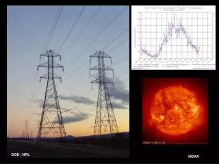
2004 • Current users of RUC data • Aviation community • air traffic mgmt • NCEP Storm Prediction Center • NWS Forecast Offices • Private forecasting • Air quality • Energy industry • . . . • 1985 • Anticipated use for RUC • Aviation community • Changes in • Number of NWP users • Frequency of access to NWP data • Ability to use shorter- and longer-duration NWP data • User requrements for forecast accuracy, incl. short-range
RUC changes • 2004-2007 • Assimilation of surface cloud obs/ current weather/vis, radar reflectivity, GPS … • 13km RUC (in testing at FSL) • WRF-based “Rapid Refresh”, replacing current RUC model • More common software (model, data assimilation) for replacements to RUC, Eta, Hurricane models. • NCEP, NCAR, NOAA labs, AFWA… • Beyond (IMHO) • 15-30 min continuous update cycle • Global update cycle • Ensemble update cycles • Use of quasi-Lagrangian vertical coordinate models – ocean, atmosphere