Download

1 / 58
580 likes | 603 Views
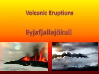
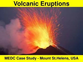
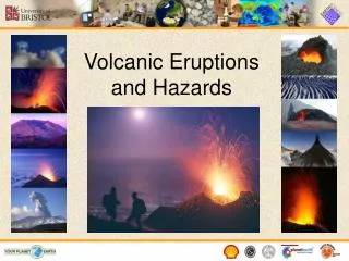
Explore the characteristics of volcanic eruptions, primary and secondary effects, types of volcanic hazards, eruption prediction methods, monitoring techniques, and causal factors for volcanic events. Learn about the diverse types of lava flows, pyroclastic eruptions, and gases associated with volcanic activity.

E N D
The slope angle of the of strato (composite) volcanoes is controlled by the angle of repose for unconsolidated pyroclasts and the viscosity properties of the silica-rich andesite and dacite flows. The volcanoes shown above are part of the Aleutian Island, Alaska.
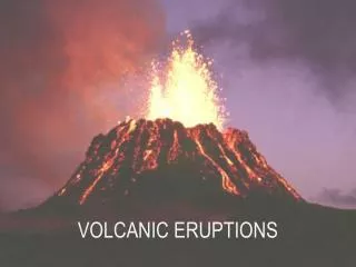
Volcanic eruptions can be classified according to the Volcanic Explosivity Index, which is based on several measurable factors that are directly related to the explosiveness of the eruption, inluding: volume of tephra ejected, cloud column height, eruption type, duration of continuous blast.
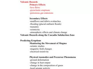
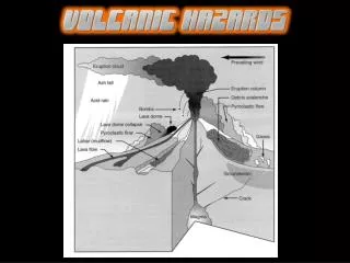
Volcanic Hazards Primary Effects -lava flows -pyroclastic eruptions -poisonous gas emissions Secondary Effects -mudflows and debris avalanches -flooding (glacial outburst floods) -tsunamis -seismicity -atmospheric effects and climate change Volcanic Hazards along the Cascadia Subduction Zone Predicting Eruptions Monitoring the Movement of Magma -seismic studies -magnetic field changes -electrical resistivity Physical Anomalies and Precursor Phenomena -ground deformation -change in heat output -change in the composition of gases -local seismic activity
Hawaiian Type Eruption: Basaltic composition lavas. Described as “gentle” or “effusive” eruption.
Plinian Eruption: St. Pierre 1903 Phreatic Eruption: MSH April 4, 1980
Basaltic eruptions are very fluid and will flow great distances from the vent or rift. The photo above is taken from the Kilauea rift zone on the Big Island of Hawaii.
Aa Flow, Hawaii Pahoehoe Flow, Hawaii
Few fatalities are typically associated with basaltic lava eruptions, as neighborhoods, such as the one shown here, can be evacuated. Buildings and other human-made structures are not so lucky!
Basaltic lava flow reaching a neighborhood near Kilauea, Hawaii.
A pyroclastic flow consists of fluidized mixture of partially molten fragments and super-heated expanding gases that flow down the flank of a volcanic edifide. Pyroclastic flows can exceed velocities of 100 km/hr and they are the most deadliest of volcanic hazards.
Pyroclastic eruptions and flows produce some of most devastating effects associated with volcanism. Destruction is total to any living organism or structure within the pathway of a pyroclastic flow.
Mt. St. Helens was predisposed to landsliding on the north face of the volcano because of weakened rock.
Devastation is total in the path of a pyroclastic flow. Note the twisted rebar steel in the damaged concrete support column from an Andean eruption.
Bishop ash was erupted catastrophically 760,000 years ago in eastern California. The eruption had a VEI = 7 and ashfall accumulated as far Nebraska. The Bishop ash provides an important stratigraphic marker for middle Pleistocene-aged deposits.
Pyroclastic flows buried Pompeii, Italy under 4 m of ash in 79AD.
Volcanic gases and particulates ejected into the atmosphere during phreatic eruptions.
Lake Nyos, Cameroon is situated within an active volcanic region of a failed rift zone. It is one of three volcanic lakes in the world that is saturated with CO2 gas and is susceptible to catastrophic degassing when the lake water infrequently overturns.
In 1986 Lake Nyos catastrophically overturned releasing tons of dense CO2, which killed over 1700 local inhabitants and thousands of livestock.
CO2 gas has been emitted near the Mammoth Lakes region of California. This area is part of the Long Valley caldera, where a major VEI=7 eruption occurred 760,000 year ago, as well as minor VEI-1-3 eruptions forming the Inyo-Mono craters.
Seismic data tilt meters indicate that magma is upwelliing beneath the surface in the Mammoth Lakes area. This activity led USGS scientists to predict that an eruption would occur in the near future, but it will likely be small. Still waiting?
Volcanic Hazards Primary Effects -lava flows -pyroclastic eruptions -poisonous gas emissions Secondary Effects -mudflows and debris avalanches -flooding (glacial outburst floods) -tsunamis -seismicity -atmospheric effects and climate change Volcanic Hazards along the Cascadia Subduction Zone Predicting Eruptions Monitoring the Movement of Magma -seismic studies -magnetic field changes -electrical resistivity Physical Anomalies and Precursor Phenomena -ground deformation -change in heat output -change in the composition of gases -local seismic activity
Lahar deposits can be recognized in the field by their poorly sorted grain-size distribution, silty matrix and composition of largely volcanic-derived sediment.
NASA 1992 Space Shuttle image of Mt. Pinatubo lahar flow deposits a year after the June 15th, 1991 eruption.
Although basaltic eruptions tend to be effusive, contact with snow and ice can create catastrophic outburst floods.
Bardarbunga caldera, Iceland produced enormous Jokulhlaups (glacial outburst floods), but did not pose a major hazard to the Icelandic people, because of its isolated location.
Effects of Volcanism on Climate Change Volcanic gases have been shown to be responsible for global cooling. The magnitude and extent of global cooling depends upon the force of the eruption, the amount of particular gases emitted and location of the eruption. When volcanic gases and fine dust reach the stratosphere, they can produce a wide spread cooling effect.
Emitted SO2gas combines with H2O to form H2SO4 aerosols in the stratosphere. Aerosols, such as H2SO4, reflect incoming sunlight and reduce the Earth’s surface temperature.
Volcanic eruptions that occur near the equator, such as Mt. Pinatubo, Phillippines, have a greater impact on global cooling because aerosols are erupted into the atmosphere in both hemispheres. Greatest aerosol distribution following the Mt. Pinatubo eruption of 1992 is shown in red.
Volcanism and Climate Change Mean acidity levels in the Greenland ice core strongly correlates with known volcanic eruptions. Increased volcanic activity index (based on acidity record) is inversely related to global temperature. The cooling effect tends to be 1-3° C and last only for a 1-2 years.
The Cascade volcanoes have variable eruption histories. Mt. St. Helens has the most frequent eruption history of the Cascade volcanoes during the Holocene.
Volcanic tephras are well-preserved in lacustrine and bog sediment throughout the Cascades. Ubiquitous organic matter provides excellent opportunities to assign radiocarbon ages to the eruptions. The Mt. Mazam O (Crater Lake) eruption occurred ~6800 years ago.
The thickness of the ash layer and grain size of ash shards provide important data regarding the volcanic source of the volcanic ash. By coring multiple lakes and/or bogs in a volcanic region the source of the eruption can be determined using the above criteria as well as the geochemistry of the tephra.
Excavating a trench behind the Hyak moraine at Snoqualmie Pass (ca. 1990).
Mt. St. Helens Wn Mt. St. Helens Yn Mazama O Three tephra layers are present in the sediment record at Snoqualmie Pass. They have been independently dated using radiocarbon dating of associated organics.
Probability hazard maps require accurate dating of preserved tephra layers.
Tephra distribution of Cascade volcanoes (Mt. Mazama, Mt. St. Helens, and Glacier Peak, 1A) compared with Longvalley (Bishop, CA) and Lava Creek (Yellowstone Park), 1B. 1B 1A
Mt. Rainier’s elevation exceeded 16,000 feet above sea level 5000 years ago. Following a large edifice collapse ~5000 years ago the mountain lost ~1500 feet of its summit.
Mt. Rainier contain 90% of the Cascade volcanoes glacial ice and permanent snow. Mt. Rainier’s glacial ice is a major potential source
A mass of sliding rocks, snow, and ice swept down the northeast side of Mount Rainier volcano about 5,600 years ago. The large landslide transformed itself into a lahar (Osceola) and flowed down the White River into the Puget Sound.
Glacier Peak has been a very active Cascade volcano over the past 15,000 years.
Isopachs of Glacier Peak tephra distribution (13,100 yr BP). Eruption history and isopachs of Glacier Peak tephra distribution (13.1 kyr BP).