The Hydrometeorology Testbed Network
130 likes | 301 Views
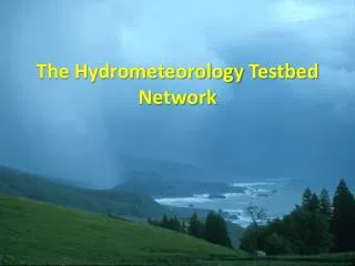
The Hydrometeorology Testbed Network. . HMT-West Legacy Project in California is implementing key land-based sensors . Sep. ‘14. . . . Apr. ‘14. . Snow-level radars. .

The Hydrometeorology Testbed Network
E N D
Presentation Transcript
HMT-West Legacy Project in California is implementing key land-based sensors Sep. ‘14 Apr. ‘14 Snow-level radars • An AR-focused long-term observing network is being installed in CA as part of a MOA between CA-DWR, NOAA and Scripps Inst. of Oceanography • Installed 2008-2014 • 100 field sites • See White et al. (JTech, 2013) Atmospheric River Observatories (AROs) Nov. ‘14 Oct.14
HMT-Legacy Network Instrument Function • Land-based GPS Sensor – measure the fuel (water vapor content) carried by the winds as the storm makes landfall. • Wind Profilers – measure the rate at which the fuel is being supplied to generate heavy rain (fuel rate) • Snow-level Radar (S-band profilers) – measure the depth of the atmosphere warmer than freezing. Deeper this layer more moisture is available and the higher the elevation snow will fall in the mtns. Higher snow level more runoff will occur. • Soil Moisture Sensors – measure the moisture content of the soil and calibrate that to field capacity to determine runoff potential.
Google Map IWV from GPS Met Stations Water vapor obs. onshore fill gap in satellite observations Atmospheric river
Atmospheric River ObservatoriesFill Largest Single Monitoring Gap
HMT-Legacy Network Atmospheric River Observatory • ¼-scale 449-MHz wind profiler • Radio acoustic sounding system • 10-m surface met. tower • GPS receiver
HMT Real-time Upslope Water Vapor Flux Tool Display HMT Weather Forecast Model Coastal Wind Profiler Snow Level Providing forecasters with the critical observations to determine how ARs are impacting the area and how model forecasts are portraying the AR conditions and orographic precipitation enhancement. GPS Water Vapor Prior Forecasts Water Vapor Flux: the fuel for precipitation Coastal and Mtn. Rainfall
CA-DWR and U.S. DOE are jointly supporting a coastal network of seven atmospheric river observatories. This “picket fence” will provide the first line of defense for winter storms that pound the West Coast each year. This network will be completed over the next two years.
Snow-level Radar Colfax, CA Elev. 636 m • Provides proxy snow-level height during precipitation events • Utilizes proven FMCW technology to substantially lower cost • Uses the patented ESRL automated snow-level detection algorithm proven in nationwide field experiments • Less than 8’ diameter footprint • Low-power requiring minimal infrastructure Photo by P. Johnston Snow level
1-2 Dec 2012 ~21 kt motion allows 3 to 12 hrs lead time of front and cessation of heavy rain
Russian River of NorCal was impacted by three separate precipitation events within a five day period in late Nov. to early Dec. 2012. • Peaks in Russian River stream flow were observed each time the observed precipitation rate and amount kept the 10 cm soil at field capacity for a period longer than 3 h. • The 15,000 cfs flow peak that occurred early on 3 Dec. was 0.42 m below flood stage for this location. Saturation Excess Runoff
Benefit of Expanded Observation Networks Recent Past and Near Future Allowed us to begin a climate record of land-falling AR magnitude, duration, relationship to flooding, seasonality. Allowed us to define the spatial and temporal resolution needed to monitor extreme rainfall events Allowed us to define the critical observations that we need to properly model extreme events - gaps Test beds have provided the scientific credibility needed to bridge the research to operations gap - Sustainability – not just a research project… Expand capability to all areas in the west.