
Characterizing Surface BRDF and Albedo Over ARM SGP Area from Multi-Satellite Observations
This study presents an analysis of the spectral, temporal, and spatial properties of surface bi-directional reflectance function (BRDF) and albedo over the ARM Southern Great Plains (SGP) region, utilizing data from multiple satellite missions, including MODIS, VGT, and Landsat, from 1995 to 2004. Our approach generated 10-day BRDF/albedo maps at resolutions of 500m and 1km. Results highlight the variability of surface albedo, validation with ground measurements, and comparisons among different satellite datasets. These findings serve as critical inputs for atmospheric radiation and climate modeling.

Characterizing Surface BRDF and Albedo Over ARM SGP Area from Multi-Satellite Observations
E N D
Presentation Transcript
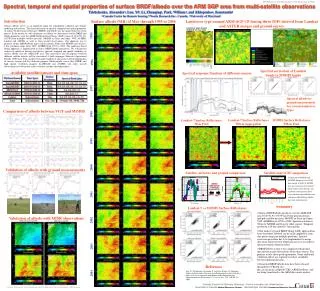
Spectral, temporal and spatial properties of surface BRDF/albedo over the ARM SGP area from multi-satellite observations Trishchenko, Alexandera, Luo, Yib, Li, Zhanqingc, Park, William a, and Khlopenkov, Konstantina a Canada Centre for Remote Sensing, b Noetix Research Inc., Canada, c University of Maryland Surface albedo (NIR) of May through 1995 to 2004 Landcover type around ARM-SGP CF during three IOPs derived from Landsat and ASTER images and ground survey Introduction Surface albedo serves as an important input for atmospheric radiation and climate modeling and analysis. The characterization of spectral, temporal and spatial properties of surface bi-directional reflectance (BRDF) and albedo was the major objective of our project. In the poster we will summarize our efforts to characterize surface BRDF and albedo properties over the ARM Southern Great Plaines (SGP) region of 30-40°N, 92-102°W from multiple satellite missions: MODIS on Terra and Aqua, VGT, AVHRR, Landsat and ASTER, as well as from ground observations. Our approach was to generate 10-day BRDF/albedo maps with resolution 500m from MODIS and 10-days, 1-km resolution maps from VGT, AVHRR from 1995 to 2004. The landcover-based fitting approach is implemented to derive BRDF/albedo parameters. We will present analysis of multiyear datasets and discuss spectral, temporal and spatial variability of surface albedo over the ARM SGP area. The consistency and discrepancy between different satellite datasets will be considered. 4 field campaigns (Intensive Operational Periods -IOP) have been conducted to gather landcover and surface albedo information of various seasons and for validation purpose. Multi-angular sensor data (MISR) and high spatial resolution imagery (LANDSAT and ASTER) and some aircraft observations have been also used to validate satellite-derived products. Landcover types around ARM-SGP CF, Sep 2002 1995 1996 Spectral correction of Landsat bands to MODIS bands Available satellite/sensors and time span Spectral response function of different sensors 1997 Spectral albedo by ground measurement for various landcover types Comparison of albedo between VGT and MODIS 1998 Landsat-7 Surface Reflectance500-m Aggregation MODIS Surface Reflectance 500-m Pixel Landsat-7 Surface Reflectance 30-m Pixel 1999 2000 Validation of albedo with ground measurements Satellite, airborne and ground comparison Satellite and GCM comparison Comparison of MODIS and ECMWF albedo over the GCM box centred at SGP CF. MODIS data (in consistency with ground observations) show diurnal cycle of albedo and variations due to sky-conditions (direct/diffuse ratio and spectral distribution). Model data lack such properties. MODIS SSFR aircraft Ground obs Landsat ETM+ MODIS 2001 ARESE-II Aerosol IOP 2003 Wheat field 5/11/2003 Grassland 5/11/2003 Young corn field 5/12/2003 38N Summary Landsat-7 vs MODIS Surface Reflectance 36N • Surface BRDF/albedo products over the ARM SGP area 30-40°N, 92-102°W have been generated from multiple satellite missions: MODIS on Terra and Aqua, VGT, AVHRR from 1995 to 2004. Spatial resolution is 500m for MODIS and 1km for other sensors. Temporal resolution is10-day interval (3 per month). • The landcover based BRDF fitting (LBF) approach has been developed. Method can be easily applied for joint data processing from multiple platforms. Spectral correction procedure has to be implemented to merge data from similar but not identical sensors to account for spectral response function effect. • BRDF/albedo results were compared with ground measurements and observations from other sensors. The primary results show good agreements. Some additional validation efforts are required to reduce variability between different missions. • Generated BRDF/albedo data have been released through the CCRS ftp site: ftp.ccrs.nrcan.gc.ca/ftp/ad/CCRS_ARM/Satellites/, and are being transferred to the ARM data centre archive. Validation of albedo with MISR observations 2002 34N 96W 94W 100W 98W VEGETATION/SPOT4 2003 Reference Luo, Yi, Trishchenko, Alexander P., Latifovic, Rasim, Li, Zhanqing, Surface bidirectional reflectance and albedo properties derived using a land cover–based approach with Moderate Resolution Imaging Spectroradiometer observations. J. Geophys. Res., Vol. 110, No. D1, 2005. 2004


