Download
1 / 35
350 likes | 470 Views
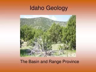
Idaho Geology. The Middle Rockies. Middle Rockies. Middle Rockies. Ranges that are separated by broad valleys and plateaus (remember this description!). The ranges are the dominant features. Opposite description of Basin and Range Peaks in 8-10,000 ft. range. Geologic Origins.

E N D
Idaho Geology The Middle Rockies
Middle Rockies • Ranges that are separated by broad valleys and plateaus (remember this description!). The ranges are the dominant features. • Opposite description of Basin and Range • Peaks in 8-10,000 ft. range
Geologic Origins • Folding for some ranges • Faulting for some ranges (rows of fault blocks like B&R) • Both folding and faulting for some ranges
Fault mountains may be simple horst and graben situations, or larger tilted fault blocks
Mountain ranges Grand Tetons Big Hole Mountains Caribou Mountains Blackfoot Mountains Portneuf Mountains Bear River Mountains
Rivers are important to this region Blackfoot River Portneuf River Bear River Gray’s River Snake River Teton River Henry’s Fork
The Snake River begins in Jackson Lake, Wyoming, before flowing into Idaho The first few miles in Idaho the river is actually Palisades Reservoir behind Palisades Dam, which controls floods and serves agricultural purposes (irrigation) as well as recreational needs (see next page).
Palisades Reservoir Palisades Dam
Blackfoot River Reservoir Gray’s Lake
The Bear River drains the Middle Rockies around Bear Lake and the Bear River Mountains. It also drains the Eastern part of the Basin and Range
Soda Springs was so named because of large phosphate deposits discovered and mined there even today. Phosphate Mining
Baking reaction with sodium bicarbonate to produce carbon dioxide (CO2) • Colas-Phosphoric Acid for fizz • Toothpaste-Dicalcium Phosphate Dihydrate as an abrasive • Tooth Gels-Sodium Tripolyphosphate as a whitening agent • Car Wash/dishwashing detergent-Sodium Tripolyphosphate which softens water, removes soils and keeps soil from redepositing
Fire Extinguishers-Mono- and Di- ammonium Phosphates as a fire retardant • Latex Paint-Sodium Potassium Tripolyphosphate, Potassium Tripolyphosphate as a dispersing agent • Fertilizers-Ammonium Phosphate as nutrient for plant growth • Synthetic Rubber-Tetrapotassium Pyrophosphate as a catalyst • Photocopier Toner-Tricalcium Phosphate as a dispersing agent • Dyeing Wool-Diammonium Phosphate for control of pH in dye bath to allow even penetration of dye through the wool • Explosives and pyrotechnics
Climate • Fairly moderate and dry • Summer average = 80 degrees • Winter average low of 8 degrees • Precipitation = 15” (at elevation) • Snowfall heavy = 73” (at elevation) • Rainshadow effect!
Rainshadow Effect WASH/ORE IDAHO CASCADES AND SIERRA NEVADA
Vegetation • Grassy valleys with irrigated farming between ranges • Forested hills with most trees in moister low points • Little vegetation on drier ridges • Open forest encourages grazing/browsing