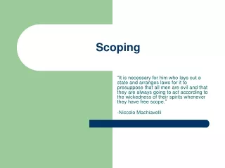
SCOPING
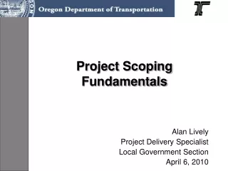
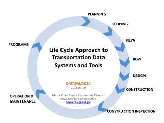
PLANNING. SCOPING. NEPA. PROGRAMS. Life Cycle Approach to Transportation Data Systems and Tools. ROW. DESIGN. DATAPALOOZA 2013.05.09 Maria Chau, Senior Community Planner FHWA New York Division Office Maria.Chau@dot.gov. CONSTRUCTION. OPERATION & MAINTENANCE.

SCOPING
E N D
Presentation Transcript
PLANNING SCOPING NEPA PROGRAMS • Life Cycle Approach to Transportation Data Systems and Tools ROW DESIGN DATAPALOOZA 2013.05.09 Maria Chau, Senior Community Planner FHWA New York Division Office Maria.Chau@dot.gov CONSTRUCTION OPERATION & MAINTENANCE CONSTRUCTION INSPECTION
EXISTING DIGITAL LIFE CYCLE MODEL (SILOED APPROACH) PLANNING Indicates Program or Process SCOPING Indicates Electronic System related to Program or process STIP PROCESS DBE – Civil Rights NEPA VDC / BIM GIS Electronic / GIS based STIP Accident Location Incident System (NYSDOT) PROGRAMS SAFETY NEPA PROCESS ITS PLANNING Traffic Viewer RESEARCH Simulators OPERATION / MAINTENANCE Environmental Tracker Environmental Viewer (NYSDOT) ROW FHWA/ STATE /AASHTO DESIGN GUIDELINES ROW Traffic Modeling Forecasting BRIDGE LIDAR PAVDAT PAVEMENT CIM EARTHWORKS ROW ACQUISITION HPMS / HIGHWAY DATA HPMS, Bridge, Pavement Viewer (FHWA) Smart Construction Tools DESIGN ENVIRONMENTAL / HISTORIC DBE wimWEB CONSTRUCTION MANAGEMENT GPS Enabled Construction Equipment DISCRETIONARY PROG. Traffic Control Management VEHICLE, SIZE & WEIGHT CONSTRUCTION EQUIPMENT OPERATION MAINTENANCE CONSTRUCTION Regional Integrated Transportation Information System (RITIS - UMD - CATTLab) INSPECTION CIM AS BUILT OPERATION & MAINTENANCE OPERATION & MAINTENANCE CONSTRUCTION INSPECTION
Life Cycle Approach to Transportation Data Systems & Tools PLANNING CONNECTING SILOS THROUGH A DIGITAL SYSTEM SCOPING 3D GIS Data Integrated Visual Analytics NEPA Data Integrated Visual Analytics PROGRAMS System Model for Forecasting / Simulation Field Surveys Augmented Reality Geospatial Data Collaboration ROW LIDAR 3D GIS Data Integrated Visual Analytics GIS Layers / Visual Analytics Tools for each Program Area Civil Integrated Management Visual Analytics Systems Model Infrastructure Model to Simulate xD Capabilities Augmented Reality DESIGN Inspections Augmented Reality Inspections Augmented Reality 3D GIS CONSTRUCTION ITS Architecture to Monitor / Report Data OPERATION & MAINTENANCE (Field Data, Sensors, Cameras, Visual Analytic Tools etc.) CONSTRUCTION INSPECTION
Layers of Policy / Program Data Visualization STIP / Projects DBE Construction Details Safety Operations & Maintenance VDC / CIM Infrastructure Highway Data / HPMS Environmental
Life Cycle Approach to Transportation Data Systems & Tools Data from Ancillary Sources PLANNING DATA FLOW Ancillary Data Sources / Inputs Data from Field Surveys Data from Field Surveys SCOPING Data Share Build from Planning to Scoping Collect Program Areas Data/Analysis to Planning 3D GIS Data Share Build from Scoping to NEPA Data Integrated Visual Analytics NEPA PROGRAMS System Model for Forecasting / Simulation Field Surveys Augmented Reality Data Share Build from NEPA to ROW Geospatial Data Collaboration ROW Other data collecting initiatives for Program Areas such as inspection LIDAR 3D GIS GIS Layers / Visual Analytics Tools for each Program Area Civil Integrated Management Visual Analytics Systems Model Data Share Build All to Design Collect Operations Data to Program Areas Infrastructure Model to Simulate xD Capabilities Augmented Reality DESIGN Inspections Augmented Reality Inspections Augmented Reality Data Share Build All to Construction 3D GIS CONSTRUCTION ITS Architecture to Monitor / Report Data (Field Data, Sensors, Cameras, Visual Analytic Tools etc.) OPERATION & MAINTENANCE Data Share Build All to Constr. Insp. Data from Construction Inspection xD data real time updates xD data real time updates Receive resurveyed Infrastructure CIM Model with xD capabilities to be inserted into System for lifecycle monitoring CONSTRUCTION INSPECTION Other data collecting initiatives for Program Areas such as inspection
Life Cycle Approach to Transportation Data Systems & Tools PLANNING EXAMPLES OF PARTS OF THE DIGITAL SYSTEM SILOED WITH SOME CONNECTION SCOPING 3D GIS PIKES PEAK AREA COG CONNECTS PROPOSED PROJECT TO DESIGN Google Earth NEPA PROGRAMS NJTPA CONNECTS OPERATIONS DATA for PLANNING FLORIDA DOT ETDM CONNECTS ENVIRONMENTAL DATA WITH RESOURCE AGENCIES AND PROJECTS Geospatial Data Collaboration ROW 3D GIS LIDAR UTAH’s UPLAN CONNECTS ALL PROGRAM AREAS GEOSPATIALLY Visual Analytics Systems Model Civil Integrated Management Augmented Reality DESIGN DALLAS FT WORTH CONNECTOR - Kiewit CIM 3D GIS CONSTRUCTION I-95 CC / CATT LAB CONNECTS SYSTEM PERFORMANCE WITH MULTI-AGENCIES OPERATION & MAINTENANCE Visual Analytics CONSTRUCTION INSPECTION
Life Cycle Approach to Transportation Data Systems & Tools Feedback loops Planning Continuing, Cooperative and Comprehensive Process from (1) Program Information, (2) Stakeholders’ input, (3) Ancillary Information to develop Plans and make informed decision in order to prioritize Projects in building and maintaining the System. PLANNING Planning works with Programs to implement policy and guidance in building the system. Planning offers feedback on targets and feasibility of implementation Gap Analysis SCOPING STIP Projects works with Planning and offers feedback on feasibility of implementation and missing or ineffective planning details specific to the project 3D GIS Data Collection from Program Areas and Ancillary Sources NEPA Use of Program Data at Specific Location of Project PROGRAMS Program Areas develop Policy and Guidance based on Principals, and Evaluation of System Performance ROW PROJECTS Geospatial Data Collaboration Civil Integrated Management 3D GIS Projects implement the plans through capital, network, projects that create building blocks of the system. These become part of the System to be monitored and maintained. Data Collection from Systems Operations Reporting and other data collecting initiatives for Program Areas Visual Analytics Design or redesign infrastructure as building block of System Systems Model Planning and Programs works with Operations and Maintenance to receive necessary and sufficient data on system performance Augmented Reality DESIGN Create As-Built or Resurvey of infrastructure building block to be placed into System to be monitored ITS Architecture Reporting/ Sharing Data CONSTRUCTION Monitoring and Maintaining System through ITS/Operations and Reporting Data to Program Areas OPERATION & MAINTENANCE Operations works with Planning and Projects to receive digital building blocks and determine components necessary to monitor system performance Operation and Maintenance monitor and maintain the system reporting on System Performance CONSTRUCTIONINSPECTION
Life Cycle Approach to Transportation Data Systems & Tools Layers of Policy / Program Data Visualization CONNECT SILOS THROUGH DIGITAL SYSTEM PLANNING SCOPING 3D GIS STIP / Project Data Integrated Visual Analytics NEPA PROGRAMS System Model for Forecasting / Simulation Field Surveys Augmented Reality Safety Geospatial Data Collaboration Operations & Maintenance ROW LIDAR 3D GIS Civil Integrated Management GIS Layers / Visual Analytics Tools for each Program Area Visual Analytics Systems Model VDC / CIM Infrastructure Infrastructure Model to Simulate xD Capabilities Augmented Reality DESIGN Inspections Augmented Reality HPMS Inspections Augmented Reality 3D GIS CONSTRUCTION ITS Architecture to Monitor / Report Data (Field Data, Sensors, Cameras, Visual Analytic Tools etc.) Environmental OPERATION & MAINTENANCE CONSTRUCTION INSPECTION
Levels of Visual Information Policy Program Project Practitioner Public PLANNING SCOPING NEPA PROGRAMS Life Cycle Approach to Transportation Data Systems and Tools ROW DESIGN CONSTRUCTION OPERATION & MAINTENANCE CONSTRUCTION INSPECTION
Levels of Visual Information Policy Program Project Practitioner Public Programs Overview System Overview Operations Over. Asset Overview Analytics Simulation Modeling / Forecasting Data Mining PLANNING SCOPING Metropolitan Areas and Mega-Regions NEPA PROGRAMS Life Cycle Approach to Transportation Data Systems and Tools ROW DESIGN CONSTRUCTION OPERATION & MAINTENANCE CONSTRUCTION INSPECTION
Levels of Visual Information Policy Program Project Practitioner Public System Mgt Operations Mgt Asset Management Analytics Modeling Data Mining PLANNING SCOPING Safety Program – Targeted Locations of Centerline Rumble Strips NEPA PROGRAMS Life Cycle Approach to Transportation Data Systems and Tools ROW DESIGN CONSTRUCTION OPERATION & MAINTENANCE CONSTRUCTION INSPECTION
Levels of Visual Information Policy Program Project Practitioner Public System Mgt Operations Mgt Asset Management Analytics Modeling Data Mining Courtesy of SUNY Albany - wimWEB PLANNING Vehicle Size & Weight Program SCOPING NEPA PROGRAMS Life Cycle Approach to Transportation Data Systems and Tools ROW DESIGN CONSTRUCTION OPERATION & MAINTENANCE CONSTRUCTION INSPECTION
Levels of Visual Information Policy Program Project Practitioner Public Fed. Aid Process Location Specific VDC / CIM Constr. CIM Files Augmented Reality Courtesy of Mortenson Construction - Oldenburg PLANNING Virtual Design and Construction Process SCOPING 3D Design Coordination Earthworks Analysis Constructability Analysis 4D Schedule Simulation 3D Site Planning Visualization NEPA PROGRAMS Life Cycle Approach to Transportation Data Systems and Tools ROW DESIGN CONSTRUCTION OPERATION & MAINTENANCE CONSTRUCTION INSPECTION
Levels of Visual Information Policy Program Project Practitioner Public Management Tools UMD CATTlab - RITIS Monitoring Tools VDC/BIM Designer Ops /Maint. Tools Enforcement Tool Simulation Courtesy of Bergmann Associates - Hixon Augmented Reality PLANNING SCOPING TCM Traffic Reporting / Maintenance Scheduling NEPA PROGRAMS Life Cycle Approach to Transportation Data Systems and Tools ROW DESIGN CONSTRUCTION OPERATION & MAINTENANCE CONSTRUCTION INSPECTION
Levels of Visual Information Policy Courtesy of Bergmann Associates - Hixon Program Project Practitioner Public UMD CATTlab - RITIS Information Outreach Public Participation Public Feedback Accountability UMD CATTlab - RITIS Courtesy of Bergmann Associates - Hixon PLANNING SCOPING 511 Services / Electronic Public Participation NEPA PROGRAMS Life Cycle Approach to Transportation Data Systems and Tools ROW DESIGN CONSTRUCTION OPERATION & MAINTENANCE CONSTRUCTION INSPECTION
PLANNING SCOPING NEPA PROGRAMS • Life Cycle Approach to Transportation Data Systems and Tools ROW DESIGN DATAPALOOZA 2013.05.09 Maria Chau, Senior Community Planner FHWA New York Division Office Maria.Chau@dot.gov CONSTRUCTION OPERATION & MAINTENANCE CONSTRUCTION INSPECTION