Download
1 / 57
570 likes | 731 Views
Earthquakes Lecture Four. Did you know we have earthquakes in Swain County?. How the Crust is Deformed. Deformation – The bending, tilting, and breaking of the earth’s crust. Plate Tectonics , the movement of the lithospheric plates, is the major cause of crustal deformation .

E N D
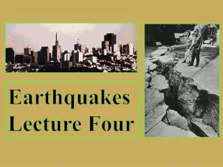
Earthquakes Lecture Four
How the Crust is Deformed Deformation – The bending, tilting, and breaking of the earth’s crust.
Plate Tectonics, the movement of the lithospheric plates, is the major cause of crustal deformation.
Isostasy and Isostatic Adjustment http://youtu.be/G9rN7qhUQZg Isostasy - The state of gravitational equilibrium between the lithosphere and the asthenosphere of the Earth such that lithospheric plates "float" at a given elevation depending on their thickness.
Removal of a large load should cause the crust to float up higher, while loading of crustal rocks should make the crust sink deeper.
These forces act like pulling a rubber band gradually until the band snaps. This theory is known as the "elastic rebound theory."
Mid-Ocean Ridges This is a map of the major oceanic spreading centers.
The Eurasian - Melanesian Belt - The mountains along this section were created by three plates colliding together.
Stress causes strain in crustal rock. Strain is a change in the shape or volume of rock. There are three main types of stress
Compression squeezes the rocks of the crust causing the rocks to take up less space and become denser
pulls rocks causing them to stretch over a larger area. Tension The ends of the rock end up being thicker and the middle is stretched out and becomes thinner.
Shearing when rock of the crust pushes in two opposite directions and usually results in a simple bend or break.
Earthquakes are vibrations in the earth’s crust Movement between plate and along faults is not smooth! They move in jerks, giving rise to earthquakes.
Earthquakes create seismic waves which shake the ground as they pass just like waves of water moving across the ocean.
Types of Seismic Waves Earthquakes generate three major types of seismic waves P, for "Primary" S, for "Secondary" waves L, for “Long” waves
A drop disturbs the flat surface of the water and creates waves that travel outward in all directions from the disturbance. Earthquake waves travel the same way
P Waves - Primary Move the fastest and are the first recorded by a seismographic Can travel through liquids, gases and solids The P waves move in a compressional motion similar to the motion of a slinky
S Waves - Secondary P and S waves Secondary Waves are the second to be recorded by a seismograph, Can only travel through solid materials S waves move in a shear motion perpendicular to the direction the wave is traveling.
L Waves – Long Waves or Surface Waves Surface or L waves occur only in the earth's crust and cause the most damage travel along the surface of the earth from the point directly above the quake or epicenter Slowest moving waves, last to be recorded by a seismograph. wave visualization
Shadow Zones are places that do not receive any earthquake waves The shadow zone is the area of the earth from angular distances of 104 to 140 degrees from a given earthquake that does not receive any direct P waves. The shadow zone results from S waves being stopped entirely by the liquid core and P waves being bent (refracted) by the liquid core.
Recording Earthquakes An earthquake is a sudden shaking of the ground. They generate seismic waves which can be recorded on a sensitive instrument called a seismograph.
Earthquake Measurement Richter Scale expresses the magnitude or measure of energy released by an earthquake.
Advances in seismograph technology have increased our understanding of both earthquakes and the Earth itself.
Finding the Origin of an Earthquake Epicenter Focus wave visualization 2
TheFOCUS of an earthquake is where slippage first occurs along the fault line • The EPICENTER is where the earthquake waves reach the earth’s surface directly above the focus
Scientist must have information from three seismographic stations at different locations to plot the epicenter of an earthquake
Aftershocks Aftershocks are earthquakes that follow the largest shock of an earthquake sequence. They are smaller than the mainshock
Faulting and Folding Faulting and Folding
Folding If rock bends and does not break, it is called folding. Folding is one way to get hills and dips in the landscape. What decides if a rock will fault or fold?
Temperature: Rock becomes very hot when it is compressed. The hotter it is, the more like it will soften and bend/fold. The cooler it is, the more brittle it is likely to be (more likely to break/fracture).
Pressure: The greater the pressure the rock is under, the more likely it is to fold and bend. One way pressure is produced is by the crustal rocks of our continents pressing down on the rock underneath it. The extreme weight of all that rock creates a great deal of pressure
RockType: Rocks can be made of many different combinations of elements. Certain elements tend to form rocks that are brittle and other elements tend to form rocks that are more bendable. How the rock is formed also helps to indicate what it will do under stress. The rock type could depend on if it cooled quickly during formation, or if it cooled slowly.
There are three general types of folds Synclines http://www.youtube.com/watch?v=tIFqPNjwB5E Anticlines Monoclines
Faulting Faults form in rocks when the stresses overcome the internal strength of the rock resulting in a fracture. A fault can be defined as the displacement of once connected blocks of rock along a fault plane.
Hanging Wall and Footwall We classify faults by how the two rocky blocks on either side of a fault move relative to each other.
Hanging Wall Its name originates from mining activities along large, ancient faults which had since been "filled in" with mineral deposits. Miners could hang their lamps from the wall above them, coining the term "hanging wall" for this side of a fault.
Footwall The counterpart of the hanging wall, the footwall is the part of the Earth's crust below a fault. As with the hanging wall, the" footwall" was so named by miners, since they would walk on the lower side of a mined-out fault.
There are several different kinds of faults http//youtu.be/tJDnfT1pqhQ Normal faults occur when tensional forces act in opposite directions and cause one slab of the rock to be displaced up and the other slab down
Reverse faults develop when compressional forces exist. Compression causes one block to be pushed up and over the other block http://youtu.be/4b81nXSVA34
Thrust faults: this is when the hanging wall is actually forced up onto and over the foot wall due to compression in the rock. http://youtu.be/aHljDIDf6js
You can tell the relative age of rock by igneous intrusions and faulting Igneous intrusion D is younger than strata layers A, B, and C, but not younger than fault line E
Geohazard Risks and Precautions • Landslides • Earthquakes • Tsunamis • Sinkholes • Groundwater pollution • Flooding
Geohazard Safety Stocking up now on emergency supplies can add to your safety and comfort during and after an earthquake. Store enough supplies for at least 72 hours.
What are the chances we will have an earthquake in Swain County? What should we do as precautionary measures? Earthquake visualization risk visualization
Stay Calm If You Are Indoors Protect yourself from falling debris by standing in a doorway or crouching under a desk or table.
If You Are In An Automobile Stay away from power lines, tunnels, tall buildings, and bridges, and stay in car until the tremors cease.
After an earthquake be cautious Check for fire and fire hazards. Watch for broken glass Avoid downed power lines