Download
1 / 51
520 likes | 672 Views
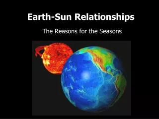
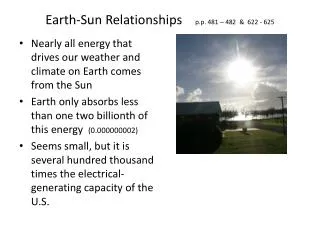
Earth-Sun Relationships. Climate vs. Weather. Weather : condition of atmosphere in 1 place during a limited time. Climate vs. weather. Climate : weather patterns of an area over a long period of time. The most important factor of climate is Earth’s position in relation to the sun.

E N D
Climate vs. Weather • Weather: condition of atmosphere in 1 place during a limited time
Climate vs. weather • Climate: weather patterns of an area over a long period of time
The most important factor of climate is Earth’s position in relation to the sun
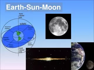
Earth’s Tilt • Axis: imaginary line runs from pole to pole, through center • Tilted at 23 ½ º angle • Places receive diff. amounts of light at diff. times
Earth’s Tilt • Areas with direct sunlight warmer temps. • Areas with indirect sunlight cooler temps.
Earth’s Rotation • Earth rotates on its axis • One complete rotation = 24 hours • From west to east, one hemisphere at a time
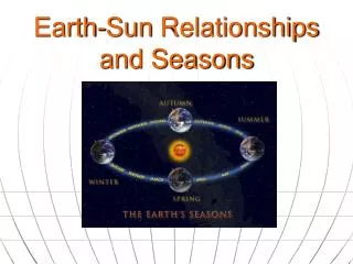
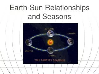
Earth’s Revolution • As it rotates, Earth revolves around the sun (365 days) • Tilt + revolution = seasons • Δs in length of days and temp. • Reversed for N & S hemispheres
Equinoxes & Solstices • Equinox: Spring and Fall • Equal days and nights • Solstice: Summer and Winter • Longer day or shorter day
Equinoxes & Solstices • Spring equinox March 21- rays hit Equator directly…equal day/night • Summer solstice June 22- rays hit Tropic of Cancer (23 ½ ºN)…longest day
Equinoxes & Solstices • Fall equinox Sept. 23- rays hit Equator directly…equal day/night • Winter solstice December 22- rays hit Tropic of Capricorn (23 ½ ºS)…shortest day
Equinoxes & Solstices • So if it is summer in Houston, what season is it in South Africa? • If we are wearing long sleeves and jackets, what are they wearing in China?
The Poles • For 6 months one pole is pointed toward sun constant sunlight • Other is pointed away little to no sunlight “lands of the midnight sun”
The Greenhouse Effect • The perfect balance must be kept: • Too much heat escapes freeze • Too much heat is trapped dry out
Global warming • More fossil fuels (coal, oil, natural gas) are burned • Greenhouse gases (CO2, O3, water vapor) trap more heat
Global warming • Water evaporation , get more rainfall • Land dries out more quickly
Factors Affecting Climate • Divide your paper into 8 squares • Label them the following: • Low Latitudes 5. Wind Patterns • High Latitudes 6. Ocean Currents • Mid-Latitudes 7. El Niño • Elevation 8. Landforms • Use Ch. 3 Sec. 2 • You will write at least 3 main points for each IN YOUR OWN WORDS! • You will draw an illustration to visually explain the factor (Must be colored)
Low Latitudes • Between the the “Tropics” • Low numbers in latitude value • Receive direct rays from Sun • Equator: 6 mos. a yr. • Each Tropic: 3 mos. a yr. • Receive indirect rays from Sun • Equator: 6 mos. a yr. • Each Tropic: 6 mos. a yr. • Warm to hot climates year round
High Latitudes • Polar areas= N of Arctic Circle and S of Antarctic Circle (high numbers in latitude value) • Receives constant sunlight for 6 months when pole faces Sun • March-Sept: North has constant daylight, South is in dark (switches for next 6 mos.) • Arctic & Antarctic Circles are last point to receive indirect rays (during summer or winter)
Mid Latitudes • Most variable weather on Earth • Between Trop. of Cancer & Arctic Circle; between Trop. of Capricorn & Antarctic Circle (~30°- 60°) • Ranges from fairly hot to fairly cold (temperate), dramatic changes, but no extremes • Summer gets warm air from low-lats, winter gets cold air from high-lats
Elevation • At any latitude, anywhere on Earth, elevation influences climate • If high enough in elevation, can have snow on the Equator! • As altitude increases, the air thins which absorbs less heat • As elevation increases, temperature decreases (3.5° per 1,000 ft)
Wind Patterns • Move clockwise in N. Hem. and counterclockwise in S. Hem. (Coriolis Effect) • Cool air flows in to replace rising warm air (Polar front), distributing Sun’s heat • Switches direction in each latitude zone • Low latitudes have trade winds (northeasterly/southeasterly) • Mid-latitudes have westerlies • High latitudes have polar easterlies *(named for direction they come FROM) • Windless bands • Doldrums @ Equator • Horse Latitudes @ Tropics
Doldrums: windless area near the equator Horse Latitudes: Historically, ships would lighten their loads in order to take advantage of the slightest wind such as cargo, excess supplies and livestock…this also included horses.
Ocean Currents • Flow same directions as wind…which is?? • Cold water moves from poles to Equator and warms up (cold currents), or warm water moves from Equator to poles and cools (warm currents) • Currents affect the climate on land: either cooling or warming (ex: North Atlantic Drift & W. Europe)
El Niño • Periodic change in currents & water temps. in mid-Pacific region • No known cause • Reversal of atmospheric pressures reduce or reverse wind patterns brings warm water from Asia to South America • Domino effect: • Precipitation increases, flooding in S. America • Or droughts and fires in SE Asia/Australia
El Nino • http://www.teachersdomain.org/resource/ess05.sci.ess.watcyc.eselnino/
Landforms • Landforms affect climates of places @ the same latitude • Bodies of water moderate temps. b/c they take a long time to change temp. • Gulf of MX is warm water keeps Houston warmer • Continentality– absence of lg. body of water means more drastic weather changes • Nebraska can have hot summers and receive snow in the winters (4 seasons instead of 2 ) • Rainshadow effect • Cool air releases moisture on windward side of mountain; then hot, dry air moves to leeward side creating deserts
Ganges Plain in India Himalaya Arid Tibetan Plateau
Climographs World Climographs webpage