Download
1 / 12
120 likes | 289 Views
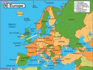
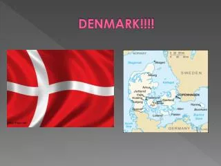
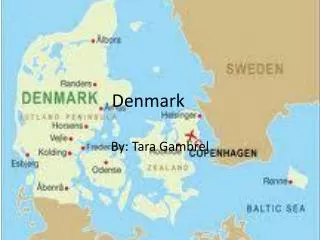
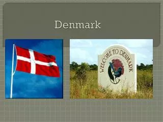
Denmark. By:Yvonne arias. Locate denmark on a map and list surrondings.

E N D
Denmark By:Yvonne arias
Locate denmark on a map and list surrondings • Zealand (also Sealand; Danish: Sjælland; pronounced [ˈɕɛˌlænˀ]) is the largest island (7,031 km²) of Denmark (the 95th-largest island in the world). Zealand is connected to Funen by the Great Belt Bridge and to Sweden by the Oresund Bridge. • The capital of Denmark, Copenhagen, is partly located on the eastern shore of Zealand and partly on Amager. Other cities on the island include Roskilde
Loctaedenmark on a map and list it’s surrondins • North jutdicDanes rarely refer to the area as a whole, but more often to the three constituent districts or to North Jutland (which also includes an area south of the Limfjord). The adjectives nordenfjords and søndenfjords are commonly used, meaning north and south of the Fjord, respectively. The names can all be considered ad hoc creations, in lack of an ancient name for the island as a geographical unity.
Locate denmark and list it’s surronding • Funen known as the Garden of Denmark, pastoral and picturesque Funen is Denmark’s second-largest island. Aero and Langeland are two of the most popular of the nearby 90 islands. The rural scenery of these islands, with their thatched farmhouses and quaint windmills scattered around the landscape, has an irresistible charm that has remained unchanged for centuries.
Countries around denmark • GarmanyGermany (i/ˈdʒɜrməni/), officially the Federal Republic of Germany (German: Bundesrepublik Deutschland, pronounced [ˈbʊndəsʁepuˌbliːk ˈdɔʏtʃlant] ( listen)),[4] is a country in Western Europe. It is bordered to the north by the North Sea, Denmark, and the Baltic Sea; to the east by Poland and the Czech Republic; to the south by Austria and Switzerland; and to the west by France, Luxembourg, Belgium, and the Netherlands. The territory of Germany covers an area of 357.021 km2 and is influenced by a temperate seasonal climate. With 81.8 million inhabitants, it is the most populous member state of the European Union,[5] and home to the third-largest number of international migrants worldwide.[6] • A region named Germania, inhabited by several Germanic peoples, was documented before AD 100. Beginning in the 10th century, German territories formed a central part of the Holy Roman Empire, which lasted until 1806. During the 16th century, northern Germany became the centre of the Protestant Reformation. As a modern nation-state, the country was first unified amidst the Franco-Prussian War in 1871. After World War II, in 1949, Germany was divided into the states of East Germany and West Germany, along the lines of Allied occupation. Germany was reunified in 1990. West Germany was a founding member of the European Community in 1957, which became the EU in 1993. It is part of the Schengen Area and adopted the euro in 1999.[7][8][9] • Germany is a federalparliamentary republic of sixteen states. The capital and largest city is Berlin. Germany is a member of the United Nations, NATO, the G8, the G20, and the OECD. It is a major power with the world's fourth largest economy by nominal GDP and the fifth largest by purchasing power parity. It is the second largest exporter and third largest importer of goods. In absolute terms, Germany allocates the third biggest annual development aid budget in the world,[10] while its military expenditure ranked seventh.[11] The country has developed a very high standard of living and a comprehensive system of social security. It holds a key position in European affairs and maintains a multitude of close partnerships on a global level.[12] Germany is recognised as a scientific and technological leader in several fields.[13] • Contents
Countries around denmark • Norway is situated in the western part of the Scandinavian peninsula. It extends about 1,100 mi (1,770 km) from the North Sea along the Norwegian Sea to more than 300 mi (483 km) above the Arctic Circle, the farthest north of any European country. It is slightly larger than New Mexico. Nearly 70% of Norway is uninhabitable and covered by mountains, glaciers, moors, and rivers. The hundreds of deep fjords that cut into the coastline give Norway an overall oceanfront of more than 12,000 mi (19,312 km). Galaho Peak, at 8,100 ft (2,469 m), is Norway's highest point and the Glama (Glomma) is the principal river, at 372 mi (598 km) long.
Countries around denmark • Sweden, which occupies the eastern part of the Scandinavian Peninsula, is the fourth-largest country in Europe and is one-tenth larger than California. The country slopes eastward and southward from the Kjólen Mountains along the Norwegian border, where the peak elevation is Kebnekaise at 6,965 ft (2,123 m) in Lapland. In the north are mountains and many lakes. To the south and east are central lowlands and south of them are fertile areas of forest, valley, and plain. Along Sweden's rocky coast, chopped up by bays and inlets, are many islands, the largest of which are Gotland and Oland.
Countries around denmark • France is about 80% the size of Texas. In the Alps near the Italian and Swiss borders is western Europe's highest point—Mont Blanc (15,781 ft; 4,810 m). The forest-covered Vosges Mountains are in the northeast, and the Pyrénées are along the Spanish border. Except for extreme northern France, the country may be described as four river basins and a plateau. Three of the streams flow west—the Seine into the English Channel, the Loire into the Atlantic, and the Garonne into the Bay of Biscay. The Rhône flows south into the Mediterranean. For about 100 mi (161 km), the Rhine is France's eastern border. In the Mediterranean, about 115 mi (185 km) east-southeast of Nice, is the island of Corsica (3,367 sq mi; 8,721 sq km).
Bodies of water • The North Sea - a part of the Atlantic Ocean - is bordered by Norway and Denmark, Scotland and England, (and in the southeast) by the Frisian Islands and Germany, the Netherlands, Belgium and France. Above the Shetland Islands in the north its waters merge with the Norwegian Sea. Waters flow east-to-west into the North Sea through the Skagerrak Strait, an outlet to the Atlantic Ocean from the Baltic Sea. Along the southern reaches of the North Sea, waters from the Atlantic Ocean flow through the English Channel and on into the North Sea through the Strait of Dover. The Kiel Channel in northern Germany, is one of the world's busiest artificial waterways. International sea traffic uses it to connect between the North Sea and the Baltic Sea, thus saving hundreds of miles of additional travel time around Denmark, and the related high costs of transportation. In the southern areas the North Sea's depth is less than 150 ft (50 m), but in the north it slopes down to about 600 ft (200 m). Along the southwestern coastline of Norway, the North Sea reaches a depth of near 1,200 ft (400 m).
Bodies of water • The Norwegian Sea, a part of the North Atlantic Ocean, is positioned (generally) to the northwest of Norway and to the southeast of Greenland. It merges with the Barents Sea off the northern coast of Norway, and with the waters of the North Sea to the southeast of the Faroe Islands. The Norwegian Current, a branch of the Gulf Stream, pushed warm water to the north past the United Kingdom (UK), through the Norwegian Sea and on into the Barents Sea. This movement is the significant factor in the somewhat mild climates experienced by the countries and island groups in the North Atlantic Ocean and Scandinavia. Estimating the exact size of the Norwegian Sea is based on where the sea actually ends, so all known measurements are estimates, at best. Wikipedia references a surface area of 1,380,000 sq km, while other reference sources vary some in their reported size number. Average depth runs near 1,700 meters (5,577 ft), while the maximum depth of the North Sea has been measured at 3,970 meters (13,020 ft). The strong currents and temperate waters here keep the Norwegian Sea ice-free throughout the year. Within its waters oil and gas production are a major business for Norway and the United Kingdom (UK), and its fishing grounds are some of the most productive on the planet.
Bodies of water • The Atlantic ocean is the second-largest of the world's oceanic divisions. With a total area of about 106,400,000 square kilometres (41,100,000 sq mi), it covers approximately twenty percent of the Earth's surface and about twenty-six percent of its water surface area. The first part of its name refers to Atlas of Greek mythology, making the Atlantic the "Sea of Atlas". • The oldest known mention of "Atlantic" is in The Histories of Herodotus around 450 BC (Hdt. 1.202.4): Atlantis thalassic(Greek: Ἀτλαντὶςθάλασσα; English: Sea of Atlas); see also: Atlas Mountains. Another name historically used was the ancient term Ethiopic Ocean, derived from Ethiopia, whose name was sometimes used as a synonym for all of Africa and thus for the ocean. Before Europeans discovered other oceans, the term "ocean" itself was synonymous with the waters beyond the Strait of Gibraltar that we now know as the Atlantic. The Greeks believed this ocean to be a gigantic river encircling the world. • The Atlantic Ocean occupies an elongated, S-shaped basin extending longitudinally between the Americas to the west, and Eurasia and Africa to the east. As one component of the interconnected global ocean, it is connected in the north to the Arctic Ocean (which is sometimes considered a sea of the Atlantic), to the Pacific Ocean in the southwest, the Indian Ocean in the southeast, and the Southern Ocean in the south. (Other definitions describe the Atlantic as extending southward to Antarctica.) The equator subdivides it into the North Atlantic Ocean and South Atlantic Ocean.
Bodies of water • The Baltic Sea is a brackishmediterranean sea located in Northern Europe, from 53°N to 66°Nlatitude and from 20°E to 26°Elongitude. It is bounded by the Scandinavian Peninsula, the mainland of Europe, and the Danish islands. It drains into the Kattegat by way of the Øresund, the Great Belt and the Little Belt. The Kattegat continues through Skagerrak into the North Sea and the Atlantic Ocean. The Baltic Sea is connected by man-made waterways to the White Sea via the White Sea Canal, and to the North Sea via the Kiel Canal. The Baltic Sea might be considered to be bordered on its northern edge by the Gulf of Bothnia, on its northeastern edge by the Gulf of Finland, and on its eastern edge by the Gulf of Riga. However, these various gulfs can be considered to be simply offshoots of the Baltic Sea, and therefore parts of it.