Download
1 / 9
90 likes | 189 Views
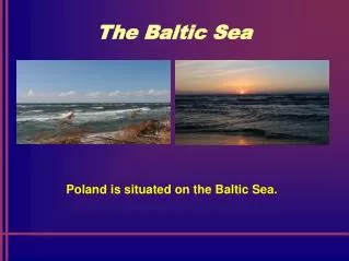
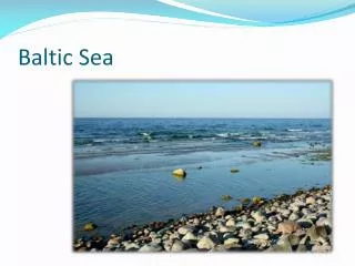
This workshop showcases the results of pre-processing and classification of satellite data in the Baltic Sea Basin using various channels and ancillary data. The final legend includes 22 classes covering different land cover types across numerous countries in Europe.

E N D
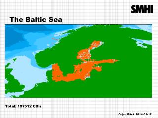
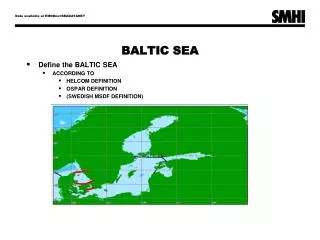
GLC2000 - Baltic Sea BasinMetria • Indata: SPOT VGT 10-day composites from 01-04-2000 to 21-10-2000 and several SPOT VGT S-1 composite data for June and September. • Channels: 2 visible (blue/red), NIR, MIR, NDVI, Status Map, Viewing Zenith Angle. • Ancillary Data: CORINE LC, BALANS LC/LU, Sverigeklassning data, 1:250 000 Rasterdata for Norway, DCW vector data, 200m EuropeDEM. GLC 2000 – “FIRST RESULTS” WORKSHOP JRC – Ispra, 18-22 March 2002
Pre-processing of Indata • Remove bad MIR data • Remove water ”ring” around coast • Remove pixels with a VZA > 50º • Remove clouds • Remove snow • Remove urban areas (based on ancillary data)
Processing • Unsupervised classification (40 classes) • Majority clustering • Masking of clusters which correspond exactly to reference data • Second unsupervised classification (40 classes) • Automatic and manual comparison od clusters with reference data • Labelling of clusters
Results • 22 Classes in final legend • 11 pure and 11 mixed classes • Countries include: Denmark, Estonia, Finland, Germany, Latvia, Lithuania, Norway, Poland, Sweden. • Additional coverage: Austria, Belarus, Belgium, Czech, France, Hungary, Luxembourg, Moldova, Netherlands, Rumania, Russia, Slovakia, Switzerland,
1 Artificial Surfaces 2 Agricultural Crops 3 Closed Woody 4 Closed Needleleaved 5 Closed Broadleaved 6 Herbaceous 7 Mixed Op/Cl Woody 8 Waterlogged Herbaceous 9 Bare Rock 10 Loose & Shifting Sands 11 Ice (Snow) 12 Water 13 Mixed 1 & Unconsolidated 14 Mixed 4 & 5 15 Mixed 6 & Shrubs 16 Mixed 6 & Unconsolidated 17 Mixed 8 & Lichen & Soil 18 Mixed 2 & 4 19 Mixed 2 & 5 20 Mixed 2 & 4 & 5 21 Mixed 4 & 5 & 12 22 Mixed 4 & 5 & 8 Legend