Download
1 / 38
380 likes | 485 Views
45 th Annual Alaska Surveying & Mapping Conference February 21-25, 2011 Hilton Anchorage Hotel Impact of Airborne Gravity Surveys on Geoid Modeling in Alaska Part I: A New National Vertical Datum. Daniel R. Roman and Vicki A. Childers.

E N D
45th Annual Alaska Surveying & Mapping ConferenceFebruary 21-25, 2011 Hilton Anchorage Hotel Impact of Airborne Gravity Surveys on Geoid Modeling in Alaska Part I: A New National Vertical Datum Daniel R. Roman and Vicki A. Childers
NGS’s Role and Authority on Vertical Datums • Coast and Geodetic Survey Act (Public Law 80-373) gives the Department of Commerce the right to (amongst numerous other things): • “…conduct …geodetic control surveys…” • http://uscode.house.gov/download/pls/33C17.txt Impact of Airborne Gravity Surveys on Geoid Modeling in Alaska Thursday, 0800-1200
NGS’s Role and Authority on Vertical Datums OMB Circular A-16 (revised)*: • Names DOC and NOAA as “lead agency” for Geodetic Control, and says: • “All NSDI [National Spatial Data Infrastructure] framework data and users' applications data require geodetic control to accurately register spatial data.” • “The National Spatial Reference System is the fundamental geodetic control for the United States.” *[originally issued in 1953, revised in 1967 and again in 1990] Impact of Airborne Gravity Surveys on Geoid Modeling in Alaska Thursday, 0800-1200
NGS’s Role and Authority on Vertical Datums OMB Circular A-16 (revised): • Hence, the NSRS responsibility falls to NGS • NGS Mission: “To define, maintain, and provide access to the National Spatial Reference System (NSRS) to meet our nation’s economic, social, and environmental needs” • NSRS includes the horizontal and vertical datums, the national shoreline, and a variety of other components. • www.whitehouse.gov/omb/Circulars/a016/a016_rev.html Impact of Airborne Gravity Surveys on Geoid Modeling in Alaska Thursday, 0800-1200
NGS’s Role and Authority on Vertical Datums Federal Geodetic Control Subcommittee (FGCS) Federal Register Notice (Vol. 58, No. 120) • Affirms “NAVD 88 as the official civilian vertical datum for surveying and mapping activities in the United States performed or financed by the Federal Government. • “To the extent practicable, legally allowable, and feasible, require that all Federal agencies using or producing vertical height information undertake an orderly transition to NAVD 88.” • http://www.ngs.noaa.gov/PUBS_LIB/FedRegister/FRdoc93-14922.pdf Impact of Airborne Gravity Surveys on Geoid Modeling in Alaska Thursday, 0800-1200
NGS’s Role and Authority on Vertical Datums • Summary: • OMB A-16 establishes DOC/NOAA (implying NGS) as lead agency for NSDI geodetic control (the NSRS) • NAVD 88 is the vertical datum of the NSRS • FGCS requires that NAVD 88 heights be used in all civilian federal surveying and mapping • These regulations do not apply to DoD nor to state and local surveying, but these groups often do adopt NAVD 88 Impact of Airborne Gravity Surveys on Geoid Modeling in Alaska Thursday, 0800-1200
"topographic map." Online Art. Britannica Student Encyclopædia. 17 Dec. 2008 <http://student.britannica.com/ebi/art-53199> What is a Vertical Datum? • Strictly speaking, a vertical datum is a surface representing zero elevation • Traditionally, a vertical datum is a system for the determination of heights above a zero elevation surface • Vertical datum comprised of: • Its definition: Parameters and other descriptors • Its realization: Its physical method of accessibility Impact of Airborne Gravity Surveys on Geoid Modeling in Alaska Thursday, 0800-1200
History of Vertical Datums in the USA Pre-National Geodetic Vertical Datum of 1929 (NGVD 29) • The first geodetic leveling project in the United States was surveyed by the Coast and Geodetic Survey (C&GS) from 1856 to 1857. • General adjustments of leveling data yielded datums in 1900, 1903, 1907, and 1912. • NGS does not offer products which transform from these older datums into newer ones (though some users still work in them!) Impact of Airborne Gravity Surveys on Geoid Modeling in Alaska Thursday, 0800-1200
History of Vertical Datums in the USA • NGVD 29: National Geodetic Vertical Datum of 1929 • Original name: “Sea Level Datum of 1929” • “Zero height” held fixed at 26 tide gauges • Did not account for Local Mean Sea Level variations from the geoid • Thus, not truly a “geoid based” datum Impact of Airborne Gravity Surveys on Geoid Modeling in Alaska Thursday, 0800-1200
History of Vertical Datums in the USA • NAVD 88: North American Vertical Datum of 1988 • Definition: The surface of equal gravity potential to which orthometric heights shall refer in North America*, and which is 6.271 meters (along the plumb line) below the geodetic mark at “Father Point/Rimouski” (NGSIDB PID TY5255). • Realization: Over 500,000 geodetic marks across North America with published Helmert orthometric heights, most of which were originally computed from a minimally constrained adjustment of leveling and gravity data, holding the geopotential value at “Father Point/Rimouski” fixed. Father Point Lighthouse, Quebec *Not adopted in Canada Impact of Airborne Gravity Surveys on Geoid Modeling in Alaska Thursday, 0800-1200
History of Vertical Datums in the USA • NAVD 88 (continued) • Defined only on the conterminous North American continent • Does not (and cannot) exist for any place you can’t level to from Father Point, such as: • Guam, American Samoa, Hawaii, Puerto Rico, American Virgin Islands, Commonwealth of the Northern Marianas, Aleutian Islands Impact of Airborne Gravity Surveys on Geoid Modeling in Alaska Thursday, 0800-1200
History of Vertical Datums in the USA • NAVD 88 (continued) • Height chosen was to minimize 1929/1988 differences in USGS maps • “Zero height surface” of NAVD 88 wasn’t chosen for its closeness to the geoid (but it was close…few decimeters) Impact of Airborne Gravity Surveys on Geoid Modeling in Alaska Thursday, 0800-1200
History of Vertical Datums in the USA • NAVD 88 (continued) • Use of one fixed height removed local sea level variation problem of NGVD 29 • Use of one fixed height did open the possibility of unconstrained cross-continent error build up • But the H=0 surface of NAVD 88 was supposed to be parallel to the geoid…(close again) Impact of Airborne Gravity Surveys on Geoid Modeling in Alaska Thursday, 0800-1200
Problems with NAVD 88 • NAVD 88 relies upon bench marks that: • Disappear by the thousands every year • Are not funded for replacement • Are almost never re-checked for movement • Are not necessarily in convenient places • Don’t exist in most of Alaska • Weren’t adopted in Canada • Cross-country error build up Impact of Airborne Gravity Surveys on Geoid Modeling in Alaska Thursday, 0800-1200
Problems with NAVD 88 NAVD 88 suffers from azero height surface that: • Has been proven to be ~50 cm biased from the latest, best geoid models (GRACE satellite) • Has been proven to be ~ 1 meter tilted across CONUS (again, based on the independently computed geoid from the GRACE satellite) Impact of Airborne Gravity Surveys on Geoid Modeling in Alaska Thursday, 0800-1200
Problems with NAVD 88 Earth’s Surface H (NAVD 88) H NAVD 88 reference level The Geoid Errors in NAVD 88 : ~50 cm average, 100 cm CONUS tilt, 1-2 meters average in Alaska NO tracking of temporal changes Impact of Airborne Gravity Surveys on Geoid Modeling in Alaska Thursday, 0800-1200
Problems with NAVD 88 Approximate level of geoid mismatch known to exist in the NAVD 88 zero surface Impact of Airborne Gravity Surveys on Geoid Modeling in Alaska Thursday, 0800-1200
Accuracy vs Precision High Accuracy, Low Precision High Precision, Low Accuracy • NAVD 88 is precise but not accurate. • GEOID09 is precise but not accurate. http://en.wikipedia.org/wiki/Accuracy_and_precision Impact of Airborne Gravity Surveys on Geoid Modeling in Alaska Thursday, 0800-1200
Can NAVD 88 be fixed? Short term fix: Height Modernization GPS surveys • Quick way to propagate NAVD 88 bench mark heights to new marks through the use of GPS and a constrained least squares adjustment • NOAA TM NOS NGS 58 and 59 guidelines • Keeps NAVD 88 useful and accessible, but does not address the majority of problems of NAVD 88 itself Lack of roads prevents Height Modernization surveys from propagating heights to western AK Impact of Airborne Gravity Surveys on Geoid Modeling in Alaska Thursday, 0800-1200
Can NAVD 88 be fixed? • Long term fix: Re-level some/all of NAVD 88 • 81,500 km of 1st order leveling at least • 625,000 km of mixed 1st and 2nd order leveling • Re-leveling NAVD 88 estimated to cost between $200 Million and $2 Billion • Still have problems related to passive control Impact of Airborne Gravity Surveys on Geoid Modeling in Alaska Thursday, 0800-1200
Can NAVD 88 be fixed? Long term fix: Replace NAVD 88 • GRAV-D: Gravity for the Redefinition of the American Vertical Datum • GRAV-D will: • define the datum as a given geoid model • realize it through GNSS technology • spanning at least the United States and its territories Impact of Airborne Gravity Surveys on Geoid Modeling in Alaska Thursday, 0800-1200
What is GRAV-D? • Official NGS policy as of Nov 14, 2007 as part of 10 yr plan 2008-18 • Estimated $38.5M over 10 years • Three thrusts of project: • Airborne survey “snapshot” • Long-term monitoring of geoid change • Partnership surveys • Re-define the Vertical Datum of the USA by 2022 (given funding levels) Impact of Airborne Gravity Surveys on Geoid Modeling in Alaska Thursday, 0800-1200
GRAV-D • Target: 2 cm accuracy orthometric heights from GNSS and a geoid model • GRAV-D would mean fast, accurate, consistent orthometric heights everywhere in the USA Impact of Airborne Gravity Surveys on Geoid Modeling in Alaska Thursday, 0800-1200
GRAV-D • One consistent vertical datum for the entire US: Continental US, Alaska, Hawaii and Pacific Islands, and Puerto Rico and the US Virgin Islands • Plan to coordinate our datum with Canada, Mexico, Caribbean, Central America • Long-term objective: North American datum from equator to Arctic Impact of Airborne Gravity Surveys on Geoid Modeling in Alaska Thursday, 0800-1200
A good-enough geoid? • Target 2 cm accuracy in orthometric heights assumes: • 1 cm accuracy in GNSS positioning • 1 cm accuracy in Geoid • An accurate geoid requires: • A sufficiently good gravity field • Good geoid theory • Under revision by Y. Wang (IAG study group) Impact of Airborne Gravity Surveys on Geoid Modeling in Alaska Thursday, 0800-1200
Gravity Field Before GRAV-D • Blend of various gravity data: • GRACE satellite gravity (wavelengths ≥ 350 km) • NGS gravity holdings: land surface and marine measurements Impact of Airborne Gravity Surveys on Geoid Modeling in Alaska Thursday, 0800-1200
Problems with Gravity Holdings 20-100 km gravity gaps along coast Terrestrial gravity • Field is not sampled uniformly • Data range in age and quality, some w/o metadata • Some surveys have systematic errors • Data gaps in littoral areas Ship gravity New Orleans Impact of Airborne Gravity Surveys on Geoid Modeling in Alaska Thursday, 0800-1200
Building a Gravity Field Long Wavelengths: (≥ 350 km) GRACE Satellite + Intermediate Wavelengths (500 km to 20 km) Airborne Measurement + Short Wavelengths (< 200 km) Surface Measurement Impact of Airborne Gravity Surveys on Geoid Modeling in Alaska Thursday, 0800-1200
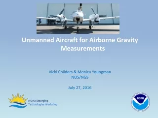
Gravity Field Recovery for Geoid • Airborne gravity “snapshot”: survey the entire region • Cover the country quickly and consistently with 20 km resolution • Fill in littoral data gaps • Connect terrestrial to near-shore oceanic data and satellite altimetric gravity fields • Enhance the surface measurements with predicted gravity from topography Impact of Airborne Gravity Surveys on Geoid Modeling in Alaska Thursday, 0800-1200
Airborne Gravity Objectives • Survey the entire US and its holdings by 2022 • Line spacing of 10 km • Extend flight lines out beyond shelf break • Complete the survey according to the following metric: Impact of Airborne Gravity Surveys on Geoid Modeling in Alaska Thursday, 0800-1200
GRAV-D Coverage Puerto Rico US Virgin Is. Impact of Airborne Gravity Surveys on Geoid Modeling in Alaska Thursday, 0800-1200
GRAV-D Coverage Hawaii Guam Am. Samoa Impact of Airborne Gravity Surveys on Geoid Modeling in Alaska Thursday, 0800-1200
Long-Term Geoid Monitoring and GRAV-D • A primary mission goal is to model the dynamic geoid for North America • IAG-sponsored workshop was held in Boulder to address how to monitor geoid change • Included representatives from the absolute/relative gravity communities, GRACE, and CORS • Formed a steering committee of interested parties to help craft plan to monitor geoid change • Group did re-convene at CMOS-CGU meeting in Ottawa in June 2010 • Concluded that this aspect would require a combination of absolute gravity monitoring and geoid change modeling Impact of Airborne Gravity Surveys on Geoid Modeling in Alaska Thursday, 0800-1200
Steering Committee Name Affiliation • Joe Henton • Hans-Peter Plag • Michael Sideris • David Avalos-Naranjo • Karla Edwards • Dan Roman • Dan Winester • Vicki Childers • David Schmerge • Dennis Milbert • Natural Resources Canada • NV Bur. of Mines&Geology • Univ. of Calgary • INEGI, Mexico • The Ohio State University • NGS • NGS • NGS • NGS • NGS (retired) Impact of Airborne Gravity Surveys on Geoid Modeling in Alaska Thursday, 0800-1200
Regional Partnerships & Collaborations • MOU letters to Other Federal Agencies • USACE already funded Gulf of Mexico survey • NGA funded Alaska 2009 survey • USGS • High level briefing in planning stages • Active science participation with Crustal Imaging and Characterization Science Center: Magnetometer • States • North Carolina, South Carolina • Industry Partners: Micro-g LaCoste, Fugro • University Researchers Impact of Airborne Gravity Surveys on Geoid Modeling in Alaska Thursday, 0800-1200
Break time! Next up: GRAV-D Airborne Project Status
Additional Information (1 of 2) The NGS 10 year plan (2008-2018) http://www.ngs.noaa.gov/INFO/NGS10yearplan.pdf The GRAV-D Project http://www.ngs.noaa.gov/GRAV-D Socio-Economic Benefits of CORS and GRAV-D http://www.ngs.noaa.gov/PUBS_LIB/Socio-EconomicBenefitsofCORSandGRAV-D.pdf Impact of Airborne Gravity Surveys on Geoid Modeling in Alaska Thursday, 0800-1200
Additional Information (2 of 2) • Contacts: • Always begin with your state advisor: • http://www.ngs.noaa.gov/ADVISORS/AdvisorsIndex.shtml • NGS Information Center • Phone: (301) 713-3242 • E-mail: ngs.infocenter@noaa.gov Impact of Airborne Gravity Surveys on Geoid Modeling in Alaska Thursday, 0800-1200