Download
1 / 32
400 likes | 1.14k Views
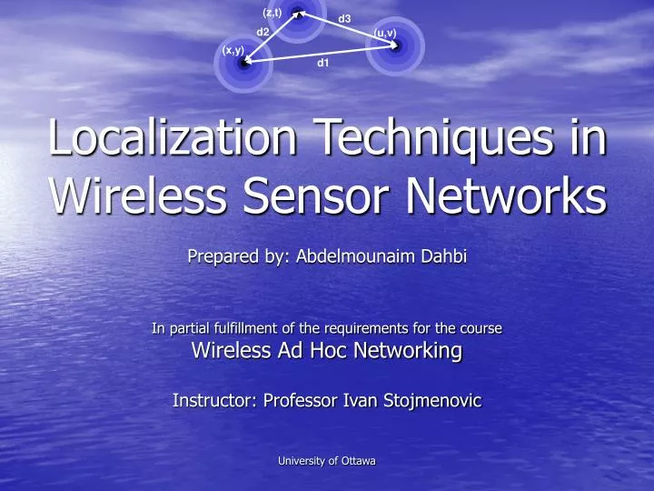
(z,t). d3. Localization Techniques in Wireless Sensor Networks. d2. (u,v). (x,y). d1. Prepared by: Abdelmounaim Dahbi In partial fulfillment of the requirements for the course Wireless Ad Hoc Networking Instructor: Professor Ivan Stojmenovic University of Ottawa. Outline. Introduction

E N D
(z,t) d3 Localization Techniques in Wireless Sensor Networks d2 (u,v) (x,y) d1 Prepared by: Abdelmounaim Dahbi In partial fulfillment of the requirements for the course Wireless Ad Hoc Networking Instructor: Professor Ivan Stojmenovic University of Ottawa
Outline • Introduction • Applications • Beacon Nodes (Anchor Nodes) • Distance/Angle Measurement Techniques • Centralized Algorithms • Distributed Algorithms • Range-based Localization Techniques • Range-free Localization Techniques • Iterative Refinement • Concluding Remarks • Ongoing Research Issues • References
y N N N x Introduction • What is Sensor Localization? The determination of the absolute or relative position of sensor nodes (geographical locations of sensors) N3(x3,y3) d3 d2 α N2(x2,y2) β y1 d1 N1(x1,y1) x1
Introduction • Why Sensor Localization? sensing data (Phenomena) without knowing the sensor location is most of the times meaningless + Large number of randomly scattered sensor nodes
Introduction • Why Sensor Localization? Gateway This is true in any location sensitive application, location aware service…
Introduction • Isn’t GPS just the answer? • Yes, but: • Not available indoor • Limited in certain environments such as Bush • Not accessible from under water • Constraints on the cost of sensors • Constraints on the size of sensors • Constraints on the energy consumption • Not very accurate • …
Applications • Network Functions: Geographical Routing, Collaborative Signal Processing • Bush Fire Surveillance/Detection • Intrusion Detection • Habitat Monitoring/Wildlife Tracking (ZebraNet) • Water Quality Monitoring • Pollution Monitoring • Traffic Monitoring • Target Tracking (Military: tracking enemy vehicles, and Civilian: tracking wild animals in wildlife preserves) • …
Beacon Nodes (Anchor Nodes) • Ordinary sensor nodes that know their global coordinates a priori • Either hard-coded coordinates • Or GPS equipped sensor nodes • Different uses of beacon nodes (Reference, Flooding of their positions and other data…) • Importance of Beacon placement • For 2D three and 3D four beacon nodes are needed • But, costly
Distance/Angle Measurement TechniquesAngle of Arrival (AoA) • The angle between the propagation direction of an incident wave and some reference direction • Does not require synchronization • But, costly and requires extensive signal processing…
Distance/Angle Measurement TechniquesReceived Signal Strength Indicator (RSSI) • In theory, the energy of a radio signal diminishes with the square of the distance from the signal’s source. • Low cost: all sensors have radios • But in practice, RSSI ranging measurements contain noise (in the order of meters) • Difference in propagation in different environments…
Distance/Angle Measurement TechniquesTime of Arrival (ToA) • c: The propagation speed of the radio signal (speed of light) • Accurate • But, requires precise synchronization
Distance/Angle Measurement TechniquesTime Difference of Arrival (TDoA) • c: The propagation speed of the radio signal • ss: The propagation speed of the ultrasound/acoustic signal • Accurate, No synchronization required • But, costly (Hardware)
A-B: 12 3 2 4 1 2 3 1 2 1 4 1 2 2 3 Distance/Angle Measurement TechniquesRadio Hop Count (DV-Hop) • Connectivity data • hij: Shortest path i,j (number of hops) • dij: Distance i,j • dij <= R x hij • Better estimate: dhop • dij =hij xdhop dhop:avg hop distance : 4 hAB:3 hops B A
Distance/Angle Measurement TechniquesRadio Hop Count (DV-Hop) • nlocal: The expected number of neighbors per node • hij: Length of the shortest path between sensor i and sensor j in terms of number of number of hops • dij: The Distance between sensor i and sensor j • dhop : The Average hop distance • dij =hij xdhop
Distance/Angle Measurement TechniquesRadio Hop Count (DV-Hop) • Distance measurements are always integral multiples of dhop • Environmental obstacles can prevent edges from appearing in the connectivity graph that otherwise would be present • Depends on the density… nlocal
Centralized Algorithms • Migration of internode ranging and connectivity data to a sufficiently powerful central base station • Complex processing of the collected data • Migration of the resulting locations back to the respective nodes. • Examples: • SDP: The SemiDefinite Programming • MDS–MAP: MultiDimensional Scaling
Distributed Algorithms • Each sensor collects its data • Computation is done by the sensors • Several iterations might be required • Not as accurate as centralized but does no migrations between a central station and the sensors • Examples: • Triangulation • Trilateration/Multilateration • Bounding Box (Min-Max) • Centroid
Range-based Localization TechniquesTriangulation y • AoA to compute the angles • The number of BSs needed for the location process is less • Compute the linear least-square solution • Assuming (x1,y1)=(0,0) and the x axis defined by the two beacon nodes we have: x
Range-based Localization TechniquesTrilateration/Multilateration • Distance measured: RSSI, ToA, TDoA • Requires at least 3 BNs in 2D, and 4 BNs in 3D.. • Compute the linear least-squares solution • Multilateration if more than three beacons are used to estimate the sensor’s position
Range-free Localization TechniquesBounding Box (Min-Max) • Distance based on Radio Hop Count (DV-Hop) • Simple • But less accurate…
Range-free Localization TechniquesCentroid Algorithm . . • Nodes localize themselves to the centroid of their proximate reference points . Xik,Yik Xi,Yi . x Xi1,Yi1 . Xi2,Yi2
Iterative Refinement • Node obtains initial position • Node broadcasts its position • Position is refined iteratively using: • Distances to neighbors • Node’s previous positions
Concluding RemarksWhat is the best localization algorithm? • No best algorithm • Depends on: • Error in range measurement • Connectivity • Network topology • Node capabilities • Application requirements • ...
Concluding RemarksPros and Cons • Two main types of distributed localization algorithms: • Range-based • Estimating the coordinates based on the collected information of distances or angles among nodes • Merit: Relatively high accuracy • Drawback: Costly (Hardware, Power consumption) • Range-free • Estimating the coordinates based on the connectivity relations • Merit: Cost-effective • Drawback: Not as accurate (But: coarse accuracy is sufficient for most sensor network applications) Hardware/Energy Cost vs Location Precision
Ongoing Research Issues • Noisy distance measurement • Costly distance measurement (hardware, energy) • Few beacons… • Scale • Mobility
L Questions • Q1: Triangulation is based on the law of sines which states (sin a)/A=(sin b)/B=(sin c)/C Prove the law of sines Answer: Sin a = L/B, sin b = L/A B . sin a = A . sin b (sin a)/A=(sin b)/B …
Questions • Q2: The Radio Hop Count (DV-Hop) distance estimation technique is based on the average hop distance dhop and the hop count hij (the length of the shortest path in the graph between si and sj in terms of the number of hops). This technique has a major drawback related to environmental obstacles which can prevent edges from appearing in the connectivity graph that otherwise would be present. Give an example of a graph where such drawback is highlighted.. Answer: In this diagram, hAC = 4. Unfortunately, hBD is also four, due to an obstruction in the topology.
B C A Questions • Q3: Knowing that dhop=3 and that an obstruction is affecting the connectivity in a number of edges as shown in the figure. Give an estimate for the ditances dAB, dBC and dAC Answer: dAB = hAB x dhop = 3 x 3 = 9 dBC = hBC x dhop = 2 x 3 = 6 dAC = hAC x dhop = 5 x 3 = 15
BN2 (x2,y2) BN1 (x1,y1) Questions • Q4: Assuming accurate distance measurements between nodes, apply the trilateration technique to determine the SN coordinates (unknown) using the three BNs coordinates and the r distances (known). Let BN3 be the origin of the coordinate system. Answer: BN3 (0,0) r3 SN (xs,ys) r2 r1
References • I. Stojmenovic, Handbook of Sensor Networks, Chapters 9 and 14, John Wiley & Sons, 2005 • T. HE, C. HUANG, B. 11. Blum, J. A. Stankovic, and T. Abdelzaher, "Range-free localization schemes for large scale sensor networks,“ Proc. 11obiCom'03, Sep. 2003, pp. 81-95. • N. Bulusu, 1. Heidemann, and D. Estrin, "GPS-less low cost outdoor localization for very small devices," IEEE Personal Communications Magazine, vol. 7, 11ay. 2000, pp. 28-34. • Boukerche, A.; Oliveira, H.A.B.; Nakamura, E.F.; Loureiro, A.A.F.; , "Localization systems for wireless sensor networks," Wireless Communications, IEEE , vol.14, no.6, pp.6-12, December 2007 • Sayed, A.H.; Tarighat, A.; Khajehnouri, N.; , "Network-based wireless location: challenges faced in developing techniques for accurate wireless location information,"Signal Processing Magazine, IEEE , vol.22, no.4, pp. 24- 40, July 2005
Thank you! Questions!