Download
1 / 24
240 likes | 332 Views
Research on circulation patterns in the Southern Bay of Biscay during a winter-spring transition period. High-resolution modeling, impact on ecosystems, operational forecasts, and complex ocean dynamics analyzed.

E N D
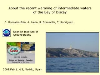
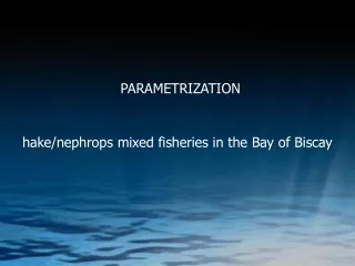
CIRCULATION PATTERNS OF THE SOUTHERN BAY OF BISCAY DURING A WINTER-SPRING TRANSITION PERIOD Paula Conde Pardo Instituto Español de Oceanografía. Centro Oceanográfico de A Coruña
Area Galician - Cantabrian Shelf & Slope • Resolution aimed at ecosystem studies (1-2 km). High-resolution forcing. • Impact on ecosystems. • Operational forecasts (ESEOO project).
Complex bathymetry • Water masses • Upwelling / Downwelling processes • Slope Current • Mesoscale structures
ROMS (Regional Ocean Modelling System, Haidvogel et al., 2002) with nesting capability (Penven et al., 2004). • Three grids with 15Km, 5Km and 1.8Km. • 30 vertical s-layers. • OSU tidal inverse model (Egbert and Erofeeva, 2002). • Wind forcing & Heat fluxes (MM5: 30Km, 1h; HIRLAM02: 22km, 6h; NCEP 2º, 6h).
IEO Local Model (ROMS) 4 2 3 1 1 1 1 1 • River run-off 2 • Slope Current 3 • Interaction Coastal – Ocean dynamics 4 • Mesoscale features
ESEOO Project • Participants: • Main Objective: Operational Oceanographic System • Historical • Data Analysis: • Real Time • Physical variables • Numerical Models: • Trajectories • Regional & Local
ESEOO Project Exercise Gijón • Emergency state • Operational model forecasts • Lagrangian Buoys USYP • Cruises
Exercise Gijon: Cruises • On board IEO RV “José Rioja” • 28 CTD stations • Cruise I 24th – 25th May • Cruise II 28th – 29th May
Cruise I: 24th-25th May Wind stress over the shelf Salinity **Hourly meteorological forecasts: - MM5 30 km during spin-up (3 months before) - NCEP & HIRLAM02 (INM) during the exercise
Cruise I: Vertical Sections Temperature Salinity
Cruise I: Vertical Sections Temperature Salinity
Cruise I: Vertical Sections Temperature Salinity
Cruise I: Vertical Sections Temperature Salinity
Cruise I: CTD Profiles Intermediate Shelf Slope Outer Shelf Inner Shelf
Cruise II: 28th-29th May Wind stress over the shelf Salinity
Cruise II: Vertical Sections Temperature Salinity
Cruise II: Vertical Sections Temperature Salinity
Cruise II: Vertical Sections Temperature Salinity
Cruise II: Vertical Sections Temperature Salinity
Cruise II: CTD Profiles Intermediate Shelf Outer Shelf Slope Inner Shelf
Wind stress over the shelf Exercise Gijon : Lagrangian Buoys
Conclusions: • Effects in Dynamics • Bathymetry • Accurate Bathymatry Data in the Shelf • Upwelling / Downwelling events • Wind Forcing • Spreading / Confinement River Plumes • High Frecuency (6h, 1h) • Slope Current Strength • Shelf dynamics • Climatological Run-off. Need for daily values • River Plumes • Upwelling / Downwelling events • IPC – River run-off interaction • Climatology • OB • Water masses • Higher Resolution Bathimetry • Bathymetry