Download
1 / 1
10 likes | 154 Views
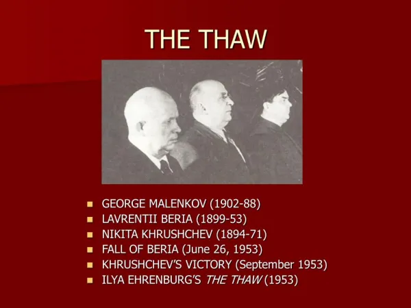
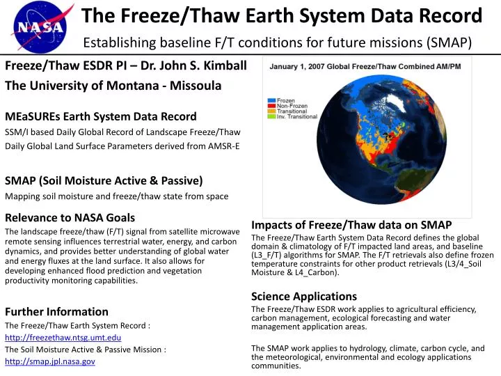
The Freeze/Thaw Earth System Data Record Establishing baseline F/T conditions for future missions (SMAP). Freeze/Thaw ESDR PI – Dr. John S. Kimball The University of Montana - Missoula MEaSUREs Earth System Data Record SSM/I based Daily Global Record of Landscape Freeze/Thaw

E N D
The Freeze/Thaw Earth System Data RecordEstablishing baseline F/T conditions for future missions (SMAP) Freeze/Thaw ESDR PI – Dr. John S. Kimball The University of Montana - Missoula MEaSUREs Earth System Data Record SSM/I based Daily Global Record of Landscape Freeze/Thaw Daily Global Land Surface Parameters derived from AMSR-E SMAP (Soil Moisture Active & Passive) Mapping soil moisture and freeze/thaw state from space Relevance to NASA Goals The landscape freeze/thaw (F/T) signal from satellite microwave remote sensing influences terrestrial water, energy, and carbon dynamics, and provides better understanding of global water and energy fluxes at the land surface. It also allows for developing enhanced flood prediction and vegetation productivity monitoring capabilities. Further Information The Freeze/Thaw Earth System Record : http://freezethaw.ntsg.umt.edu The Soil Moisture Active & Passive Mission : http://smap.jpl.nasa.gov Impacts of Freeze/Thaw data on SMAP The Freeze/Thaw Earth System Data Record defines the global domain & climatology of F/T impacted land areas, and baseline (L3_F/T) algorithms for SMAP. The F/T retrievals also define frozen temperature constraints for other product retrievals (L3/4_Soil Moisture & L4_Carbon). Science Applications The Freeze/Thaw ESDR work applies to agricultural efficiency, carbon management, ecological forecasting and water management application areas. The SMAP work applies to hydrology, climate, carbon cycle, and the meteorological, environmental and ecology applications communities.