Download
1 / 47
470 likes | 657 Views
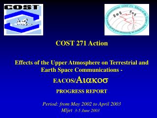
COST 271 Action Effects of the Upper Atmosphere on Terrestrial and Earth Space Communications - EACOS/ Aiakos PROGRESS REPORT Period: from May 2002 to April 2003 Mljet 3-5 June 2003. COST Action 271 : Effects of the Upper Atmosphere on Terrestrial and Earth-Space Communications ( EACOS ).

E N D
COST 271 ActionEffects of the Upper Atmosphere on Terrestrial and Earth Space Communications - EACOS/AiakosPROGRESS REPORTPeriod: from May 2002 to April 2003Mljet 3-5 June 2003
COST Action 271 : Effects of the Upper Atmosphere on Terrestrial and Earth-Space Communications ( EACOS ) • TC Recommendation: 29 October 1999 • CSO Approval: 10 December 1999 • First MC meeting: 9 October 2000 • Start date: 16 August 2000 • Duration: 48 months • End date: 15 August 2004
COST Action 271 : Effects of the Upper Atmosphere on Terrestrial and Earth-Space Communications ( EACOS ) Number of signatories: 17Signatories and date of signature • Austria 7 June 2000 • Greece 31 May 2000 • Poland 10 May 2000 • Hungary 23 May 2000 • Bulgaria 16 August 2000 • Italy 3 July 2000 • Czech Rep. 26 June 2000 • Spain 10 May 2000 • Portugal 26 October 2000 • Latvia 9 June 2000 • Finland 6 September 2000 • Turkey 26 May 2000 • France 10 May 2000 • United Kingdom 29 June 2000 • Germany 17 May 2000 • Serbia and Montenegro 1st March 2002 • Belgium 1st September 2002
Participating Institutions • Insitute fur Meteorologie und Geophysik, Universitat Graz, Austria • Bulgarian Academy of Sciences, Geophysical Institute, Bulgaria • Institute of Atmospheric Physics, Academy of Sciences of Czech Republic • Geophysical Observatory, Sodankyla, Finland • DLR/DFD Fernerkundungsstation, Neustrelitz, Germany • Universite Paris-SUD 11, Laboratoire d'Etude des Transmissions Ionospheriques, France • Universite de Rennes, France • Rutherford Appleton Laboratory, United Kingdom • DERA, Malvern, United Kingdom • Istanbul Technical University (İTÜ) Faculty of Aeronautics and Astronautics, Turkey • INTA, Atmospheric Sounding Station, 'El Arenosillo, Spain • Universidade do Algarve, Portugal • Polish Academy of Sciences, Space Research Centre, Poland • Istituto Nazionale di Geofisica e Vulcanologia, Italy • Istituto di Fisica Applicata, CNR, Italy • International Center for Theoretical Physics “ Abdus Salam”, Italy • Department of Telecommunications, Aristotelian University of Thessaloniki, Greece • National Observatory of Athens, Greece • Geodetic & Geophysical Research Institute, Hungarian Academy of Sciences • University of Bath, United Kingdom • University of Wales, Aberystwyth, United Kingdom • University of Leeds, United Kingdom • University of Leicester, United Kingdom • Middle East Technical University, Ankara, Turkey • Geomagnetic Institute, Belgrade, Serbia-Montenegro
Participating Institutions • Non-COST countries: • Institute of Terrestrial Magnetism, Ionosphere and Radiowave Propagation, Russia • University of Saint Petersburg, Russia • University of Massachusetts Lowell, USA • European Space Agency as observer • To be accepted by the MC: • China Research Institute of Radiowave Propagation, Xinxiang, China
Objectives • The main objectives of the COST 271 Action are: • to perform studies to influence the technical development and the implementation of new communication services, particularly for the GNSS and other advanced Earth-space and satellite to satellite applications, • to develop methods and algorithms to predict and to minimise the effects of ionospheric perturbations and variations on communications and to ensure that the best models over Europe are made available to the ITU-R,
to collect additional and new ionospheric and plasmaspheric data for now-casting and forecasting purposes, • to stimulate further co-operation in the domain of ionospheric and plasmaspheric prediction and forecasting for terrestrial and Earth-space communications, including interactive repercussions on the corresponding standards in this field, taking into account the present and future needs of users.
TECHNICAL DESCRIPTION AND IMPLEMENTATION • Working Group 1: Impact of variability of space environment on communications • Impact of space weather on communication • Real-time satellite and terrestrial measurements for now-casting, forecasting and warning purposes • Long-term trends in the ionosphere and upper atmosphere parameters • Upper atmosphere parameters monitoring for now-casting and forecasting purposes
Working Group2: Assessment of space plasma effects for satellites applications • Plasma effects on GNSS applications • Assessment of plasma propagation errors in navigation systems and merits and shortcomings of novel data sources • Investigation of extremes of ionization
Working Group3: Ionospheric effects on terrestrial communications 1. Effects of large-scale fluctuations on terrestrial communications 2 . Effects of small-scale ionospheric irregularities, interference and noise on terrestrial communication, including remote sensing, radio localization and radar 3. Mid-latitude ionospheric features in radio propagation models 4. Development of methods and algorithms to minimize the effects of small and large scale fluctuations on terrestrial communications
Working Group 4: Space plasma effects on Earth-space and satellite to satellite communications • Effects of space plasma variability and irregularities on Earth-space and satellite to satellite communication channels. • Development of algorithms and software to treat with disturbances in Earth-space and satellite to satellite communications • Application of theoretical considerations to the study of space plasma effects • Effects of the electron density vertical and horizontal gradients on the satellite-satellite communications
MAIN RESULTS DURING THE PERIOD MAY 2002 TO APRIL 2003 Working Group 1: Impact of variability of space environment on communications Four active Working packages report their progress during the last year. The first one on “Impact of space weather on communication” studied propagation phenomena, which are under some circumstances related to the space weather events.
WP1.2 “Database and tools for nowcasting, forecasting and warning” The Ionospheric component of the Space Weather Database has been developed by RAL team and is now regularly receiving data from all the known UMLCAR DPS instruments in the COST area, and work is underway to include data from UMLCAR DGS instruments. Data are catalogued and archived typically within minutes of the soundings being taken and data are then immediately available to users through the web interface. The database is available to all at http://www.wdc.rl.ac.uk/cgi-bin/digisondes/cost_database.pl.
The web interface of RAL-Ionospheric Space Weather Database downloading data
plotting parameters true-height analysis
In the frames of developing space weather now-casting and forecasting procedures and software tools, a software tool of real-time mapping of the ionosphere over Europe is under development (Zolesi et al., 2002). This mapping technique is based on the Simplified Ionospheric Regional Model, updated using autoscaled ionospheric parameters from four real-time European digisondes operated in Rome, Athens, Chilton and Juliusruh. According to the first results, the method of real-time updating SIRM, results to improvement of ionospheric mapping over Europe, especially during storm periods. A new mapping technique has been developed by Perrone et al. (2002), based on archived data.
Maps of the foF2 parameter obtained with the method of updating SIRM with real time automatic scaled digisonde data, for a quiet period (7 December 2001) and for a storm period causing positive storm effect over Europe (17 August 2001), at 1900UT (Zolesi et al., 2002).
Concerning the topside ionosphere, Stankov et al. (2003) developed an operational model for topside electron density profile reconstruction on a real-time basis, using combined ground-based GPS TEC and ionosonde measurements.
WP1.3 “Long term trends in the ionosphere and upper atmosphere parameters” General objectives: To investigate and understand the nature of the long-term behaviour of all ionospheric regions; to define the potential effect of the long-term trends on prediction models. Regarding the potential effect of long-term trends on prediction models the trends in foF2 and hmF2 are very small and have a not significant practical meaning (Bremer and Lastovicka, 2002; Lastovicka, 2003; Mikhailov et al., 2002). The scientific origin needs to be investigated. The possible role of other causes, as the consequences of the greenhouse gasses emission enhancement, are still under investigation.
Working Group 2: Assessment of space plasma effects for satellites applications In the frame of Work Package 1 " Plasma effects on GNSS applications" validation studies were carried out with "Ionospheric Radio Occultation (IRO)" data gained by the German CHAMP (CHAllenging Minisatellite Payload) satellite. The data were subjected to a model assisted retrieval technique to provide vertical electron density profiles on a global scale. Validation studies revealed RMS deviations of the F2 layer parameters foF2 and hmF2 of about 1.3 MHz and 47 km, respectively.
IRO Validation - Vertical sounding / TEC DLR Day-time profile retrieved from GPS IRO measurements onboard CHAMP during the HIRAC/SolarMax of IGS on 27 April 2001, supported by COST 271 Comparison with ionosonde vertical profile measured in Juliusruh/IAP Kühlungsborn, with the corresponding TEC map and planar Langmuir probe data obtained on CHAMP Neustrelitz
Global distribution of the typical vertical sounding parameters f0F2 and hmF2 on night-time between 11 April and 12 August 2001 Possibility to complete the global ionosonde network by IRO data Night-time f0F2 values for days 101-224 /2002
Working Group 2: Assessment of space plasma effects for satellites applications The main "products" to be reported of Work Packages 2 plus 3 "Assessment of plasma propagation errors in navigation systems and merits and shortcomings of novel data sources" are three dimensional and time dependent electron density models for assessment studies. The models provide a larger scale background ionosphere which is "modulated" to incorporate smaller scale structures like troughs and ridges. The most important structures ready to use are the main trough of the F regions which is found at the border between mid latitudes and high latitudes and Traveling Ionospheric Disturbances (TIDs).
COST 271, Working Group 2 Example: electron density models for assessment studies ITU-R peak density modulated by the main trough Contours of peak density in units of 109 m3
The third WPon “ Investigation of extremes of ionization “ was approved during MCM2 with the following terms of reference: “The WP will deal with observations with the aim to come up with reasonable occurrence statistics when possible and useful, and a collection of well documented extremes. The WP will provide a list of criteria to define type and nature of the extreme cases and to guide the data collection."
Working Group 3: Ionospheric effects on terrestrial communications The activities of the Working Group 3 are organised in 4 Work Packages. Concerning the Effects of large-scale fluctuations on terrestrial communications the behaviour of Planetary and Gravity Waves have been studied.
WP3.1 : Effects of large-scale fluctuations on terrestrial communications. Planetary waves. The persistence of the planetary wave type oscillations in the lower ionosphere (radio wave absorption) and foF2 was investigated and compared. The typical planetary wave type oscillation persistence in foF2 for Europe is 4 cycles for ~5-day waves, rather 3.5 cycles for ~10 day waves and rather 3 cycles for ~16-day waves , whereas in the lower ionosphere it appears to be by a 0.5 cycle longer , but this difference is not statistically significant. The oscillation activity in the geomagnetic activity plays an important role in the percentage of existence of such oscillations in the F region.
Planetary wave activity inferred from foF2 for Průhonice, January – December 1980, Morlet wavelet transform. Top panel – time series of raw foF2 data. Bottom left panel –wavelet transform power spectrum of the planetary wave activity changing by colour from white and black-blue (minimum values) through green to red and black-red (maximum values). Power spectrum is normalized to 1. Bottom right panel – global (over 365 days) Morlet wavelet and Fourier spectrum; horizontal axis – power; vertical axis - period of oscillations in days.
WP3.1 : Effects of large-scale fluctuations on terrestrial communications. Gravity waves Study of the variations of GW using Continuous Wavelet Transform applied on the data measured during campaigns of rapid ionospheric sounding (variations of electron concentration) shows the diurnal changes in intensity and presence of the GW in the F-region ionosphere. The large family of the GW of the wide range periods exists in the ionosphere. There are several groups of waves (groups of specific periods) that do not change too much their onset time during the day (sunrise, sunset waves). The corresponding variations were detected on the Total Electron Content measurements over the same area as well.
WP3.2: Mid-latitude ionospheric features in radio propagation models. • F1 region (160-200 km) behaviour during intense geomagnetic storms in Europe displays summer/winter asymmetry with much stronger effects in the winter half of the year (maximum during autumn). • At European high-middle and high latitudes, the daytime effect at F1 region heights was found to be negative and independent on the F2 region (foF2) response to intense geomagnetic storm for all 18 newly analysed cases. • Spread F. The origin of mid-latitude spread F has been studied considering plasma instabilities and TIDs producing spread F and a closer relation to Es layer occurrence .
WP3.4: Development of methods and algorithms to minimize the effects of small and large scale fluctuations on terrestrial communications . TRILION project Its goal is to build a modem to transmit images via the ionospheric HF channel. A first system has been developed to evaluate the feasibility of the system. The algorithm has been optimized. A new multi channel HF receiver is developed for angle of arrival measurements of long distance propagation mode via the ionospheric channel, using co-localized antennas and high- resolution algorithms. Very encouraging results have been obtained with direction of arrival changes and simulated ionograms being reminicent of the experimental measurements.
Working Group 4 - Space plasma effects on Earth-space and satellite to satellite communications The activities of the Working Group 4 are organised in 4 Work Packages. Concerning the Efffect of space plasma variability and irregularities on Earth-space and satellite to satellite communication channels it has been studied the scintillation probability distribution functions and frequency correlation. The results obtained will be used to build up a scintillation effect model which could be used for system specification. Comparisons have been made between experimental data from low latitudes and theoretical models (WBMOD and GISM). The results show advantages and limitations of such models.
Concerning the - Development of algorithms and software to treat disturbances in Earth-space and satellite to satellite communications, the Neural Networks based model of the Middle East Technical University Group was used to forecast the 10 minutes values of the total electron content, 1 hour ahead, during high solar activity in the current solar cycle is examined. The network is designed to forecast total electron content data evaluated from GPS measurements from 2000 to 2001 at Chilbolton (51.8 N, 1.26 W). An additional validation has been performed on an independent data set by producing the forecast total electron content values at Hailsham (50.9 N, 0.3 E) receiving station for selected months in 2002.
Observed GPS TEC results for disturbed solar-terrestrial conditions (red), 1 hour ahead forecast by METU-NN (blue), and monthly median (black) TEC values for Halisham ( UK GPS site) , 18-22 April 2002.
Concerning the “ Application of theoretical considerations to the study of space plasma effects” the study of the mechanism of natural electromagnetic and electrostatic plasma emissions generated in the near space has been continued together with the investigation of radio broad band electromagnetic emission particularly over the ionospheric trough. The study of the electromagnetic emissions and modifications of plasma ionosphere density and electron temperature profile over seismo-active and those generated during the injection of electron beam into the ionospheric plasma have been carried out.
Concerning the “ Effects of the vertical and horizontal gradients of the electron density on Earth-space and satellite to satellite communication “ an investigation of the slant to vertical TEC conversion errors introduced by the thin shell approximation for the ionosphere and the use of a simple mapping function to obtain vertical delay starting from slant values has been continued. Results based on experimental data indicates a strong dependence of the errors with respect to geomagnetic activity as given by the Dst index. An extensive work of validation of IRI and NeQuick topside electron concentration models using 20000 satellite topside profiles from available databases that cover different seasons and solar activity level have been carried out.
Comparison of vertical electron density profiles for high solar activity. Red: experimental ISIS 2 profile. Blue: NeQuick profile. Green: IRI profile.
Publications and Reports Most of the papers concerning the activities of the COST271 Action have been published in the following special issues: 1st COST271 Workshop Proceedings CD “Ionospheric Modelling and Variability studies for Telecommunication Applications”, 25-27 September 2001, Sopron, Hungary. 2nd COST271 Workshop Proceedings CD “Products for ITU-R and other Radio communication applicationon”, 1-6 October 2002, Faro, Portugal.
Special volume of Acta Geophysica Hungarica on the COST271 Workshop “Ionospheric Modelling and Variability studies for Telecommunication Applications”, Volume 37, N. 2-3,2002 Special volume of Annals of Geophysics dedicated to the XXVI EGS General Assembly Session on Solar-Terrestrial Sciences:’’ Ionospheric variability and modelling”, Vol. 45, N.1, February 2002
Scientific and Technical Cooperation Most part of the scientific studies performed during this last year has been obtained as result of co-operations among different countries in Europe. A pilot project involving Italian, Greek and UK partners , named GIFINT, Geomagnetic Indices Forecasting and Ionospheric Nowcasting Tools, has been recently approved and financially supported by the European Space Agency.
Scientific and Technical Cooperation Moreover participants of this action are active in international projects as the HIRAC campaign or are promoting new international projects that are involving other COST271 members as the European FP6 or the “ ROSE” a project to establish in “Gaudos” the southernmost land in Europe an international geophysical observatory .
Scientific and Technical Cooperation DIAS “ a proposal on a Digital Upper Atmosphere Server has been recently approved and supported by the European “eContent” activity
Scientific and Technical Cooperation within FP6 Last year COST271 Action has organised and/or supported a few different expressions of interest to EU as the first step to the FP6. One of them was sent by myself on behalf of all COST 271 community having the subject of the action itself as the main topic. Other two EoI were sent by Dr. Norbert Jakowski concerning the MOPLE project (Monitoring of the Geo Plasma Environment) and by Prof. Alain Bourdillon and Prof. Paul Cannon on combined ionospheric and tropospheric propagation. This matter was developed further during the COST271 MC meeting in October 2002 and other two meetings at beginning of this year and the conclusion was to support only the MOPLE proposal that may fit the best the FP6 program requirements.
MOPLE (“Monitoring of the Geo Plasma Environment”) is a proposal to be prepared by the German Aerospace Center Institute for Communication and Navigation (DLR) and has the aim to establish Europe as an international leader in understanding and monitoring of the upper part of the Earth’s atmosphere, for enhancing reliability and security of modern technological systems, and to reduce the risk of natural hazards. A number of the COST271 Action participants are involved in the proposal “Space Weather: Elaboration of European Tools (SWEET)”, co-ordinated by the Finnish Meteorological Institute and targeted to the 6th Framework Programme in Aeronautics and Space priority.
Short-term scientific missions Five short-term scientific missions have been planned for the period considered . Moreover 5 young scientist : Petra Sauli (Czech Republic), Ioanna Tsagouri (Greece), Marta Cueto (Spain), Erdem Senalp (Turkey), Markus Rieger (Austria), were invited to attend the 2nd COST 271 workshop held in Faro, Portugal, 2- 4 October 2002.
Web site The Web site of the COST271 action is active on the following address: http://www.cost271.rl.ac.uk/