Download
1 / 23
230 likes | 505 Views
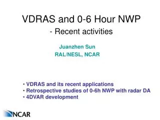
VDRAS and 0-6 Hour NWP - Recent activities. Juanzhen Sun RAL/NESL, NCAR. VDRAS and its recent applications Retrospective studies of 0-6h NWP with radar DA 4DVAR development. Overview of VDRAS.

E N D
VDRAS and 0-6 Hour NWP- Recent activities Juanzhen Sun RAL/NESL, NCAR • VDRAS and its recent applications • Retrospective studies of 0-6h NWP with radar DA • 4DVAR development
Overview of VDRAS • VDRAS is an advanced data assimilation system for high-resolution (1-3 km) and rapid updated (6-18 min) analysis • Produce Low-level wind, temperature, and humidity analysis • VDRAS assimilates mesoscale model data, surface data, and radar radial velocity and reflectivity data from single or multiple radars • The core is a 4-dimensional data assimilation scheme based on a warm-rain cloud-scale model • It has been installed at nearly 20 sites for nowcasting applications since 1998 and currently running over 10 domains in and outside of U.S.
VDRAS analysis flow chart Mesoscale model output (netcdf) Vr & Ref (x,y,elev) Surface obs. VAD analysis Radar Preprocessing& QC Background analysis Cloud model & adjoint 4DVar Radar data assimilation Last cycle Analysis/forecast Minimization of cost function Updated analysis U, v, w, T, Qv, Qc, Qr
Summary of recent VDRAS activities • Continuing collaboration with BMB • - Analysis of convective cases of 2008 and 2009 • - Understanding of convective initiation in Beijing • - Development of forecast index • Implementation for CWB of Taiwan • - Study of terrain-induced convection • - Support of ANC for nowcasting in Taiwan • Wind energy applications • - Evaluation of VDRAS performance for 80m wind analysis • - Development of techniques for 0-2 hour wind forecast • Others: 10 instances of VDRAS are running in and • outside of U.S
x x x x x x x x 0135 UTC 0208 UTC 0240 UTC 0314 UTC VDRAS for wind energy in Northern Colorado VDRAS wind and temperature08 June 2010 X location of wind farm
x x x x x x x x x x x x x x x x x x x x 0244 UTC 0207 UTC 2311 UTC 2237 UTC 0353 UTC 0320 UTC 0016 UTC 2344 UTC 0130 UTC 0053 UTC VDRAS for wind energy in Northern Colorado VDRAS wind vector and speed10-11 June 2010 X location of wind farm
Verification of VDRAS wind against Turbine wind 10-11 July, 2010, Northern Colorado 04-05 AUG, 2010, Texas Turbine wind VDRAS wind Turbine wind VDRAS wind • Questions raised for the phase shift on 04-05 Aug, 2010 case • Discrepancy between radar and turbine observations • Issue of inadequate vertical resolution in radar obs.? • Reliability of turbine wind?
Wind nowcasting based on VDRAS • Feature extrapolation - Convergence line - Temperature gradient - Simple and efficient • Direct integration of VDRAS model - Use a 2-D advection wind - May be more accurate than feature extrapolation - More computation
Summary of 0-6 h NWP research • IHOP retrospective study through NCAR’s STEP program - Emphasize radar data assimilation and connection between model and nowcasting - Techniques include nudging, 3DVAR, 4DVAR, EnKF - Sensitivity of initial conditions vs. physics • WRF 3DVAR operational pre-testing (collaboration with BMB) • Further development of advanced techniques, 4DVAR & EnKF • Evaluation of 0-6 h NWP with radar DA over Front Range - Strategies for improved 0-6 h NWP for nowcasting purposes - Evaluate pros and cons of different techniques - Running systems of Nudging, 3DVAR, DDFI, EnKF over the same domain and the same period
IHOP retrospective study Lesson 1: 0-12 hour forecasts highly sensitive to initial conditions Forecast skill over one-week OBS 10-16 June 2002 CTRL Physics experiments Initial condition experiments Radar WSM6
IHOP retrospective study Lesson 2: Short-term forecast sensitivity depends on storm type “Easy to forecast” storm OBS WRF fcst NAM WRF fcst GFS “Hard to forecast” storm OBS WRF 3-h fcst WRF 3-h fcst No radar With radar
IHOP retrospective study Lesson 3: radar data impact depends on storm type forecast skill over one-week 10-16 June 2002 • Preliminary findings: • Radar data has less impact on • equilibrium and elevated convection • Radar data assimilation provides • triggers for surface-based convection • Challenge: optimal fit to • convective-scale while • maintaining large-scale balance With radar WSM6 microphysics Positive impact of radar Negative impact of radar 15 June 13 June With radar With radar
FRONT - future STEP testbed • S-Pol: N of Hwy 52 between • I-25 and Hwy 85; near Firestone. • Operational ~Summer, • 2012 after DYNAMO deployment • Testbed for • - software development • - data assimilation • - instrument/model • intercomparison/validation • - QPE/QPF and nowcasting Pawnee CHILL 42 km 67 km 73 km S-Pol 48 km
Evaluation of radar data assimilation systems EnKF Mesoscale and storm-scale data assimilation and prediction RTFDDA latent heat nudging of radar reflectivity WRF 3DVAR radar data assimilation NOAA/ESRL HRRR radar reflectivity initialization June 2009 Front-Range Convection Retrospective Studies Mesoscale data assimilation on CONUS domain Storm-scale DA on Front Range 15 km 3 km 15
WRF/DART EnKF storm-scale data assimilation June 12 2009 over Front Range region Frequency of updraft helicity over a 6hr ensemble forecast No radar DA With radar DA
Development of WRFDA-4DVAR for Radar 1.Radar reflectivity assimilation - Assimilating retrieved rainwater from RF; - The error of retrieved rainwater is specified by error of RF. 2. New control variables and background error covariance - Cloud water (qc), rain water (qr); - Recursive filter is used to model horizontal correlation ; - Vertical correlation is considered by EOFs; 3. Microphysics scheme - Linear/adjoint of a Kessler warm-rain scheme; - Incorporated into WRF tangent/adjoint model.
WRF-4DVAR: Impact of reflectivity WSM6 Thompson Threshold: 5 mm/hr Threshold: 5 mm/hr 4DVAR-RV+RF 4DVAR-RV+RF 4DVAR-RV 4DVAR-RV 3DVAR 3DVAR FCST Time (hour) FCST Time (hour) • Reflectivity improves the forecast skill.
Impact of RV outside rain region Threshold: 5 mm/hr WSM6 Thompson Threshold: 5 mm/hr RF-RVall RF-RV RF-RV RF-RVall 3DVAR 3DVAR FCST Time (hour) FCST Time (hour) • RV outside rain region improves forecast skill with Thompson microphysics.
Hourly rainfall at 01Z 13 June Obs BG 4D-R2-T15-RVall WSM6 Thompson 4D-R2-T15 4D-R2-T15 3D-R2 WSM6 WSM6 Thompson
Hourly rainfall at 06Z 13 June Obs BG 4D-R2-T15-RVall WSM6 Thompson 3D-R2 4D-R2-T15 4D-R2-T15 WSM6 WSM6 Thompson
Summary • VDRAS analysis is an valuable addition to the existing precipitation nowcasting systems • Recent applications to wind energy prediction showed promises • Active research is being pursued to improve 0-6 hour NWP for nowcsting applications • A joint workshop with MWG is being planned on “NWP for nowcasting”
The analysis Surface wind (vector), surface temperature (contour) Precipitable water (shaded) 3D-RF-RV 4D-RF-RVall