Download
1 / 62
620 likes | 708 Views
Explore advanced geoprocessing tools, such as attribute extraction and spatial relationship identification in GIS analysis. Learn to extract, select, and manipulate data for optimal results. Enhance your GIS skills with practical applications.

E N D
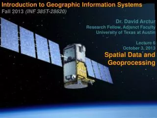
Introduction to Geographic Information Systems Fall 2013 (INF 385T-28620) Dr. David Arctur Research Fellow, Adjunct Faculty University of Texas at Austin Lecture 6 October 3, 2013 Spatial Data and Geoprocessing
Outline INF385T(28620) – Fall 2013 – Lecture 6 Attribute extraction Feature location extraction Location proximities Geoprocessing tools ModelBuilder
Lecture 6 Attribute extraction INF385T(28620) – Fall 2013 – Lecture 6
Attribute query extraction INF385T(28620) – Fall 2013 – Lecture 6 You have tracts for an entire state, but want tracts for one county only
Attribute query extraction INF385T(28620) – Fall 2013 – Lecture 6 • Select tracts by County FIPS ID • Cook County = 031
Attribute query extraction INF385T(28620) – Fall 2013 – Lecture 6 Cook County tractsselected Export to new featureclass or shapefile
Export selected features • Right-click to export selected features INF385T(28620) – Fall 2013 – Lecture 6
Add new layer INF385T(28620) – Fall 2013 – Lecture 6 Cook County tracts
Lecture 6 Feature location extraction INF385T(28620) – Fall 2013 – Lecture 6
Select by location INF385T(28620) – Fall 2013 – Lecture 6 Powerful function unique to GIS Identify spatial relationships between layers Finds features that are within another layer
Select by location INF385T(28620) – Fall 2013 – Lecture 6 • Have Cook County census tracts but want City of Chicago only • Can’t use Select By Attributes • No attribute for Chicago • Use “Municipality” layer • City of Chicago is a municipality within Cook County
Select by location INF385T(28620) – Fall 2013 – Lecture 6 Select “Chicago” from municipalities layer
Select by location • Selection, select by location INF385T(28620) – Fall 2013 – Lecture 6
Export selected features INF385T(28620) – Fall 2013 – Lecture 6
Lecture 6 location proximities INF385T(28620) – Fall 2013 – Lecture 6
Points near polygons INF385T(28620) – Fall 2013 – Lecture 6 Health officials want to know polluting companies near water features
Points near points INF385T(28620) – Fall 2013 – Lecture 6 School officials want to know what schools are near polluting companies
Polygons intersecting lines INF385T(28620) – Fall 2013 – Lecture 6 Transportation planner wants to know what neighborhoods are affected by construction project on major highway
Lines intersecting polygons INF385T(28620) – Fall 2013 – Lecture 6 Public works official wants to know what streets or sidewalks will be affected by potential floods
Polygons completely within polygons INF385T(28620) – Fall 2013 – Lecture 6 City planners want to know what buildings are completely within a zoning area.
Lecture 6 Geoprocessing tools INF385T(28620) – Fall 2013 – Lecture 6
Geoprocessing overview INF385T(28620) – Fall 2013 – Lecture 6 GIS operations to manipulate data Typically take input datasets, manipulate, and produce output datasets Often use multiple datasets
Common geoprocessing tools INF385T(28620) – Fall 2013 – Lecture 6 • Analysis • Extract – clip • Overlay – intersect and union • Data management • Generalization – dissolve • General • append • merge
Accessing tools INF385T(28620) – Fall 2013 – Lecture 6 Geoprocessing menu
Accessing tools INF385T(28620) – Fall 2013 – Lecture 6 ArcToolbox
Accessing tools INF385T(28620) – Fall 2013 – Lecture 6 Search window
Clip vs. Select By Location INF385T(28620) – Fall 2013 – Lecture 6 • Clip • Clean edges • Looks good • Select By Location • Dangling edges • Better for geocoding(chapter 8)
Dissolve INF385T(28620) – Fall 2013 – Lecture 6 Combines adjacent polygons to create new, larger polygons Uses common field value to remove interior lines within each polygon, forming the new polygons Aggregate (sums) data while dissolving
Dissolve INF385T(28620) – Fall 2013 – Lecture 6 • Create regions using US states • Use SUB_REGION field to dissolve • Sum population
Dissolve INF385T(28620) – Fall 2013 – Lecture 6
Dissolve results INF385T(28620) – Fall 2013 – Lecture 6 States dissolved to form regions Population summed for each region
Append INF385T(28620) – Fall 2013 – Lecture 6 • Appends one or more datasets into an existing dataset • Features must be of the same type • Input datasets may overlap one another and/or the target dataset • TEST option: field definitions of the feature classes must be the same and in the same order for all appended features • NO TEST option: Input features schemasdo not have to match the target feature classes’ schema
Append • DuPage and Cook County are combining public works and need a new single street centerline file. INF385T(28620) – Fall 2013 – Lecture 6
Append INF385T(28620) – Fall 2013 – Lecture 6 Append will add DuPage streets to Cook County streets
Resultant layer • One street layer (Cook County) with all records and field items INF385T(28620) – Fall 2013 – Lecture 6
Merge INF385T(28620) – Fall 2013 – Lecture 6 • Combines multiple input datasets of the same data type into a single, new output dataset • Illinois campaign manager needs a single voting district map but wants to preserve the original layers
Merge INF385T(28620) – Fall 2013 – Lecture 6
Resultant layer INF385T(28620) – Fall 2013 – Lecture 6 New voting district layer
Union INF385T(28620) – Fall 2013 – Lecture 6 • Overlays two polygon layers • Resulting output layer has combined attribute data of the two inputs • Contains all the polygons from the inputs, whether or not they overlap
Union INF385T(28620) – Fall 2013 – Lecture 6 Neighborhoods and ZIP Codes
Union INF385T(28620) – Fall 2013 – Lecture 6
Union INF385T(28620) – Fall 2013 – Lecture 6 • Better describes characteristics of a neighborhood • Central business district 15222 vs. 15219
Union • Attributes tables contain different fields and data INF385T(28620) – Fall 2013 – Lecture 6
Union results • New polygons with combined data INF385T(28620) – Fall 2013 – Lecture 6
Union vs. Merge vs. Dissolve INF385T(28620) – Fall 2013 – Lecture 6
Intersect INF385T(28620) – Fall 2013 – Lecture 6 Computes a geometric intersection of the input features Features (or portions of features that overlap in all layers and/or feature classes) will be written to the output feature class Inputs can have different geometry types
Intersect INF385T(28620) – Fall 2013 – Lecture 6 City manager needs to know what buildings intersect flood zones and wants the flood data attached to each intersecting building
Intersect INF385T(28620) – Fall 2013 – Lecture 6
Intersect result INF385T(28620) – Fall 2013 – Lecture 6 Only building polygons that intersect flood zones with combined data fields
Lecture 6 Modelbuilder INF385T(28620) – Fall 2013 – Lecture 6