Download
1 / 37
370 likes | 503 Views
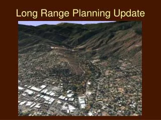
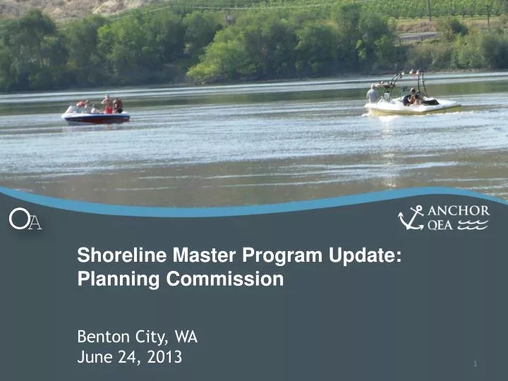
Shoreline Master Program Update: Planning Commission. Benton City, WA June 24, 2013. Agenda. Introductions Review of SMP & Planning Process SMP Content and Environment Designations Shoreline Modifications and Use Regulations Critical Areas Restoration Plan Table Next steps.

E N D
Shoreline Master Program Update: Planning Commission Benton City, WAJune 24, 2013
Agenda • Introductions • Review of SMP & Planning Process • SMP Content and Environment Designations • Shoreline Modifications and Use Regulations • Critical Areas • Restoration Plan Table • Next steps
What is a SMP? Shoreline Management Act (SMA) RCW 90.58 To prevent harm caused by uncoordinated and piecemeal development of the state’s major shorelines Shoreline Master Program (SMP) Guidelines WAC 173-26 SMP--Carries out provisions of SMA Must be approved by Dept. of Ecology, using policy of RCW 90.58.020 and Guidelines as approval standards/criteria
Key Principles of the SMP • Balance • Environmental protection • Public access • Water-oriented uses • Preferred Uses • No Net Loss of Ecological Function Residential aerial photo courtesy of fortress.wa.gov
Steps and Status SMP - Environment Designations - Goals - Policies - Regulations Cumulative Impacts Analysis Inventory & Analysis Determine Jurisdiction Local Adoption Restoration Plan Public Participation Ecology Review and Adoption
Shoreline Jurisdiction • Lakes ≥ 20 acre • Streams (a mean annual flow of 200 cftper second or more, or the portion downstream from the first 300 square miles of drainage area) • Upland areas 200 feet from ordinary high water mark • Floodways and adjacent floodplain area • Associated wetlands
Benton City Shoreline Yakima River Shoreline • Land within 200 feet of the ordinary high water mark (OHWM) of the waterways • Floodways • Floodplains up to 200 feet from the floodway edge
Shoreline Jurisdiction and Inventory Benton City Shoreline Area = Approximately 200 acres along both sides of the Yakima River Major Features • Public Access – access exists in some areas • Shoreline Use – Agricultural, recreation, residential, limited commercial • Ecological Function – riparian species, aquatic functions • Water quality – dissolved Oxygen, pH, DDE, DDT. Elevated temperature. Stressors • Irrigation for agriculture, bridge, recreation and transportation development
SMP Content • Goals and Policies • Shoreline Elements • Regulations • Environment Designations • General, use-specific and modification regulations • Critical area regulations • Applicability and Implementation (non-conforming use, enforcement, administration)
Goals and Policies • Economic Development • Public Access and Recreation • Circulation • Shoreline Use and modifications • Conservation • Historic, Cultural, Scientific and Educational Resources • Flood Hazard Management • Private Property Right
Environment Designations • Current SMP – adopted in 1975 • Environment Designation – Natural, Conservancy, Rural and Residential • 2013 SMP Update • Aquatic • Agriculture Conservancy • Urban Conservancy • Shoreline Residential • High Intensity
Environment Designations: Aquatic • Waterward of the Ordinary High Water Mark (OHWM) • Purpose is to protect, restore, and manage the unique characteristics and resources • Management policies guide the use and activities in this ED
Environment Designations: Urban Conservancy • Applies on public and unimproved lands • Purpose is to protect and restore ecological functions of open space, flood plain and other sensitive lands where they exist in urban and developed settings • Management policies guide the use and activities in this ED; e.g. uses allowed that result in restoration
Environment Designations: Agriculture Conservancy • Applies on floodway areas with Ag-Suburban land use • Purpose is to protect and restore existing ecological functions of floodway • Low intensity uses are allowed • Management policies guide the use and activities in this ED; e.g. new low intensity agricultural uses
Environment Designations: Shoreline Residential • Applies on residential land use areas • Purpose is to accommodate primarily residential development; also allows other uses, public access and recreation • Management policies guide the use and activities in this ED; e.g. no net loss policy by limiting lot coverage, providing setback
Environment Designations: High Intensity • Applies mostly on commercial areas outside floodway • Purpose is to provide for to provide for higher intensity land uses such as commercial and transportation together with appropriate accessory uses • Protecting the existing ecological functions in areas that have been previously degraded • Management policies
No Net loss of ecological functions Water-dependent uses shall be preferred as a first priority and water-related and water-enjoyment as a second priority Single-family residential is a preferred use Public access of shoreline General Standards
Shoreline Modifications and Use Regulations • Agriculture • Boating Facilities • Commercial Development • Fill and Excavation • Groins and Weirs • In-Stream Structures • Recreational Development • Residential Development • Shoreline Habitat and Natural Systems Enhancement Projects • Shoreline Stabilization • Transportation • Utilities
Agriculture • Existing and future Ag uses per Comprehensive Plan shall be allowed • SMP provision applies to: • New Ag uses or Ag expansion on non-Ag lands • Conversion of Ag lands to other uses • Other developments that are not Ag activities • Ag activities that are not exempted by this Program • New uses shall assure no net loss of ecological functions • Fertilizers and pesticides shall prevent direct runoff into waterbodies, wetlands or aquifer recharge areas • State and Federal policies shall apply
Boating Facilities • Existing boat launches are to continue • New boating facilities – only non-motorized boating facilities (such as paddle boats or electric boats) are allowed. • Accessory uses shall be: • Limited to water-oriented uses that provide physical or visual shoreline access • Located as far landwards as possible • Environmental protection
Commercial Development • Standards for water-oriented priority • Criteria are provided for when non-water-oriented uses are allowed; these are mostly applicable for Benton City • Application review criteria • Compatibility with surroundings. City can modify project standards to achieve this • Public Access
Fill and Excavation • Fill shall be of the minimum amount and extent necessary to accomplish the purpose of the fill • Fill waterward of the OHWM • Fill upland • Need to demonstrate fill shall be minimum necessary • Fills or excavation shall not be located where shore stabilization will be necessary to protect materials placed or removed
Recreational Development • General preference standards: • Recreational uses shall include features for access, enjoyment and use of shoreline • Allow passive and active recreational development • Water-oriented recreational uses and activities are preferred; • Performance Standards for mitigation, protection of fragile and unique shoreline, location, design • Non-motorized access is preferred. Motorized access shall protect functions
Residential Development • Single-family residential development is a preferred use • Accessory uses and structures shall be outside of the riparian buffer, unless the structure is or supports a water-dependent use • New shoreline residences shall ensure that shoreline stabilization and flood control structures are not necessary to protect proposed residences • Density according to the Comprehensive Plan
Critical Areas • Wetlands • Critical Aquifer Recharge Areas • Frequently Flooded Areas • Geologic Hazards • Fish and Wildlife Habitat Conservation Areas
Critical Areas Overview • 2010 Legislature – Critical areas within shorelines regulated by SMA/SMPs • Integrate City CAO into SMP with updates: • Delete “reasonable use exception” and use “no net loss” standard • Wetland buffers and mitigation ratios • Fish and wildlife habitat areas updated for vegetation mgt and riparian buffers
Wetlands • Use latest Ecology and USACE info for Eastern WA “most current, accurate and complete scientific and technical information available” (WAC) • Buffers based on wetland functions and land use intensity • Mitigation ratios revised per 2006 USACE document (slight adjustments)
Varies based on: Land use intensity Wetland habitat and water quality functions Wetland Buffers
Riparian Buffers/Vegetation Mgt. • Reach based approach • Consider existing conditions and riparian functions • Aquatic and terrestrial habitat • Shade and cover • Erosion control • Water quality treatment/protection • Organic material/wood inputs • Consider land ownership/future uses
Riparian Buffers – Preliminary Draft Yakima River • Urban Conservancy – 75 feet • Agriculture Conservancy – 75 feet • Shoreline Residential – 75 feet • High Intensity – 75 feet (measured from OWHM) (Stormwater measures applied consistent with E WA Stormwater manual)
Riparian Buffers/Vegetation Mgt. • Buffers extended to include: • Adjacent regulated wetland(s)/buffers • Landslide hazard areas and/or erosion hazard areas/buffers • Buffers won’t extend across roads or other lawfully established structures or hardened surfaces that functionally disconnect ecological processes
Restoration Plan Restoration Actions/ Opportunities – see table • Important for no net loss and improvement • Protection of riparian buffer and habitat • Protection and enhancement of riparian vegetation • Implement storm-water control consistent with Eastern Washington manual • Implement soil erosion BMPs • Address Yakima River water quality conditions (through stormwater mgt)
Next Steps • Update SMP and other drafts based on additional comments • Council Workshop – July 8th • Council review for submittal to Ecology – mid July • Submit draft to Ecology end of July • Adopt SMP – by Summer/Fall 2013


![First Review of Preliminary Draft Shoreline Master Program [Entity] [Month Day, 2009]](https://cdn1.slideserve.com/2169369/slide1-dt.jpg)


![[College Name Here] 201X Draft Facilities Master Plan Update](https://cdn2.slideserve.com/3870934/college-name-here-201x-draft-facilities-master-plan-update-dt.jpg)