Download
1 / 43
430 likes | 555 Views
This presentation by Lex Berman at the 2nd International Workshop on Monies, Markets, and Finance in East Asia explores the integration of spatio-temporal networks with the Chinese Historical GIS (CHGIS) database. It covers essential elements such as admin units, populated places, and significant features, along with the challenges of digitizing historical maps and data sources. Key examples include boundary comparisons, temple georeferencing, and population distribution analyses, demonstrating how GIS layers can visualize historical transitions and movements over time.

E N D
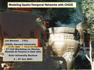
Modeling Spatio-Temporal Networks with CHGIS Lex Berman 贝明远 CHGIS, Harvard University 2nd Intl Workshop on Monies, Markets & Finance in East Asia Ruhr-University Bochum 4 – 6th Oct 2007
Funded By: Henry R. Luce Foundation (2001 – 2004) National Endowment for the Humanities (2005 – present)
admin unit, populated place, natural feature, religious site, archaeological site, trade route, place where an event occurred, etc placename feature type city, village, mountain, temple, ruin, trade route, etc footprint latitude and longitude for each feature valid date date or range of time for which this record is valid source note citation of data source, commentary on feature core elements of a digital gazetteer
digital gazetteer GIS layers placename feature type coordinates valid date source note spatial objects CHGIS =gazetteer database+GIS layers
秦始皇 清宣统 222 BCE 1911 CE POINT Features: National Capitals Province Capitals Prefecture Capitals County Capitals Towns & Villages POLYGON Features: National & Regime Boundaries Province Boundaries Prefecture Boundaries 1911 County Boundaries scope: a base GIS of Chinese admin divisions
Data Model Name Change Unit Change Location Change Time Series = instances with ranges of time
Da Qing yitongzhi. [Qing National Gazetteer] Yajima, Genryo. Chugoku no ji’in. [Temples of China] Tōhoku Daigaku Fuzoku Toshokan , 1966. [1941] Buddhist temple gazetteer sources
page from Yitongzhi Da Qing yitongzhi (Yitongzhi)
select area of interest convert to “shapefile” Associating data values with polygon features
export attribute data for focus area to TEXT file add a new column to the TEXT file enter new values in the new column, then REJOIN to original GIS focus area shapefile join new data values to GIS attribute table
create chloropleth map based on your data Thematic map based on new data values
center points + outer boundary aggregation of Thiessen boundaries Thiessen Polygons based on points Thiessen polgyons generated from points
Male Population (1820) normalized by area DEM background Thiessen polygons compared with natural features
Mapping and animation of locations over time - Life of Ouyi Zhixu
Addition of paths of movement between locations for each event
www.fas.harvard.edu/~chgis photo: Heilongtan, Kunming, Yunnan