Download
1 / 22
220 likes | 241 Views
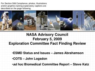
Learn about NASA's exploration plan for Mars, focusing on the search for water and its implications for life, climate, geology, and human exploration. Explore key missions like the Mars Global Surveyor and Mars Science Laboratory, as well as candidate landing sites like Eberswalde Crater, Gale Crater, Mawrth Vallis, and Holden Crater.

E N D
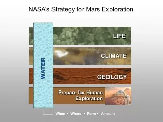
NASA’s Strategy for Mars Exploration NASA’s Exploration Plan: “Follow the Water” LIFE CLIMATE WATER GEOLOGY Prepare for Human Exploration When • Where • Form • Amount
Mars Global Surveyor (1997-2006) First orbiter around Mars since Viking (mid-1970’s) Recently lost after 10 years of successful operations. discovery of recent water-carved gullies Global topography (elevation)
1997 Mars Global Surveyor (MGS) • Mars Orbiter Laser Altimeter (MOLA) • Global 500 m resolution grid with < 1 m vertical resolution • Mars Orbiter Camera (MOC) • Few-meter resolution camera • more than 120,000 released images • Thermal Emission Spectrometer • Near-Infrared broadband spectrometer • rock, ice, and atmosphere compositions • thermal structure of the Martian surface
2011 MSL Key Goals • Characterize a site that: • was a habitable environment. • What does this mean? • is likely to have preserved biosignatures. • can be related to the “Big Picture”.
Keeping in Mind the Key MSL Goals… • Characterize a site that: • was a habitable environment. • What does this mean? • is likely to have preserved biosignatures. • can be related to the “Big Picture”.
Where would you land a $2.3B spacecraft? 2007 Phoenix VL2 VL1 MPF MER-B MER-A
But how can we assess the engineering and safety of the landing sites??
Four Finalist Candidate Landing Sites Eberswalde Crater (24°S, 327°E, -1.5 km) contains a clay-bearing delta formed when an ancient river deposited sediment, possibly into a lake. Gale Crater (4.5°S, 137°E, -4.5 km) contains a 5-km sequence of layers that vary from clay-rich materials near the bottom to sulfates at higher elevation. Mawrth Vallis (24°N, 341°E, -2.2 km) exposes layers within Mars’ surface with differing mineralogy, including at least two kinds of clays. Holden Crater (26°S, 325°E, -1.9 km) has alluvial fans, flood deposits, possible lake beds, and clay-rich sediment.