Download
1 / 49
490 likes | 518 Views
This step-by-step process guides the identification of assessment areas, assembly of an ID team, and review of existing information for riparian resource assessment using the PFC method. Key skills needed include quantitative sampling, knowledge of hydrology, vegetation, and geomorphology, as well as the ability to communicate findings.

E N D
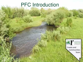
Integrated Riparian Management Process 1a. Identify Assessment Area & Assemble ID Team Steps 1a through 1d (7-step process) 1b. Review Existing Information & Delineate & Stratify Reaches 1c. Determine Reach Potential 1d. Complete PFC Assessment
Step 1: Assess Riparian Resource Function Using PFC • Identify Assessment Area and assemble an ID team with: • Strong observation and interpretation skills • Knowledge of quantitative sampling that supports PFC • Knowledge of hydrology, vegetation, and geomorphology attributes and processes. • Knowledge of reference conditions • Ability to communicate findings.
ID Team Skills Needed • Knowledge of quantitative sampling methods to support PFC assessment. • Ability to gather pertinent geographic information • (GIS) layers, remote sensing products, maps, monitoring data, etc. • Knowledge of a watershed’s geology, size, landforms, climate and weather patterns, hydrologic and fluvial processes, sediment dynamics, and how each affects streams in the region. • Knowledge of reference conditions for assessment reaches, whether based on data or professional judgment.
ID Team Skills Needed • Ability to identify riparian plant species/communities of the region, • Knowledge of riparian vegetation • reproductive strategies, • rooting characteristics, • disturbance response and recovery, • ecological amplitude, • soil water tolerance and dependence • expected distribution, structure, & abundance in different stream types, fluvial surfaces, and flooding regimes.
ID Team Skills Needed • Ability to determine soil texture, interpret soil features, particularly redoximorphic features, and relate soil texture and soil-water states to expected potential vegetation. • Knowledge of geomorphic processes including sediment sources and storage/transport dynamics, influence of roughness elements, etc.
ID Team Skills Needed • Knowledge of stream attributes and bankfull indicators of a region • Ability to use streamgage data and publications to determine timing, frequency, and duration of flooding • Knowledge of surface-water/ground-water interactions within river corridors including water tables and hyporheic zones.
ID Team Skills Needed • Ability to document assessment results in a report, make recommendations, and use PFC assessment results to inform collaborative adaptive management and monitoring.
An ID Team needs to: Review existing documents. Determine attributes and processes key to area being assessed. Determine potential or altered potential for the site. Determine a “functional rating”. Provide written comments on all items.
Step 1: • 1b. Review existing information: • Riparian concepts • The importance of uplands and tributaries • Recovery process http://www.blm.gov/or/programs/nrst/tech_refs.php
Step 1: • 1b. Review Existing Documents • Information specific to the drainage basin. • Previous assessments, inventories, monitoring data. • Resource information • GIS data, etc.
Step 1: • 1b. Delineate and stratify reaches: • Delineate the riparian areas into reaches/riparian complexes of similar character based on observable differences and/or similarities • May stratify reaches into groups with similar resource values, uses, geology etc.
Purpose of Delineation/Stratification: • Prediction – e.g. potential; response to management actions • Efficiency/Extrapolation – sampling a subset; applying throughout study unit • Prioritization – doing the right work in the right place with limited dollars and people
Delineation of Reaches – A 2-step process • 1. Identify tentative reach breaks using office reference materials • 2. Use field observations to validate or modify starting and ending points.
Delineate Reaches Mountainous terrain Axial stream (perennial) Tributary stream (intermittent)
Delineation: Hydrologic Processes and attributes • Drainage area / Contributing area • Major confluences • Streamflow duration • Perennial, intermittent • Interrupted • Groundwater/surface-water interactions • Hydrologic regime • Snow-melt, storm runoff (monsoon), spring-fed brook
Delineation: Physiographic Processes and Attributes • Geology and Geomorphology • Topography – elevation, relief, aspect • Sediment source, transport, storage capacity
Step 1: 1c. Determining Potential of Stream Reaches • Compare: • 1) Hydrology, • 2) Vegetation, and • 3) Geomorphology
Potential Defined Potential – The highest ecological status a riparian area (stream reach) can attain in the present climate.
Applying Potential to PFC Decision Space • Consider potential to assess PFC • A site does not have to be at potential for a “yes” Strategies Objectives PNC NF FAR PFC DC Ecological Threshold Time Fisheries Values Livestock Values Recreation Values Wildlife Values Watershed Values Sustainable Vulnerable Unproductive
Why is potential important? • Accuracy - for the PFC assessment to be accurate. • Realistic -to gauge the system against what it can actually be.
Management Reach Reference Reach
Process/tools for determining potential Consider (as an ID team): • Climate, landform, soil, hydrology, & vegetation relationships for clues • Regional and local riparian classifications & other literature • Historic information and photos • Species lists and habitat needs • Past inventory and monitoring data • Reference areas • Once stream potential is established, it should be documented!
Factors that influence riparian plant species & communities: • Wetness: Height above the water surface • Substrate: Channel and bank particle size • Slope: Stream gradient in percent • Stream size: Channel width and depth • Valley morphology: Geomorphic valley type
Factors that influence riparian plant species & communities: • Wetness: Height above the water surface • Substrate: Channel and bank particle size • Slope: Stream gradient in percent • Stream size: Channel width and depth • Valley morphology: Geomorphic valley type
Potential in fine soils E Type channel Vegetation = sedge dominated banks and active floodplain with willows, cottonwood and aspen occurring on less frequently flooded surfaces
Slope: < 2 % W/D: > 12 Sinuosity: > 1.4 Valley: broad/terraces Potential in coarse substrates C4 type channel. Gravel-dominated substrate.
Forests can provide woody debris B type channel; gradient > 2%; bedrock / boulder controlled; large wood important to channel complexity; vegetation = alder / fir
Example Riparian Complex COMPLEX A Narrow Valley Bottom Steep gradient Coarse Substrate Alder/Dogwood COMPLEX B Wide Valley Bottom Low gradient Fine Substrate Tufted Hairgrass
Riparian Complexes Groupings of potential plant communities that form vegetation patterns along the stream. • From interaction of: hydrology, geomorphology and climate. Consider: • Valley bottom gradient and width (types); Geology, deposition, and soil characteristics; Elevation; and climate.
Delineation of Riparian Complexes • Valley bottom type (Rosgen 1996) • Dominant soil family (USDA, NRCS) • Entrenchment • Stream profile or gradient – Stream type (Rosgen 1996) • Vegetation patterns along the stream, • Land uses
Valley Types Narrow, confined valley; Bedrock controlled Broad, unconfined valley; Alluvial fill
Rosgen Valley Types IV V Glacial Trough Gentle Canyon X VIII Broad Lakebed Wide Floodplain
Longitudinal, cross section, and plan views of major stream types
Applying Altered Potential to PFC • Change in TR revision is to “altered potential” instead of capability (for direct human alterations) • Capability simple to define but difficult to consistently apply • Capability precluded some altered streams from ever achieving PFC if gauged against historic potential or PNC
Altered Potential… New Approach …Is the best possible ecological status and channel form that can be attained under permanent human alterations. Permanent human alterations include railroads, dams, diversions, channelization, levees, roads, ground-water pumping, and related permanent alterations that change the potential of the reach.
Proposed Guidelines for Altered Systems • Are direct alterations (i.e. limiting factors) present that have created predominantly artificial channel conditions for a large part of the reach? If so, Don’t do PFC.
Proposed Guidelines for Altered Systems • Are direct alterations present but the overall potential of the reach remains unchanged? USE POTENTIAL Example Diversion of 10% of low flow and <1% of high flows – The same plant communities and channel type can still exist.
Proposed Guidelines for Altered Systems • Are direct alterations present but the overall potential of the reach has been changed (but is not predominantly artificial)? Describe new potential. Example: Diversion of > 50% of low flows has caused a drop in water table and potential has shifted from hydric to more mesic plant types.
Understanding Attributes and Processes - Determine Potential or Altered Potential If you do not spend the time to develop an understanding of the attributes and processes affecting an area, your judgment about PFC will be incomplete and may be incorrect.
Plan and Time the Assessment • On-the-ground reconnaissance • Analyzed in the office (using digital photos, aerial photos, GIS data, very large scale aerial photos, light detection and ranging (LIDAR) data, etc.), with random field verification on 25 percent of the reaches (Clemmer et al. 1999) • OR both depending on need and ability • Start at the top and work downstream using knowledge of upstream – Adjust vertical stability if needed • Consider recent high-magnitude floods
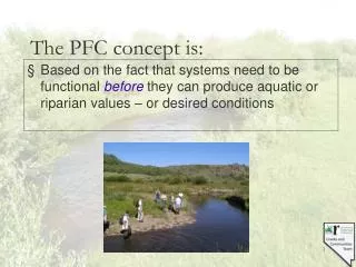
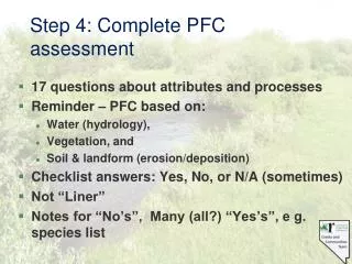
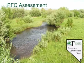
Step 1: Assess Riparian Resource Function Using PFC • 1d. Complete PFC assessment • 17 questions about attributes and processes • Reminder – PFC based on: • Water (hydrology), • Vegetation, and • Geomorphology • Answer: Yes, No, or N/A (sometimes) • Not “Liner” • Notes for “No’s” and “Yes’s”, e g. species list
Step 1: Assess Riparian Resource Function Using PFC • 1d. Complete PFC assessment • Items numbers do not relate to importance • The importance of an item varies relative to an area’s attributes & processes • Assessment of an individual item often affects future management, restoration, and monitoring actions —regardless of the functional rating. • If a “yes” is not within the system’s potential NA • A reach does not have to be at potential for an item to be “yes.” The answer depends on the condition needed to meet the definition of PFC and maintain stability within a natural range of variation.
Information Provided for each Assessment Item: • The purpose of the assessment item. • Observational indicators and examples useful for addressing the item. • The supporting science used to derive the response to the item. • Correlation with other items on the assessment form.