Download
1 / 11
110 likes | 131 Views
Implementation progress of AWIPS II Task Order 9, addressing rendering issues, and awaiting tasks for additional satellite products. CIMSS CRAS data suite delivery for Alaska region and NOAA Direct Readout Conference highlights.

E N D
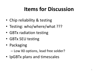
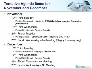
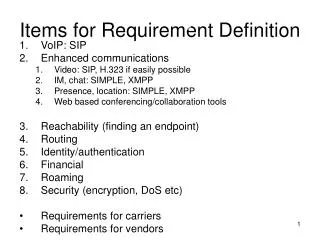
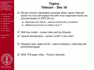
Items for December PG telecon • Simulated ABI data in AWIPS • AWIPS-II TO9 • Spring Experiment • CRAS for Alaska Region • NOAA Direct Readout Conference • Mini-GOES Workshop • GOES-12/13
AWIPS II • AWIPS II Task Order 9 was installed on new workstation and is successfully running over network without interruption • There are still some serious issues with graphics rendering as shown last time, despite sufficient graphics card memory • Awaiting next the Task Order for the implementation of more satellite products, including polar data and sounder data
Spring Experiment • The CIMSS AWIPS-ready data suite has been delivered to the SPC via Gregg Grosshans. Gregg reviewed the data and was able to display the MODIS AREA files and most of the CRAS GRIB2 data. Most netCDF files were not read by N-AWIPS. • For others who are interested, data is permanently available on the FTP server: ftp://ftp.ssec.wisc.edu/pub/jordang/spc/
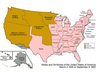
CIMSS has configured the CIMSS Regional Assimilation System for Anchorage, Alaska. It uses simulated “GOES-R precipitable water” and cloud-top pressure retrievals computed from MODIS to initialize water vapor and clouds. The domain is a superset of the AWIPS 216 grid so forecast products can be transferred directly to AWIPS. Shown at right are some comparisons between 18-hour CRAS forecast images and images from the GOES-11 imager. The 6.7u CRAS images are generated using the GOES-11 radiative transfer model to generate clear sky brightness temperatures. The 11u CRAS images are computed using the predicted cloud mixing ratio to attenuate the predicted skin temperature. Note: The map projection on the GOES-11 images are slightly different than on the CRAS images. CRAS Forecast Products for the Alaska Region 24 and 48-hour forecasts of 6-hour accumulated precipitation, 1000hPa – 500hPa thickness and mean sea-level pressure valid 12UTC 04Dec08 18-hour forecast sky cover (0% - 100%) valid 18UTC 02Dec08
CRAS Forecast Products In AWIPS • 1. Output from the CIMSS Regional Assimilation System (CRAS) continues to feed into AWIPS in real time. • Full CRAS output in grib2 format is now being transferred to NWS Central Region. • Implementation of CRAS into GFE, as requested by forecasters in the Western and Alaska Regions, is in progress. • Forecasters notified of recent changes to real time CRAS FXUS63 KMKX 110828 AFDMKX AREA FORECAST DISCUSSION NATIONAL WEATHER SERVICE MILWAUKEE/SULLIVAN WI 328 AM CDT SAT OCT 11 2008 .SHORT TERM... CRAS IR FORECAST IMAGERY SHOWS PATCHY CLOUDS OVER WI/IL WILL BE MOVING NORTHEAST OUT OF AREA. THEY ARE RELATED TO WEAK VORT MAX MOVING THRU OUR AREA. THEN SUNSHINE AND ABOVE NORMAL TEMPS TODAY. WILL GO A POINT OR TWO HIGHER THAN MOS MAV VALUES GIVEN 850 MB TEMPS OF +14/+15....WHICH TRANSLATES TO PERHAPS 80 DEGREE WELL INLAND AWAY FROM LAKE MICHIGAN. CRAS IMAGERY SHOWS COOLER TOPS COMING ACROSS LATE MONDAY NIGHT INTO TUE MORNING...SO WE SHOULD SEE SOMETHING AT THAT TIME. (Screen captures courtesy of S. Bachmeier, CIMSS)
NOAA Direct Readout Conference • Tim Schmit, Scott Bachmeier, and Jordan Gerth (as well as other CIMSS colleagues) attended the NOAA DRO conference in Miami on December 8 to 12 • CIMSS had a booth with demonstrations and two posters to highlight DBCRAS and MODIS in AWIPS • Tim Schmit gave a presentation on GOES-R • Scott Bachmeier gave a presentation on VISITview • Jordan Gerth visited with NHC, TAFB, and WFO Miami forecasters at the conference and on a special trip with Bill Sjoberg and Brian Gockel to understand GOES-R requirements for tropical forecasters • Bill Sjoberg proposed an experiment/testbed in Miami for 2009/2010 similar to the spring experiment in Norman
Mini-GOES Workshop • Presentation Given at a GOES Workshop at TPC: Three presentations were (remotely) given at a Geostationary Operational Environmental Satellite (GOES) workshop at the Tropical Prediction Center (TPC). • The topics included GOES-13/O/P, the ABI (Advanced Baseline Imager), ABI for continuity of current Sounder products, simulated imagery, and the ABI and GOES Imager and Sounder Weighting Function web-based tool. • J. Gurka of the GOES-R Program Office was the other presenter and organizer.
GOES-13 • GOES-13 may return to storage no sooner than mid-January. • Current GOES-12 is experiencing a “GOES-12 suffered a thruster anomaly” • GOES-13 data are being sent via GOES-12