Download
1 / 18
180 likes | 292 Views
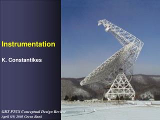
Selected Regional Maritime Instrumentation. Jason Felton Pier Technician SCUBA Diving Safety Officer. San Luis Yacht Club Wet Wednesday September 8, 2010. 1 of 17. Selected Regional Maritime Instrumentation. Mission Statement Pier Facility ( Avila Beach )

E N D
Selected Regional Maritime Instrumentation Jason Felton Pier Technician SCUBA Diving Safety Officer San Luis Yacht Club Wet Wednesday September 8, 2010
1 of 17 Selected Regional Maritime Instrumentation • Mission Statement • Pier Facility (Avila Beach) • Meteorological Station • Water Column Profiler • Mooring • Boat Based Sampling • Seawater System • Underwater Vehicles • Ocean Surface Current Mapping (County-wide) • SLOSEA (Morro Bay) • Example Initiative: Water Quality Monitoring Stations
2 of 17 Mission • To promote and facilitate basic and applied interdisciplinary studies of coastal marine systems for the purpose of addressing environmental concerns and fostering hands-on student learning through discovery and outreach.
3 of 17 Selected Regional Maritime Instrumentation • Mission Statement • Pier Facility (Avila Beach) • Meteorological Station • Water Column Profiler • Mooring • Boat Based Sampling • Seawater System • Underwater Vehicles • Ocean Surface Current Mapping (County-wide) • SLOSEA (Morro Bay) • Example Initiative: Water Quality Monitoring Stations
4 of 17 Pier • Boat Based Sampling • Seawater System • Underwater Vehicles • Meteorological Station • Water Column Profiler • Mooring
5 of 17 Meteorological Station • Meteorological stations along the coast provide wind speed, wind direction, air temperature, relative humidity, barometric pressure, solar radiation, and rainfall data. • These basic measurements provide important information for predicting coastal circulation, upwelling, and changes to the weather and climate.
6 of 17 Water Column Profiler • The water column profiler consists of a suite of sensors that are lowered down to the bottom and back up every 30 minutes. • These automated sensors measure temperature, salinity, chlorophyll, turbidity and water level at frequent intervals with depth. • These data can provide local and regional information on mixing and upwelling, land run-off, and algal blooms.
7 of 17 Mooring • Mooring are fixed buoys in the ocean that consist of several packages of automated sensors which are spaced throughout the water column. • These automated sensors can measure the water temperature, salinity, turbidity, and chlorophyll. • Mooring data is used in model forecasts, as well as in analysis of long term ocean trends.
8 of 17 Boat Based Sampling • Boats are used to take measurements offshore, providing snapshots of regional conditions at the time data are collected. • Boat based programs sample physical, chemical and biological properties of the ocean using instruments that are mounted to the ship or are deployed overboard at specific stations. • 19' Zodiac • 16' Bayrunner • 14' Whaler • Kayak
9 of 17 Seawater System • Flowing seawater system delivers continuous streams of filtered and unfiltered ocean water to a large variety of tank designs. • Seawater provides life support for the fauna and flora that exist in immediate area for both education and collaborative research efforts. • Provides the flow required for in-line monitoring instrumentation.
10 of 17 Underwater Vehicles • Underwater vehicles can operate by remote control or autonomously, independently navigating a pre-programmed course. • These instruments can provide data about the ocean in more detail and for greater durations than boat based station sampling. • Repeat profiles over the same area also provide insight into the variability of ocean, and the conditions which drive those changes.
11 of 17 Selected Regional Maritime Instrumentation • Mission Statement • Pier Facility (Avila Beach) • Meteorological Station • Water Column Profiler • Mooring • Boat Based Sampling • Seawater System • Underwater Vehicles • Ocean Surface Current Mapping (County-wide) • SLOSEA (Morro Bay) • Example Initiative: Water Quality Monitoring Stations
12 of 17 Radiowave Ocean Surface Current Mapping • Compact non-water contact antennae use radiowaves to measure the speed and direction of the ocean surface waters in near real-time. • 9 Cal Poly stations (green markers). • 50+ stations along the U.S. West Coast provide coverage from Washington to Mexico. • Data coarser offshore, finer near the coast. Shown are coarsest 6 km resolution arrows… still hard to see!
13 of 17 Selected Regional Maritime Instrumentation • Mission Statement • Pier Facility (Avila Beach) • Meteorological Station • Water Column Profiler • Mooring • Boat Based Sampling • Seawater System • Underwater Vehicles • Ocean Surface Current Mapping (County-wide) • SLOSEA (Morro Bay) • Example Initiative: Water Quality Monitoring Stations
14 of 17 San Luis Obispo Science & Ecosystem Alliance (SLOSEA) Six SLOSEA science initiatives together provide the data for improved understanding of the Morro Bay ecosystem. Protecting Coastal Habitats Sustainable Regional Fisheries Invasive Species Water Quality Sustainable Marine Economies/Working Waterfronts Local Climate Change Adaptation
15 of 17 San Luis Obispo Science & Ecosystem Alliance (SLOSEA) Six SLOSEA science initiatives together provide the data for improved understanding of the Morro Bay ecosystem. Protecting Coastal Habitats Sustainable Regional Fisheries Invasive Species Water Quality Sustainable Marine Economies/Working Waterfronts Local Climate Change Adaptation
16 of 17 SLOSEA Morro Bay Water Quality Station Map • Measured marine parameters include temperature, salinity, tidal height, dissolved oxygen, chlorophyll, turbidity, nitrates, currents. • BS1 station also has a meteorological station. “We need to ensure that pollution does not affect our strong history of a clean, healthy bay and safe drinking water.” — Janice Peters, Mayor, Morro Bay
17 of 17 Summary • Cal Poly’s Center for Coastal Marine Sciences (CCMS) operates a host of oceanographic and meteorological instrumentation used by the public, government, and academia. • CCMS researchers conduct programs locally, State-wide, throughout the coastal United States, and around the world’s oceans. • For more information see: • http://www.marine.calpoly.edu/ • http://www.cocmp.org/ • http://www.slosea.org/ • Questions?