Download
1 / 59
590 likes | 730 Views
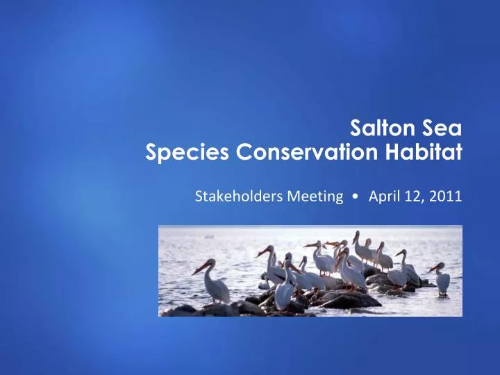
Salton Sea Species Conservation Habitat. Stakeholders Meeting • April 12, 2011. Introduce new team member Provide general updates on Salton Sea/activities Provide updates on SCH Project Provide opportunity for Stakeholders to provide informal input. Meeting Purpose. 1. Agenda.

E N D
Salton Sea Species Conservation Habitat Stakeholders Meeting •April 12, 2011
Introduce new team member Provide general updates on Salton Sea/activities Provide updates on SCH Project Provide opportunity for Stakeholders to provide informal input Meeting Purpose 1
Agenda Salton Sea Restoration Fund State of the Salton Sea SCH Project Schedule Stakeholder coordination Special studies Alternatives development Salton Sea Financial Assistance Program Stakeholder feedback/general discussion 2
Introductions Rick Davis – Davis Group Kim Nicol – Department of Fish and Game David Elms – Department of Fish and Game Kent Nelson – Department of Water Resources Rob Thomson – Cardno ENTRIX Ramona Swenson – Cardno ENTRIX 3
Salton Sea Restoration Fund Update and State of the Salton Sea
Salton Sea Restoration Fund Update (July 2007 through February 2011)
Current State of Salton Sea Salinity – 53 ppt Water elevation – dipped below -230 feet this winter Bird numbers – very high last few years (especially fish-eating birds) due to continuing abundance of tilapia Bird disease – very low levels Fishery – tilapia fishery very robust; no signs of marine species return Fish die-offs – occasional smaller ones, no large events by historic standards Pileworm and barnacle populations – severely reduced; barnacle bars and beaches not replenished as Sea recedes
Species Conservation Habitat Project Current Schedule
NEPA/CEQA scoping – June/July 2010 Draft NEPA/CEQA document – Spring 2011 Draft permit applications – Spring 2011 Final NEPA/CEQA document – Late 2011 to early 2012 Final design – Mid to late 2012 Permits complete – Mid 2012 Begin construction – Late 2012 Current Schedule (Subject to Change) 9
Species Conservation Habitat Project Stakeholder Coordination
Stakeholder Meetings Meetings held with Imperial County Farm Bureau Imperial Irrigation District Geothermal development companies Sonny Bono National Wildlife Refuge Vector control agencies Elected officials Purpose of meetings Share information about SCH Project Identify any concerns or conflicts with future plans Identify solutions and opportunities(cooperative efforts)
Imperial County Farm Bureau Issues Westernmost New River pond next to farmland good for lettuce production New guidelines require remedial action if leafy greens exposed to animal feces Typically includes eliminating affected portion of crop Response Analysis identified potential for increase in birds No increase in habitat for birds that forage in fields compared to current conditions Ducks and geese may roost and loaf, but not a change Habitat for gulls at SCH ponds, but maykeep away from fields Overall bird population decrease over time from habitat loss
Imperial County Farm Bureau, cont. Issues Westernmost New River pond site is most easily reclaimable land Need to accommodate runoff in natural drainages Cost of SCH Project Response New River ponds truncated on western side Too costly (long berms for small amount of habitat) Avoids drains carrying natural runoff Combination of New and Alamo River sites eliminated due to cost
Imperial County Farm Bureau, cont. Issues Fish for birds could be raised in hatcheries, not ponds Response Raising fish at hatcheries would not meet Project goals Would not develop range of aquatic habitats to support fish and wildlife species dependent on Salton Sea Would not develop/refine information needed to manage SCH Project through adaptive management Issues Previous technique of using geotubes as berms presented Response Use of geotubes being considered in geotechnical study
Imperial County Farm Bureau, cont. Issues Saline water not needed to address selenium issues Response Range of salinity retained (20-40 ppt) Selenium in river water likely to reduce hatching success in some birds and likely to increase risk of embryo malformation Salinity range would minimize vegetation, reducing potential for bioaccumulation and mosquitoes Issues Potential conflicts with geothermal development Response Meetings held with geothermal developers and IID to address potential conflicts
IID and Geothermal Developers Issues Proposed SCH pond sites in known geothermal area Geothermal companies have contractual right to develop supplies Geothermal facilities (wellpads, roads, power lines) may be located in or near SCH ponds Response SCH agencies working cooperatively with geothermal companies to avoid conflicts SCH facilities would not preclude future geothermal development
IID and Geothermal Developers, cont. Issues Potential conflicts between sensitive species using SCH ponds and future geothermal development Construction disturbances Emergency brine basin could attract wildlife Bird collisions with transmission lines Accidents (blow-outs, leaking wells) Response SCH agencies coordinating with IID to avoid conflicts with operations and obtain appropriate coverage in HCP/NCCP
Sonny Bono National Wildlife Refuge Issues Future NWR projects planned at proposed SCH pond sites Red Hill Bay shallow water habitat Unit 1 A/B Ponds Reclamation Response SCH pond footprint redesigned to avoid Red Hill Bay Exploring potential for sharing infrastructurewith USFWS Guidance being developed to ensure SCH compatibility with refuge management, including Unit 1 A/B Reclamation
Vector Control Agencies Issues Agencies raised concerns regarding potential increase in mosquito habitat at SCH ponds and sedimentation basins Response UC Riverside mosquito expert added to SCH team Providing input into EIS/EIR impact analysis Developing Vector Control Plan in coordination with Imperial County and Coachella Valley vector control agencies
Elected Officials Imperial County Supervisors Jack Terrazas Ray Castillo Gary Wyatt State Senator Bill Emmerson State Senator Juan Vargas staff Assemblymember V. Manuel Perez staff
Species Conservation Habitat Project Special Studies Overview
Questions Addressed by Special Studies How to design SCH ponds that are ecologically productive and efficient? Biological requirements for productive fish community -Fish tolerance Pond design and operation - Hydrologic modeling How to build stable berms - Geotechnical studies Will SCH ponds increase ecotoxicity risks while providing habitat? Sediment and water contaminants (Se, As, Bo, pesticides) Selenium ecorisk
Fish Tolerance Study What are biological requirements for thriving fish community? Which tilapia species are best given their tolerances? What range of salinity and water temperature can be tolerated? Tested 3 tilapia species 3 salinities (20, 45, 60 ppt) 3 temperatures (11-16°C, 23-28°C, 33-38°C)
California Mozambique tilapia hybrid, male Blue tilapia Lousy survival when salty (60 ppt) plus extreme temperature (hot or cold) • Good survival in cold,20 ppt Redbelly tilapia • Wild fish – best survival in cold, 20 & 45 ppt • Hatchery strain – very high survival in medium temps, moderate survival in hot • Poor survival in experiment • Found mainly in fresher waters
Hydrologic Modeling Water quality conditions in ponds raise challenges for operations and biota Desired salinity (20-40 ppt) Selenium levels higher in fresh water Salinity tolerated by fish, suppresses vegetation and mosquitoes Evaporation of river water takes too long, concentrates selenium Blend of Sea and river water more efficient SCH pond depth and operations affect DO and temperature Ponds become stratified in summer (May to October) Low oxygen at bottom in spring and fall Tilapia can go to surface, but invertebrates may not Winter temperatures could fall below fish tolerance Deeper ponds stratified more often
Preliminary Geotechnical Studies Characterized soils/geotechnical information for preliminary engineering design Sea sediments – low strength, dispersive Subject to erosion from wave action Potential for compressibility, seepage, expansion, liquefaction Possible berm instability from seismic shaking Low risk of injury, property damage from berm failure
Preliminary Geotechnical Studies, cont. Conditions have implications for construction Increased construction costs due to soil characteristics May use onsite soils to minimize cost Playa soils may be too weak to support traditional construction equipment May need very flat slopes for berms Need to minimize seepage, dispersionof soils Shoreline protection needed
Contaminant Survey Arsenic and boron not a problem Selenium Present in sediment, but not at toxic levels Rewetting sediments releases some Se, but greater source from river water Pesticides Higher concentrations close to river mouth and below surface Submerged sediments had lower concentrations than exposed playa DDE is predominant organochlorine pesticide in sediment
Selenium Ecorisk Elevated risk compared to other habitats Moderate risk of reduced hatching Risk higher with Alamo River, low salinity Uncertainties Bioaccumulation rates in fish-eating birds Proportion of diet from SCH ponds Reduce risk through management Use New River water Higher salinity (35 ppt) Flush ponds in first year Monitor SCH ponds Ongoing research Birds Fish Invertebrates Phytoplankton Algae Plants Water Sediment Selenium
General conclusions Use CM tilapia, wild from Sea and from hatchery, to accommodate variable conditions Low oxygen at bottom and in spring and fall; cold in winter Selenium - moderate risk for some bird species that breed at Sea, can be reduced with management Weak, dispersive soils - challenging for construction, berms Remaining uncertainties and data gaps Soil dispersion in saline water Selenium transfer from fish to birds Selenium management using constructed wetlands Conclusions
Adaptive Management Plan Goals & objs, alternatives Design Physical designs, operations plan Adapt, LearnDecision-making framework, communications Implement Construct and operate ponds Evaluate Analysis, data management Monitoring Water quality, fish & birds, Se
Species Conservation Habitat Project Crafting the Alternatives
Prior Alternatives New River, gravity diversion (2,460 acres) New River, pumped diversion (2,260 acres) Alamo River, gravity diversion (2,420 acres) Alamo River, pumped diversion (2,860 acres) New and Alamo River, gravity diversion (4,880 acres) New and Alamo River, pumped diversion (5,120 acres)
Factors Used to Refine SCH Alternatives Stakeholder input Existing and proposed land uses Special studies Geotechnical information Costs
Current Alternatives Combinations of New and Alamo River sites eliminated Too costly SCH pond footprints modified Red Hill Bay eliminated at Alamo River due to NWR plans NWR Unit 1 A/B in but will coordinate with NWR Far western pond at New River truncated due to high cost for small amount of habitat, drains Ongoing coordination with geothermal companies to ensure that design does not preclude geothermal development Not under DSOD jurisdiction as designed
Alternative 1, New River, Gravity Diversion 2,500 acres Independent ponds for West New and East New Cascading ponds for West New and East New (berm @ -236)
Alternative 2, New River, Pumped Diversion 2,100 acres Independent ponds for West New and East New Far West New extended pond, but truncated from original skinny extension west
Alternative 3, New River Combination, Pumped Diversion 2,900 acres Independent ponds for West New, East New, andFar West New Cascading ponds for West New, East New, andFar West New (berm @ -236)
Alternative 4, Alamo River, Gravity Diversion 2,290 acres Independent ponds for Morton Bay Cascading pond for Morton Bay that includes Mullet Island (berm @ -239)
Alternative 5, Alamo River, Pumped Diversion 2,080 acres Independent pond for Morton Bay Wister Beach extended pond
Alternative 6, Alamo River Combination, Pumped Diversion 2,940 acres Independent ponds for Morton Bay andWister Beach extended pond Cascading ponds for Morton Bay andWister Beach extended pond (berm @ -239)