Download
1 / 9
100 likes | 212 Views
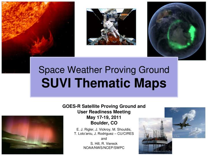
Space Weather Proving Ground SUVI Thematic Maps. GOES-R Satellite Proving Ground and User Readiness Meeting May 17-19, 2011 Boulder, CO E. J. Rigler, J. Vickroy, M. Shouldis, T. Loto’aniu, J. Rodriguez – CU/CIRES and S. Hill, R. Viereck NOAA/NWS/NCEP/SWPC. Multispectral Solar Imagery.

E N D
Space Weather Proving GroundSUVI Thematic Maps GOES-R Satellite Proving Ground and User Readiness Meeting May 17-19, 2011Boulder, CO E. J. Rigler, J. Vickroy, M. Shouldis,T. Loto’aniu, J. Rodriguez – CU/CIRES and S. Hill, R. ViereckNOAA/NWS/NCEP/SWPC
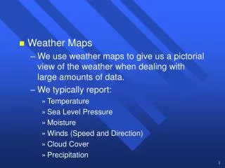
Multispectral Solar Imagery • Similar to Earth-focused image data, multispectral solar images can help users identify features of scientific or operational interest. • Solar features visible in SUVI’s EUV channels include coronal holes, “quiet” corona, prominences, active regions, and solar flares. • False-color images to right are SUVI proxy data derived from the Solar Dynamics Observatory Atmospheric Imaging Array (SDO-AIA).
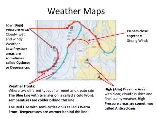
Full-disk Solar Synoptic Charts SWPC forecasters currently hand-draw daily synoptic charts using a light table, translucent paper, and several different types of solar images to identify different solar features. Solar feature identification is labor-intensive, slow (1 chart per day), and can be inconsistent due to varying levels of forecaster training.
SUVI Thematic Maps • An automated solar pixel classification algorithm has been developed that identifies most of SWPC’s desired solar features as often as SUVI can produce a multichannel image set (~2 minute refresh). • STAR compliant demonstration code, proxy data, ATBDs, and other related documentation will be packaged and delivered mid-summer 2011. • Sample to right is output from working SUVI Thematic Map algorithm.
Configure and Train Algorithm • SWPC forecasters and scientists are already working together to specify solar feature types appropriate for space weather forecasts. • SWPC forecasters and scientists generate training and test data using Thematic Map utilities developed to augment algorithm.
Proving Ground Proposal Summary (1) • Purpose: create GOES-R-like products using near-real-time proxy data and GOES-R space weather product algorithms • Scope: • Create infrastructure to ingest near-real time SDO/AIA images • modify AIA images to resemble L1b SUVI images; • generate high dynamic range composite images for each spectral channel; • apply automated solar pixel classification algorithm to multichannel solar images; • generate thematic map display tools; • tailor algorithms and tools to best meet SWPC’s operational needs. Develop near real time SDO/AIA image ingest pipeline to SWPC Generate Thematic Maps, display tools, and validation/O2R procedures Modify AIA images and generate Multi-channel EUV HDR Images
Proving Ground Proposal Summary (2) • Customer training: • Product capabilities • Product Interpretation • Product Limitations • Product Validation: • Does product match or exceed operational value of current synoptic charts? • Does product meet new performance requirements for SWx Phase 3 algorithms like solar flare location and coronal hole boundaries? • Does product demonstrate operational or scientific utility beyond SWPC? • Operations to Research (O2R): • Determine if solar feature list is adequate, and if additional non-EUV solar images might improve product accuracy and operational utility. • Periodically update Thematic Map configuration parameters to track changes in instrument performance and solar activity. Image of forecast center!!!
Discussion • The Proving Ground offers an ideal framework for validating and refining the operational utility of SUVI Thematic Maps by building on existing relationships between CIRES SWx participants and NWS/NCEP/SWPC. • Proposal also validates SUVI HDR Composite Image algorithm, and may be easily extended to test SWx Phase 3 algorithms that depend on Thematic Maps as their primary input. • An opportunity to parallel terrestrial weather product validation procedures by exploiting NASA scientific assets for proxy data; note however that SDO/AIA is not an operational instrument, has a limited lifetime, and no guarantee of a follow-on.