Download
1 / 39
390 likes | 549 Views
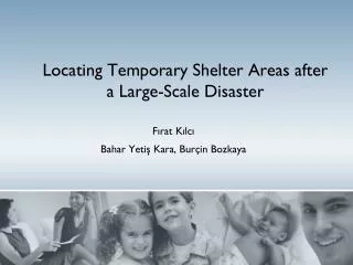
Fırat Kılcı Bahar Yetiş Kara, Burçin Bozkaya. Locating Temporary Shelter Areas after a Large-Scale Disaster. Disasters in Turkey. Source: Ozmen et al. (2005) . Shelter Areas. Sphere Project: Started in 1997 by several humanitarian organizations and IFRC

E N D
Fırat Kılcı Bahar Yetiş Kara,BurçinBozkaya Locating Temporary Shelter Areas after a Large-Scale Disaster
Disasters in Turkey Source: Ozmen et al. (2005)
Shelter Areas • Sphere Project: • Started in 1997 by several humanitarian organizations and IFRC • Defines standards and some quality measurements for humanitarian operations. • For temporary settlements, • Must plan settlement areas, access to those areas and routes to public facilities. These areas should be far from threat zones. • Must provide enough supply of tents, shelter kits, construction kits and cash. • Must provide adequate space to everyone to live • Must provide necessary utilities to achieve best thermal conditions. After a disaster, homeless people stay in shelter areas.
Turkish Red Crescent • In Turkey, TRC is the main authority for identifying the shelter area locations. • First they identify the candidate locations. • Each candidate location has a weightw.r.t. some criteria • Sort w.r.t. these weights and open facilities one by one until there is enough space for all the population.
Turkish Red Crescent • Criteria: • Transportation of relief items • Procurement of relief items • Healthcare institutions • Structure and type of the terrain • Slope of the terrain • Flora of the terrain • Electrical infrastructure • Sewage infrastructure • Permission to use
Turkish Red Crescent No population – shelter area assignment No consideration of shelter area utilization Distances between population and shelter area ignored
Problem Definition • Develop a methodology that decides on • the locations of the shelter areas • assignment of population points to shelter areas • considers utilization of shelter areas • considers distances between shelter areas and the affected population.
Mathematical Model • TRC Criteria: • Transportation of relief items • Procurement of relief items • Healthcare institutions • Structure and type of the terrain • Slope of the terrain • Flora of the terrain • Electrical infrastructure • Sewage infrastructure • Permission to use • Weight function Data created using GIS
Mathematical Model • Maximize the minimum weight of operating areas. • Minimize total distance from the shelter areas to nearest main roads and health facilities. • Maximize the total utilization of open shelter areas. • Minimize the maximum pairwise utilization difference of open shelter areas. • Subject to; • Assign all districts to an area • Respect capacity of shelter areas • Calculate utilization
Threshold values • DistHealth: max. allowable shelter area – health facility distance • DistRoad: max. allowable shelter area – main road distance • β: threshold value for minimum utilization of open shelter areas • α: threshold value for pairwise utilization difference of open shelter areas
Mathematical Model The population needs to be converted into “demand” demandj = populationj × percentAffected×livingSpace • percentAffected: percentage of population that is assumed to live in the shelter areas • livingSpace: assigned living space per person • populationj: the number of people living in district j
Mathematical Model Sets I: set of candidate locations J: set of districts Parameters wi : weight of candidate location i, between 0 and 1. dihealth : distance b/w candidate location i and nearest health bldg. diroad : distance between candidate location i and nearest main road demandj: total demand of the area j (in m2) capi : capacity of candidate location i (in m2) distij : distance between candidate location i and demand point j utilSpace: assigned space for utilities per shelter area
Mathematical Model Decision Variables: • xi: 1 if candidate location i is chosen, 0 otherwise. • yij: 1 if district j is assigned to location i, 0 otherwise. • ui: utilization of candidate location i
Mathematical Model Decision Variables : : : Utilization of the candidate location i.
Constraints (Capacity and Assignment) • Capacity constraints of shelter areas • * • Assign every district to a shelter area
Constraints (Utilization) • Calculate the utilization of each shelter area,
Objective Functions Maximize the minimum weight of operating areas. (O1) Minimize total distance from the shelter areas to nearest main roads and health facilities. (O2) (O3)
Objective Functions Maximize the total utilization of open shelter areas. (O4) Minimize the total pair wise utilization difference of open shelter areas. (O5) Minimize the total distance min (O6)
Selecting the Best Objective Select one objective function for the model Introduce other five objectives as constraints Choose O1 as primary objective
(O2) and (O3) • Minimize total distance from the shelter areas to nearest main roads and health facilities. • Define cover distances • DistHealth : max allowed shelter area - health institutions distance • DistRoad : max allowed shelter area - mainroaddistance • Add Constraints: • * DistHealth • * DistRoad
(O4) Maximize the total utilization of open shelter areas. Define a threshold value, and force utilization to be greater than it. : Threshold value for minimum utilization of open shelter areas Add constraint:
(O5) Minimize the total pair wise utilization difference of open shelter areas. Define a threshold value similarly : Threshold value for pair wise utilization difference of candidate shelter areas Add constraint: Linearize:
(O6) • Minimize the total distance. • Add a constraint that assigns every district to nearest open shelter area • “Nearest neighbor” constraints. • Define: • : ithclosest candidate location index to district j • Add constraint:
(O1) Revisited • Must linearize and define an upper bound • New decision variable: minWeight • Objective function: maximize minWeight • Define upper bound with a constraint • Add: • MinWeight + (1-)
Maximize the minimum weight of operating shelter areas • Capacity • Assignment Utilization To maximize the total utilization shelter areas. To minimize the maximum pairwise utilization differences
To minimize total distance from the shelter areas to nearest main roads and health facilities. Nearest assignment constraints
Computational Study Model is tested on a sample data on Kartal, Istanbul. 25 potential shelter areas 20 districts
Results • Generated 3000 instances by varying DistHealth, DistRoad, β, and α. • Solved using Gurobi integrated with DSS • The objective value decreases as β is increased and α, DistHealth and DistRoad are decreased. • This is expected as these changes tighten the feasible set.
Decision Support System • An ArcGIS extension that utilizes Gurobi and developed in C# • The user • Can solve the mathematical model • Edit the solution • Save the current solution • Compare up to 4 solutions • Visualize the current solution • Graph the shelter area utilizations • See the lists of assignments
Decision Support System • 5 layersneeded: • Location of districtswithpopulation data in its data table • Location of candidate shelter areaswith has weight and capacity data in its data table • A layer that contains the hospitals • A layer that contains the main road junctions • A “Network Dataset” that contains the road network
Conclusion In this study, a mathematical model to capture the requirements of TRC is formulated To implement the mathematical model, a decision support system via GIS is developed Tested with TRC personnel.
Related Literature Healthcare/Blood Logistics: • Bloodmobiles Brennan et al. (1992) Alfonso et al. (2012) Doerner and Hartl (2002) • Mobile healthcare facilities Hodgson et al. (1998) Doerner et al. (2007) Şahin et al. (2007) Selective VRP (a.k.a Team Orienteering Problem): Chao et al. (1996) Feillet et al. (2005) Vansteenwegen et al. (2011) Jozefowiez et al. (2008) Aksen and Aras (2005) Archetti et al. (2009)
Related Literature Decisions to be made simultaneously: • Stops of the bloodmobiles, (Selective VRP) • Length of the stay in a stop, (Time exp.) • Tours of the bloodmobiles, • Tours of the shuttle. No study covers these issues simultaneously. (Integrated Tours)