Download
1 / 15
150 likes | 280 Views
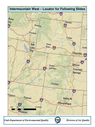
The Western Regional Air Partnership Technical Support System as a Model for Technical Data Sharing. Aerosol & Atmospheric Optics: Visual Air Quality and Radiation. AWMA Specialty Conference Moab, Utah April 30, 2008. Patrick Barickman, Brock LeBaron, Utah Division of Air Quality

E N D
The Western Regional Air Partnership Technical Support System as a Model for Technical Data Sharing Aerosol & Atmospheric Optics: Visual Air Quality and Radiation AWMA Specialty Conference Moab, Utah April 30, 2008 Patrick Barickman, Brock LeBaron, Utah Division of Air Quality Shawn McClure, CIRA, Tom Moore, WRAP Utah Department of Environmental Quality Division of Air Quality
Extending the Regional Haze Tools • 1) Distribution of Large Datasets • Archive, Manage and Distribute Data in Manageable Bytes • 2) Climate Change – Mitigation Strategies and Costs • Collecting and Analyzing Greenhouse Gas Inventories • 3) Expanding and Adding Observational Data • Integration Of Satellite-based Observational Data Utah Department of Environmental Quality Division of Air Quality
Large Datasets 2003 – Clean Air Corridors Perl program to extract and prepare gridded inventory • 2006 – Oil and gas development in N.E. Utah • Adapt Perl to extract subsets of emissions and modeling data • Extend scripting for further analysis Utah Department of Environmental Quality Division of Air Quality
Large Datasets 2008 – New desktop GIS tools Handle netCDF directly Still use Perl scripts for analysis Relevant needs now are for temporal subsets rather than spatial subsets of data netCDF files are already in single-day format Utah Department of Environmental Quality Division of Air Quality
Large Datasets IPAMS 12 km ozone study Counties potentially affected by new PM2.5 NAAQS Additional counties very near the new NAAQS Counties exceeding new ozone NAAQS RPO Unified Grid/WRAP 36 km domain WRAP 12 km domain Why Is This Capability Important? 4-Corners 4 km ozone study (CAMx) 1) As time movesOn So do modeling needs and the capability to address them • 2) Regionally Consistent Emission Inventories • State agencies • International • Windblown dust • Fire • 3) Comprehensive Emission Inventories • Natural/anthropogenic • Controllable/uncontrollable Utah Department of Environmental Quality Division of Air Quality
Climate Change Use of the TSS for Housing and Analyzing GHG Inventories Leveraging existing analysis tools to address new regional questions; same sources, different pollutants. Utah Department of Environmental Quality Division of Air Quality
States are Establishing GHG Inventories Climate Change • Historical trends and projected growth • Identify best areas to reduce emissions • Registering emissions to establish baseline – TCR • Response to public demand for action • All western/WRAP states now have a GHG inventory • Most developed by CCS and utilize a consistent methodology • Include the same GHGs listed by the IGCC • Cover the same historical and projection years Utah Department of Environmental Quality Division of Air Quality
Need Tools for Tracking GHGs and Evaluating Reduction Strategies Climate Change • Analysis by sector using totals, percentages and apportionment • Traceability and support for certification • Regional, state, sector, or source focus • Same sources as for Criteria or RH pollutants • Some differences from Criteria pollutants or RH pollutants: • Consumption or Production Based • Indirect vs. direct sources • Sector based not SCC code based Utah Department of Environmental Quality Division of Air Quality
TSS Could Add Value With Limited Development Cost Climate Change • Government, public and industry review of emissions for all sources • Spatial mapping of emissions and sources using GIS • Ability to view totals by source sector, geography, GHG species or other characteristics • Links to current understanding of GHG forcing; absorption, scattering, secondary effects • Cross sector comparisons of cost and energy efficiency Utah Department of Environmental Quality Division of Air Quality
TSS Data Links Climate Change • GHG inventories - State, Federal and Registry • GHG radiative equivalency calculations - IPCC • GHG accounting protocol – WRI ISO14064 • GHG scenario cost comparison -WCI Utah Department of Environmental Quality Division of Air Quality
TSS Enhancement of The Climate Registry Climate Change • View emissions trends over time • Geographic mapping of participants and reductions • Comparisons of emissions calculation methodologies • Compare composite changes by source type Utah Department of Environmental Quality Division of Air Quality
Expanding and Adding Observational DataContinuing ImprovementsIntegration Of Satellite-based Observational Data Utah Department of Environmental Quality Division of Air Quality
VIEWS/TSS Data Inventory Utah Department of Environmental Quality Division of Air Quality
VIEWS/TSS Project: Future Near-Term Plans • Add satellite data in conjunction with NASA ROSES contract • Add additional NAAQS (ozone, for example) and global data • Develop more tools that offer region- and locale-specific analyses • Develop appropriate new functionality as web services • Refine decision tools for making interpretations and recommendations • Expand and refine guidance documentation • Establish case studies from the user community as guidance • Allow users to upload and immediately work with their data • Develop modular, reusable, components for other developers • Establish reusable precedents for air quality decision support Utah Department of Environmental Quality Division of Air Quality
Acquisition and Import of NASA Satellite Data into VIEWS/TSS • 2007 NASA ROSES Solicitation for “Enhancing a Decision Support System” with NASA satellite data • End users for project are WRAP, EPA, NPS, + others • Awarded to CIRA and UNC Chapel Hill as Co-P.I.s • 3-year project starts May 2008 – activities include: • Acquire and import relevant satellite data into the TSS database • Quantitative concentration values, aerosol optical depth, other • Qualitative satellite vertical profiles, maps • Incorporate and use satellite data in CMAQ - utilize for model evaluation • Enhance/build upon recent work in the scientific community to integrate ground-based and satellite data for fire activity and emissions as input to air quality models • Enhance TSS tools to provide access to and visualization of satellite data • Display vertical profiles for a given site to investigate aerosol events • “Fill in” sparse monitoring data to produce better contour maps • Correlate satellite data to ground-based monitoring data • Investigate long-term transport, evaluate substituted data, additional QA of monitored data, etc. Utah Department of Environmental Quality Division of Air Quality