Download
1 / 30
340 likes | 702 Views
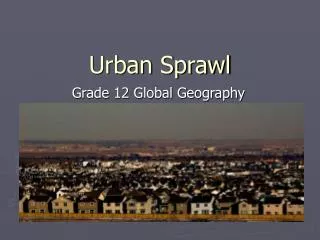
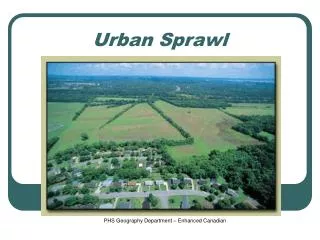
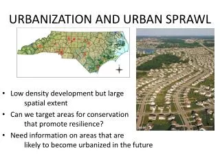
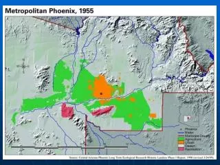
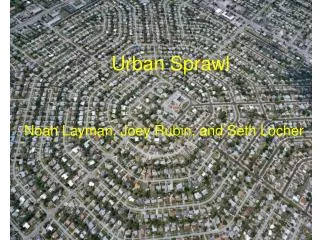
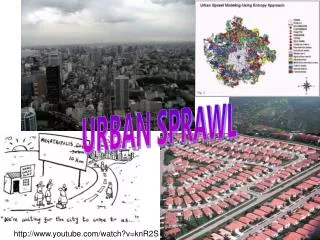
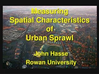
Measuring Spatial Characteristics of Urban Sprawl. John Hasse Rowan University. Recent Landscape Changes in New Jersey. Mullica Hill NJ 1986 to 1995 growth. What is Urban Sprawl?. Your favorite definition here. So What? Problematic qualities of sprawl

E N D
MeasuringSpatial CharacteristicsofUrban Sprawl John Hasse Rowan University
Mullica Hill NJ 1986 to 1995 growth
What is Urban Sprawl? • Your favorite definition here. • So What? • Problematic qualities of sprawl • Sprawl as “dysfunctional” urban growth • Spatial characteristics indicating dysfunctional qualities of sprawling urban growth
GIUS Measures • 12 spatial measurements • empirical indicators • focus on dysfunctional characteristics • new urban (suburban) growth
GIUS Measures • Land Use Patterns (1) Density; (2)Leapfrog; (3)Segregated Land Use; (4)Highway Strip; (5)Regional Planning Inconsistency • Transportation Measures (6) Road Infrastructure Inefficiency; (7) Transit Inaccessibility; (8) Community Node Inaccessibility • Environmental Impacts (6) Road Infrastructure Inefficiency; (7) Transit Inaccessibility; (8) Community Node Inaccessibility
1) Density John Hasse 2002 Less Sprawling More Sprawling Land consumed per unit of new development.
2) Leapfrog John Hasse 2002 Less Sprawling More Sprawling Distance of new development from previous settlement.
3) Segregated Land Use John Hasse 2002 Less Sprawling More Sprawling Number of different land uses within walking distance of new development.
4) Highway Strip John Hasse 2002 Less Sprawling More Sprawling New development that lines rural highways with “ribbon” growth.
5) Regional Planning Inconsistency John Hasse 2002 Less Sprawling More Sprawling The degree to which new development is consistent with a regional plan.
6) Road Infrastructure Inefficiency John Hasse 2002 Less Sprawling More Sprawling New lane-miles, cul-de-sacs & intersections created per new unit of development.
7) Transit Inaccessibility John Hasse 2002 Less Sprawling More Sprawling Road distance to alternate transportation.
8) Community Node Inaccessibility John Hasse 2002 Less Sprawling More Sprawling Average road distance from new development to important community nodes.
9) Land Resource Impacts John Hasse 2002 Less Sprawling More Sprawling Acres of lost wetlands, prime farmlands and endangered habitat per unit of new development.
10) Sensitive Open Space Encroachment John Hasse 2002 Less Sprawling More Sprawling Distance of new development to farmland preservation and protected habitat.
11) Impervious Surface Per Capita John Hasse 2002 Less Sprawling More Sprawling Acres of new impervious surface created by each new unit of development.
12) Growth Trajectory John Hasse 2002 Less Sprawling More Sprawling • Rate of development relative to: • Previous settlement • Size of locality • Remaining open space
Demonstration of GIUS measures for 3 recent residential subdivisions in Hunterdon County, NJ
Califon Tract • 11 units • 5 acres • Municipal services
Readington Tract • 25 units • 29.8 acres • Septic / well
Alexandria Tract • 34 units • 91.5 acres • Septic / well
Results – Land Use Measures 3) Segregated Land Use 2) Leapfrog 1) Density acres per unit feet to nearest previous settlement number of different land uses fewer than county maximum (7) within 1,500 of a development 5) Regional Planning Inconsistency 4) Highway Strip • Tracts weighted for each planning area (PA) where: • centers, metro & suburban PA’s = 1, • fringe PA’s = 3 • rural PA’s = 5 • rural/environmentally sensitive PA’s = 6 proportion of a tract that is within 300’ of a non-local road.
Results – Transportation Measures 6) Road Infrastructure Inefficiency 7) Transit Inaccessibility 8) Community Node Inaccessibility New Road Efficiency – length of roads per unit created or fronted by patch. Transport Accessibility – road network distance to nearest bus or transit route. average road network distance to nearest, rescue, fire, police, municipal bldg, hospital, school, grocery, park, and post office.
Results – Environmental Impacts 10) Sensitive Open Space Encroachment 9) Land Resource Impacts 11) Impervious Surface Per Capita acres of wetland, prime farmland & heritage area (endangered or threatened habitat) consumed per unit. weighted inverse distance to sensitive open space (farmland preservation & preserved endangered or threatened habitat). number of acres of impervious surface per unit within patch 12) Growth Trajectory percent urban growth + percent municipal growth + percent available land consumed for locality in which tract is located.
Findings Efficient development “smart growth”? Average Sprawl Extreme Rural Sprawl
Conclusion • Sprawl needs to be well defined • GIUS measures provide an objective means of characterizing dysfunctional qualities of urbanization • GIUS measures can be utilized for comparative analysis • Between tracts • Between regions • Alternate development scenarios • Potential for exploring socioeconomic factors of sprawl