Download
1 / 12
130 likes | 152 Views
This report outlines the assessment of the devastating impact of the earthquake, tsunami, and liquefaction in Central Sulawesi. It covers the chronology of events, including the Palu-Koro fault details, liquefaction phenomenon, tsunami risks, methods of assessment, assessor training, and recapitulation of assessment results. The report concludes with insights on the damages caused and recommendations for mitigation strategies to minimize future risks.

E N D
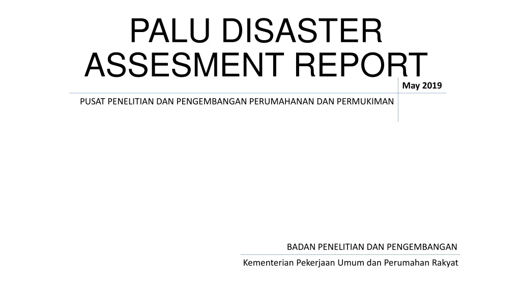
PALU DISASTER ASSESMENT REPORT May 2019 PUSAT PENELITIAN DAN PENGEMBANGAN PERUMAHANAN DAN PERMUKIMAN BADAN PENELITIAN DAN PENGEMBANGAN KementerianPekerjaanUmumdanPerumahan Rakyat
OUTLINE INTRODUCTION METHODOLOGY ASSESOR TRAINING ASSESEMENT RECAP CONCLUSION
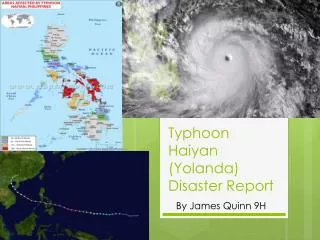
EARTHQUAKE CHRONOLOGY The Indonesian region has potential earthquake due to its position at the confluence of the three main plates of the world, namely Eurasia, Indo-Australia and Pacific. It also has 263 active faults which are the source of shallow earthquakes. One of the active faults is the Palu-Koro fault which has a 10 mm / year slip rate with Mmax 6.8. • September 28th 2018 • Foreshock at 15:00 WITA, M6.1 • Mainshock at 18:02:45 WITA, M7.5 and caused tsunami, liquefaction, land movement, surface rupture. PALU-KORO FAULT • Epicenter According to the USGS • Donggala District, 70 km north of Palu City (0.256 ° S; 119.846 ° E) • 20 km depth • Based on data from BNPB, the series of earthquakes, tsunamis and liquefaction caused : • 3,474 deaths, 4,438 injured, and 212,719 people to evacuate. • Thousands of buildings were damaged, both lightly damaged, moderate to severe and collapsed.
LIQUEFACTION TSUNAMI WAVE The phenomenon of liquefaction is a phenomenon that occurs when saturated or somewhat saturated soil loses strength and stiffness due to stresses, such as the vibration of an earthquake or sudden changes in other tensions, so that dense soil changes into liquid or heavy water. This phenomenon is most often observed in saturated and loose sandy soils (low or not dense density) Ponulele Bridge, Palu Talise Beach, Palu • The liquefaction phenomenon recorded caused by earthquake: • Niigata earthquake 1964 • Kobe earthquake 1994 , • Tohoku earthquake 2011, • Chile earthquake 2012, • In Indonesia, Yogyakarta earthquake 2006, • Padang earthquake 2009, and the • Palu earthquake 2018. • A tsunami is a natural disaster which is a series of large fast-moving waves in the ocean, but more general form is a sudden rising water level, it can be reach 15 – 30 m caused by : • powerful earthquakes (The most common causes of tsunami is submarine earthquake especially those that occur in subduction zones with a strength of 7.0 magnitude moments or more) • volcanic eruptions, • Landslides, • asteroid or a meteor crash inside the ocean. • liquefaction area: • The residential area of Balaroa and Petobo, Palu City • JonoOge area, Sigi Regency Tsunami risk can be detected by a tsunami early warning system that observes large-scale earthquakes and analysis the changing of sea water level and It can be used for people evacuation. 1,700 houses were swallowed by the earth after the earthquake caused the soil to become liquid. Hundreds to thousands of people are believed to be buried. • The risk of damage can also be minimized by: • spatial design (making buildings with wide spaces) • reinforced concrete materials for breakwaters • educate people how to save themselves from tsunami.
METHODOLOGY References: • Badan Penelitian dan Pengembangan PU – Pusat Penelitian dan Pengembangan Permukiman, 2004. • Ditjen Cipta Karya,2006. • National Institute of Land and Infrastructure Management Japan, Maret 2002. • PeraturanKepala BNPB No.15 Tahun 2011. Criterias of walldamage: Light Medium Heavy
TRAINING OF ASSESSORS In the verification of houses and buildings in Palu, Sigi, and Donggala, using assistance from building assessors. The goal is that the building assessment can run faster and effectively. The assessor training was carried out for residential and school buildings. Training for School Building Assessors
RECAPITULATION OF ASSESMENT RESULTS • Recapitulation of Building Assessment Results The buildings reviewed include government buildings, health facilities, educational facilities, worship facilities, trade facilities, flats and state-owned (BUMN) and private buildings. Building recapitulation that has been assessed in Palu, 545. Building recapitulation that has been assessed in Sigi, 109. Building recapitulation that has been assessed in Donggala, 187.
SUMMARY OF SCHOOL AND HOUSE BUILDING VERIFICATION RESULT IN PALU Time: Desember 2018
VERIFIED PERCENTAGE OF ENTRY DATA IN PALU Time: Jan, 21st 2019
CONCLUSION • Earthquake, Tsunami, and Liquefaction in Central Sulawesi had the greatest impact on buildingsin Palu, Sigi, and Donggala, due to the geographical location which is close to the epicenter and the shore. • Based on the public buildings assessment result, the numbers of buildings in every damage level are shown as follows: • Heavy damage buildings in Palu: 51, Donggala: 27, Sigi: 8 • Moderate damage buildings in Palu: 126, Donggala: 17, Sigi: 13 • Light damage buildingsin Palu: 356, Donggala: 125, Sigi: 80 • No damage buildings in Donggala: 18, Palu: 12,, Sigi: 8 • Based on the school buildings assessment result , the numbers of buildings in every damage level are shown as follows: • Heavy damage buildings in Palu: 40, Donggala: 24, Sigi: 10 • Moderate damage buildings in Donggala: 41, Palu: 37, Sigi: 16, ParigiMoutong: 14 • Light damage buildings in Donggala: 309, Palu: 224, ParigiMoutong: 94, Sigi: 51 • No damage buildings in Donggala: 72, Palu: 25, ParigiMoutong: 11, Sigi: 8 • Based on the residential buildings assessment result, the numbers of buildings in every damage level are shown as follows: • Heavy damage buildings in Sigi: 372, Donggala: 172, Palu: 76, • Moderate damage buildings in Sigi: 275, Donggala: 126, Palu: 123 • Light damage buildings in Palu: 630, Sigi: 576, Donggala: 287 • No damage buildings in Sigi: 194, Palu: 136, Donggala: 11 • Based on the data verification, the main concern in the post-earthquake disaster response was prioritized Palu due to the highest damage category building damage. For a residential house, the focus is more on Sigi for major and moderate damage and Palu for minor damage.