Download
1 / 17
170 likes | 306 Views
Join Sara Johnson from Waterwatch Victoria for a comprehensive workshop aimed at demystifying spatial data discrepancies, particularly the distinctions between the Australian Geodetic Datum (AGD) and the Geocentric Datum of Australia (GDA). Discover how these datums affect water monitoring and understand the importance of accurate mapping tools. Participants will engage in interactive activities, discussions, and view educational video content. Learn how to effectively convert data between AGD and GDA for practical application in your environmental projects.

E N D
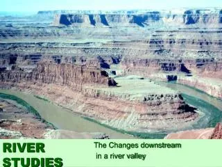
Has the river changed course, or are my coordinates wrong? A workshop to overcome spatial data confusion Sara Johnson, Waterwatch Victoria 4th National Waterwatch Conference, February 2004
Spatial Data Workshop Overview • Introduction • Video, overview and Q&As • GPS Activity - find the chocolate booty! • Discussion - What does the new GDA mean for Waterwatch?
Introduction • 3 minute discussion with a partner • Find out - • Neighbour’s name • Have they ever collected coordinates off - Maps? • GPS? • What is the most important thing they’re wanting to take away from the workshop
Video • 10 minute video on the new GDA
1966 - Australia adopted the Australian Geodetic Datum • the AGD was the best early fit of the Australian region • not compatible with satellite Global Positioning Systems • 1994 - Australia adopted the Geocentric Datum of Aust. • the GDA is compatible with rest of the world and GPS • Implemented from 2000 Video Overview Datum - a mathematical surface that best fits the earth
Video Overview The AGD and the GDA vary by approx. 200 metres, depending on location. • Applies to both latitude/longitude and eastings/northings
Australian Geodetic Datum Geocentric Datum of Australia GDA94 145o AGD66 145o AGD66 37o50’ 204m GDA94 37o50’ What is the impact?
On a topographic map, it’s a matter of scale Negligible How significant is 200 metres? On the ground, 200m may be the difference between: • A creek and a paddock • Rural and urban land use • VIC and NSW!
Is everyone moving to GDA? No, there is no requirement for organisations to move to GDA. AGD - private organisations generating spatial data for their own use, not requiring external comparative spatial data. GDA - government agencies and public organisations that use external spatial data, or supply data to external data users. Where does Waterwatch sit?
How can I convert between AGD and GDA? EASY!Use an online transformer GDAit http://www.geom.unimelb.edu.au/gda94/ • Most states have a local govt agency/university link for a state-specific transformer. • Check workshop summary notes for QLD/VIC/NSW link. • Check state govt websites - some states have developed small excel converters that can be downloaded and installed onto desktop.
GDA and GPS You borrow a mate’s GPS and log a series of WW monitoring sites with a GPS. Does that mean the data is in GDA? Yes, if the datum is either WGS84 or GDA. You must check the settings to be sure. No, if the datum is anything but WGS84 or GDA Which projection/position do you need? Eastings/Northings = UTM Latitude/Longitude = hdddomm.mmm
Want to know more about GPS? Many websites contain information and tips on how make the most out of a GPS Eg. http://gps.faa.gov/FAQ/faq-gps.htm http://gislounge.com/ll/gps.shtml Search GPS on Australian and international websites using a search engine (eg Google)
5 Easy Steps to GDA... • 1. Understand GDA • access GDA information sheets and websites • 2. Inventory of spatial information • What spatial data have you got? Collected in which datum? • 3. Transform data to GDA (if desired) • Clearly identify datum with all spatial data • 4. Archive superseded AGD maps/data 5. Update products derived from digital data
Sara Johnson Waterwatch Victoria - Science Coordinator Arthur Rylah Institute 123 Heidelberg Vic 3084 (03) 9450 8748