Download
1 / 55
670 likes | 817 Views
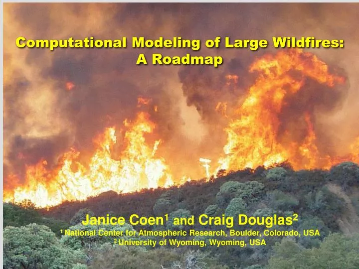
Computational Modeling of Large Wildfires: A Roadmap. Janice Coen 1 and Craig Douglas 2 1 National Center for Atmospheric Research, Boulder, Colorado, USA 2 University of Wyoming, Wyoming, USA. Wildland Fire - Weather Basics. 3 Environmental Factors that affect Wildland Fire Behavior.

E N D
Computational Modeling of Large Wildfires: A Roadmap Janice Coen1and Craig Douglas2 1 National Center for Atmospheric Research, Boulder, Colorado, USA 2 University of Wyoming, Wyoming, USA
3 Environmental Factors that affect Wildland Fire Behavior • Fuel • Moisture, mass/area, size, hardwood vs. conifer, spatial continuity, vertical arrangement • Weather • wind, temperature, relative humidity, precipitation • Weather CHANGES: fronts, downslope winds, storm downdrafts, sea/land breezes, diurnal slope winds • Topography • Slope, aspect towards sun, features like narrow canyons, barriers (creeks, roads, rockslides, unburnable fuel) Tree crowns duff Surface litter, grass, shrubs, twigs, branches, logs These are not independent
Weather Weather is one of the most significant factors influencing wildland fire and (compared to terrain and fuel characteristics) the most rapidly changing. • Weather conditions over wide time and space scales influence: • where a fire occurs (lightning) • ignition efficiency • how fast/where it spreads • combustion rates • whether or not the fire produces extreme behavior
Flow in the vicinity of a fire Updraft Flow into the base Compensating downdrafts Notes: Air is not ‘nothing’. It has weight & exerts a force. There are rules about how it can behave. We calculate these forces with mathematical equations of fluid dynamics, mass conservation, and thermodynamics
Fire creates its own weather & can change winds over several miles Wildland fires don’t just respond to weather, they interact with the atmosphere surrounding them: The fire releases heat, water vapor into the atmosphere. This alters winds, pressure, humidity, etc. in the fire, in the fire plume, & in the fire environment This in turn feeds back on the fire behavior. • This is a basic component of ALL fire behavior, not just in “plume” vs. “wind” driven, or high vs. low intensity, crown vs. grass fires. Photo courtesy of Jeff Zimmerman
Is this understanding currently being used? • ACCEPTED: • Changes in wind and slope cause variations in fire behavior. • HOWEVER: • Current operational tools & training modules • Do not include interplay between fire & atmosphere • Are diagnostic, not predictive. • Example: They cannot predict dynamical effects (i.e. changes in fire behavior or blowups) that lead to severe fire behavior or firefighter safety problems. The next generation of fire models for operations and planning & training materials should include realistic fire, wind, and terrain interactions.
How does fire interact with its environment? Fire whirls Photo courtesy of Canadian Forest Service Photo courtesy of Josh Harville
How does fire interact with its environment? Convective fingers Photo courtesy Charles George, USDA Forest Service
How does fire interact with its environment? Turbulent bursts
Wildland Fire Modeling Increasing complexity • A Hierarchy of Models • Experience, Intuition • Point-based Empirical, semi-empirical equations (i.e. Rothermel 1972) • 2-D in horizontal, non time dependent (FARSITE) • 3-D, time dependent, weather model:semi-empirical fire, 10 m – 1 km grids), NCAR/USFS CAWFE, WRF-Fire • 3-D, time dependent, air flow model:parameterized combustion, 1 m grids - Los Alamos FIRETEC, NIST FDS • Full combustion treatment (1 cm grids) (does not exist) - Computational science problem! The ‘best’ one: depends on the constraints of what you are trying to do.
Possible usage scenarios for a model in a wildfire incident Time Horizon Specific Decision Information Will there be extreme behavior on this fire this afternoon? (safety) Where will the fire be at the end of today ? What are the Best/Worst/Most Likely scenarios for where this fire can be stopped? Could this become one of the “biggies”? What would a fire do in this location? How would various fuel treatments affect this? Few hours: 1 day : ~ 1 Week: Few hours: 1 day : ~ 1 Week: “What If?”: “What If?”: These pose different challenges, require different development tracks, and may be suited best for different models.
An Atmospheric (“Weather”) Model While modeling flow over U.S., can telescope to model flow over single mountain valley with high resolution Models atmospheric structures like fronts, windstorms, formation of clouds, rain, and hail in “pyrocumulus” clouds over fires Numerical weather prediction models solve predictive equations of fluid motion to forecast air velocity, temperature, water vapor, cloud water, rain, and ice on a grid in a 3-dimensional box.
Wildland Fire Modeling Important output quantities: Rate of spread (ROS) of the leading edge of the flaming front, intensity, flame length In dynamic models (where forces are calculated), spatial and temporal variability of consumption is also very important • Concept of “fire line” – interface between burned and fuel that has not yet ignited
Dead Fuel moisture FIRE ENVIRONMENT Coupled Weather – Wildland Fire models 2-way coupling Heat, water vapor, smoke ATMOSPHERE (Weather model) Atmospheric Dynamics FIRE Fire Behavior Model Fire Propagation
Fire Model Surface fire Contains components representing: • Surface fire • Spread of “flaming front” depends on wind, fuel, and slope. Based on Rothermel (1972) semi-empirical equations. • Post-frontal heat/water vapor release • Subgrid-scale tracer points define the interface between burning and unburning regions (computational science problem!) • Fire line shape evolves naturally • Fuel can be heterogenous, can change any property 2. Crown fire • If the surface fire produces enough heat, it heats, dries, and ignites the tree canopy. • 3. Heat, water vapor, and smoke fluxes released by fire into atmosphere Crown fire
Common Computational science problem: Keeping track of an interface within grid cells Defining Burning Regions within each atmospheric cell At the surface, within each atmospheric grid cell… • Fuel is divided into rectangular grids (4x4, 10x10, etc.). When a grid of fuel is ignited, 4 tracers are created, defining what part of a fuel cell is burning. • Fire tracers can move with the wind, back, or move normal to it.
Fire Line Propagation Fire spreads perpendicular to the (local) fire line Spread rate specified by empirical formulas that calculate the rate of spread as a function of local winds, terrain slope, and fuel Contour advection scheme keeps fireline coherently shaped.
Mass loss rate An approximation to the BURNUP (Albini and Reinhardt) algorithm treats the rate of mass loss due to burning for fuel of different types and sizes.
Heat flux (kW/m2) Fraction fuel remaining with time Grass W=30 Woody fuel mixture W=500
The “Universal” Fire shape Photo courtesy Ian Knight, CSIRO The head (the flaming front), flanks, and the backing region.
The “universal” fire shape and fire whirls evolve from fire-atmosphere interactions. ANIMATION (fire1.avi) Field: smoke Arrows: strength and direction of winds near ground level
Big Elk Fire, CO-ARF-238 July 17–23, 2002 “Simple” Case study “Simple” weather & airflow regime “Simple” fuel distribution
Big Elk (cont.) Photo courtesy of Kelly Close
Inputs Atmosphere Initialize atmosphere & provide later boundary conditions with large-scale weather forecast Topography US 0.33 - 3 second topography Fuel - Surface and canopy fuels. Mass/area Physical characteristics Dead (live) Fuel moisture Configuration for a research problem Domain 6 6.7 km 6.7 km • 6 nested domains ( 106-107 gridpoints): • 10 km, 3.3 km, 1.1 km, 367 m, 122 m, 41 m horizontal atmospheric grid spacing. (Fuel grids much finer.). Time step in finest domain < 1 sec.
ANIMATION: Big Elk Fire bigelk_cinepak.avi (4400 acres)Pinewood Springs, CO 17 July 2002 N 4 hr simulation Grid spacing ~50 m. Red: Isosurface 10 oC (18 oF)buoyancy White: smoke concentration Arrows: strength & direction of wind Frame each 30 sec. W
Although this influence is most dramatic near the fire, model simulations show this influence can change winds by several miles per hour even miles from the fire.
2. Esperanza Wildfire Collaborators: Phil Riggan, Francis Fujioka, David Weise (USDA Forest Service, Riverside Fire Lab), Charles Jones (Univ. of California Santa Barbara)
Santa Ana Winds & Wildfires that occur during them Complex meteorology Complex fuels Complex terrain
Esperanza Fire Overview Ignition: arson-caused wildfire on 10-26-06 at 0112 in a river wash outside Cabazon, CA (Riverside Co.) Burned uphill influenced by strong winds and steep slopes. Spread WSW. Rapid fire spread due to Santa Ana winds (E 6-10 mph, 20-25 mph gusts), 6% RH, flammable brush
Typical study addresses the meteorological factors, fire behavior, and interactions leading to the observed phenomena in the 1st day of the fire Experiment: Start with 10-26-06 0 Z (10-25-06 1700 local time) 48-hour MM5 simulation (C. Jones, UCSB) 10 km domain Interpolate to Clark-Hall weather model grid Use to Initialize and update CAWFE boundary conditions Use CAWFE to model weather and fire Nest grids, refining from 10 km -> 3.3 km -> 1.1 km -> 0.37 km Simulate 17 hrs of weather + fire beginning at 10-25-06 at 2100.
Fuel First approximation: LANDFIRE Developing improved fuel information from pre-fire aerial imagery and hand-collected samples Grass: (1) short grass Shrub: (5) mixed brush Forest: (10) heavy litter Grass Brush Forest
ANIMATION (seq2_repaired.avi)Fire sensible & latent heat flux and smoke. Simulation covers 1:00 am – 9:43 am
FireMapper Data USDA Forest Service, Riverside Fire Laboratory Laboratory 10-26-06 1117
LandSat 5 image False color composite
Wave motions in air caused by two upwind ranges of mountains are bringing high momentum air down on the fire, causing it to spread quickly. Fire site Wave motions excited in air by 2 ranges upsteam
WRF-FireA module to enable simulations of wildland fire behavior and interactions with weather Purpose:Develop, maintain & test a public domainwildland fire module for use with WRF (Weather Research and Forecasting model) that simulates wildland fire behavior over prescribed and landscape-scale fires. Why? Understand 2-way interactions between 4-D weather & wildland fires that influence fire behavior and growth • Status:WRF-Fire module and documentation released in WRF 3.2, April 2010. Image: Ronan Paugham J. L. Coen, J. D. Beezley, M. Cameron, J. Mandel, J.Michalakes, E.G. Patton, K.Yedinak, WRF-Fire: Coupled Weather-Wildland Fire Modeling with the Weather Research and Forecasting Model. in preparation. J. Mandel, J. Beezley, J. L. Coen, and M. Kim, 2009: Data Assimilation for Wildland FiresEnsemble Kalman filters in coupled atmosphere-surface models, IEEE Magazine.
Sensitivity studies Study the sensitivity of simulated fire characteristics such as perimeter shape, intensity, and rate of spread to external factors known to influence fires such as fuel characteristics, wind, and terrain slope. Using theoretical environmental vertical profiles, experiments vary these external variables Results: simulated fires evolve into the observed bowed shape as a result of fire-atmosphere feedbacks that establish the flow in and near fires. Coupled model reproduces recognized differences in fire shapes and head intensity between flashy grass fuel, shrub surface fuel, and forest litter types. Coupled model reproduces the observed tendency of heavy, dry fuels in strong winds on steeper slopes to lead to faster moving fires. J. L. Coen, J. D. Beezley, M. Cameron, J. Mandel, J.Michalakes, E.G. Patton, K.Yedinak, in preparation.
LINGERING ISSUES Tough problem. Challenges include all those of weather modeling + fire behavior Modeling/Forecasting limitations to predictability physical processes that span a vast range of scales (combustion: mm or cm, weather: m - 10s of km) processes such as spotting (where burning embers are lofted and tossed ahead of the fire, starting new fires) that should perhaps be modeled stochastically instead of deterministically estimating the consequences of uncertainty, difficulty of gathering pertinent data for verification and initialization in a dangerous environment