Download
1 / 24
240 likes | 401 Views
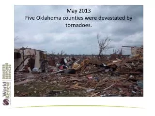
GIS Activities at NWS Norman with a Focus on the May 2013 Tornadoes. Aaron Anderson Information Technology Officer NWS Norman Forecast Office. Overview. Background on operations and staffing during events Use of GIS during the May tornadoes Other GIS activities both local and NWS wide.

E N D
GIS Activities at NWS Norman with a Focus on the May 2013 Tornadoes Aaron Anderson Information Technology Officer NWS Norman Forecast Office
Overview • Background on operations and staffing during events • Use of GIS during the May tornadoes • Other GIS activities both local and NWS wide
The Norman WFO We issue forecasts and warnings for… 48 counties in OK 8 counties in TX 47,546 sq. mi. 2.175 million people
Tornado Path Application (TPA) • Goals • Easy to use operationally • Rapid updates • Simplify dissemination • Standard GIS formats (.shp, .kmz, .kml) • Advantages • Near real time GIS information • Aid first responders • Assist local, state, and federal EM community in planning response
Development • Location of rotation signature on radar and tornado on the ground can differ • Compared radar signatures to damage surveys • Developed algorithm to quantify track uncertainty based on distance from radar
Operational Use • Forecaster selects point and radar being used in TPA • Updates point in AWIPS with each radar update • TPA stores positions, generates, and sends new KML file with each update
Preliminary Damage Path 3:13 PM and 3:43 PM
FEMA Administrator Craig Fugate FEMA used prelim tornado track data to deploy additional USAR teams to Moore before they were officially requested
Future Plans • Software • Add functionality • AWIPS2 Plugin • Integrate and capitalize on GIS architecture • How to best communicate uncertainty area • Dissemination • Determine best ways to share data with partners • NOAA Geoplatform, Geoserver, etc • Coordinate and collaborate with other NWS projects • Hazard Services • GIS in AWIPS
Damage Assessment Toolkit (DAT) • Main tornado survey tool • Enables rapid assessment of damage points • Ability to include photos/narratives for specific damage indicators
DAT on Portable Devices • Surveyors can enter damage information on smartphones and tablets
DAT Web Interface • Real time updates from field teams • Quality control • Export variety of GIS formats
Use of GIS Data from May Tornadoes • EM (planning and response) • Media (graphics, etc) • Planning aerial flyover assessments • Google Crisis Map (integrated with DAT) • Research • Lead time by population using Landscan data
97% of the people in the path had 31+ minutes warning
42 minutes 40 minutes 37 minutes
Local GIS Applications • Situational Awareness • Decision Support • Internal Web Apps
AWIPS 2 • New operational software • Fully spatially enabled • Open source technologies (PostGIS, GeoTools, etc) • Provides underlying architecture for new capabilities and products
Geoplatform.gov • Centralized platform to discover and access GIS data and services • Similar to OKMaps but for Fed Govt • Early in deployment • www.geoplatform.gov/noaa/noaa-home
Questions? Aaron Anderson Aaron.Anderson@noaa.gov