Download

1 / 12
120 likes | 143 Views
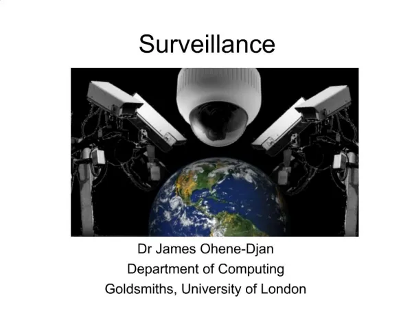
Three-Dimensionalizing Surveillance Networks. James Elder, Project Leader York University. The challenge. To use persistent visual surveillance data to maintain and improve the security and efficiency of our urban centres in the face of rapid growth and increasing complexity. Goals.

E N D
Three-Dimensionalizing Surveillance Networks James Elder, Project Leader York University
The challenge • To use persistent visual surveillance data to maintain and improve the security and efficiency of our urban centres in the face of rapid growth and increasing complexity
Goals • Automatic, efficient, scaleable methods for extraction and integration of 2D and 3D urban data at street level • Surveillance video, UAV photogrammetry, airborne & terrestrial LIDAR… • Automatic inference of 3D scene properties • Scene segmentation, building characteristics, foliage modeling • Automatic inference of 3Dscene dynamics • Human and pedestrian traffic • Integrated reporting and 3D visualization • For efficient human interpretation • Integration into distributed software architecture • CAE S-Mission architecture
Claire Samson Frank Ferrie Carleton McGill Jim Little Ayman Habib Calgary UBC John Zelek Dave Clausi Waterloo James Elder Gunho Sohn York Academic Team
Associated Korean Land Spatialization Group Projects • Project 1. Real-time Aerial Monitoring System • Project Leader: Impyeong Lee, Head, Dept. of Geoinformatics, The University of Seoul • Project 2. Mobile Mapping at Street Level • Project Leader: Taejung Kim, Associate Professor, Dept. of Geoinformatic Engineering, Inha University
Partners • Aeryon Labs • Aimetis • Applanix • Array Systems • CAE • City of Toronto Survey & Mapping Services • dmti Spatial • DRDC • Honeywell • Ministry of Transport Ontario • Miovision • Presagis
What are the goals of this workshop? • To understand each other’s interests. • To form specific collaborations with well-defined objectives to be achieved over the next 4 years.
Suggested Approach • Form the collaboration around one or more specific students (or postdocs). • Establish a working relationship between the student and individuals in the partner organization. • Program in a specific period in which the student works on site with the partner.
Funding • The project has been told by GEOIDE that we must demonstrate some financial commitment from our partners. • If we do not have this commitment, the project will be cancelled. • This commitment could be demonstrated through partial support of a designated student.
Accelerate Canada • Accelerate Canada is an internship programme for graduate students and postdocs run by MITACS. • The government matches funds provided by a company to fund a student/postdoc for a specific length of time. • The program is available across Canada and may also involve public sector agencies.
Example: Accelerate Ontario • 4-month research project • Student/postdoc spends roughly 2 months on site with company • Company provides $7,500 • Government provides $7,500
Schedule • We need to line these up now, or at least by the fall, so that we can report back to GEOIDE. • Please see www.mitacsinternships.ca for more details.