Download
1 / 15
150 likes | 170 Views
This project aims to improve convective initiation forecasts for the FAA using satellite data integration. It focuses on developing an algorithm for better nowcasting of convective initiation and growth, utilizing NASA satellite assets and data integration techniques. The goal is to enhance the prediction accuracy of convective weather patterns for aviation safety. The project includes database formulation, case analyses, and algorithm optimization. Ground-based validation and benchmarking are integral parts of the plan to ensure improved convective regime definitions and the overall efficiency of the DSS. The project leverages NASA's "A-Train" satellite data and analyses the factors influencing convective initiation such as cloud development, lightning, and rainfall. The ultimate objective is to increase the precision and reliability of convective weather forecasts for aviation applications.

E N D
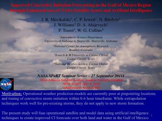
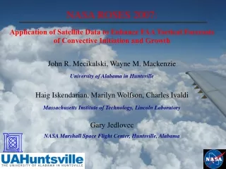
NASA ROSES 2007: Application of Satellite Data to Enhance FAA Tactical Forecasts of Convective Initiation and Growth John R. Mecikalski, Wayne M. Mackenzie University of Alabama in Huntsville Haig Iskendarian, Marilyn Wolfson, Charles Ivaldi Massachusetts Institute of Technology, Lincoln Laboratory Gary Jedlovec NASA Marshall Space Flight Center, Huntsville, Alabama
Outline • Overview of Applied Science Problem: Satellite CI Nowcasting and SATCAST • Proposed Plans • Project goals • Convective regime: Definition • NASA “A-Train” data • Database formulation • Case analyses • Progress to Date & Timeline
SATCAST Ambient Environment: Thermodynamic profile (i.e. tropical vs. midlatitude) CAPE (also, its shape) & CIN Models/ Sounders Cumulus: Cloud-top T Cloud growth rate Cloud glaciation Freezing level: warm rain process ice microphysics Interactions with ambient clouds (pre-existing cirrus anvils) ROSES 2007 Satellite: VIS & IR CI, LI Rainfall What are the factors? LMA & NLDN Lightning: Type (CG, IC, CC) Amount Polarity Altitude in clouds with respect to anvil Courtesy, NCAR RAP
SATCAST Algorithm: LI Interest Fields Chris Siewert/UAH - 2007/2008
SATCAST Algorithm: MSG CI Interest Fields COPS data analysis ongoing for GOES-R
Applied Science Problem • Currently, the GOES CI algorithm suffers from low predictive skill scores due to its lack of tuning to the different convective environments present across the continental U.S. at any given time. • NASA assets are optimizing the GOES-based CI method via the in-line convective-regime “training” information they provide via a multi-parameter database—statistical look-up table approach. • Satellites are the primary source of CI (pre-radar echo) information, representing a powerful capability to improve fine-scale convective-scale forecasts, and therefore the utility of the DSS. DSS: Corridor Integrated Weather System (CIWS) as the cornerstone of the FAA Consolidated Storm Prediction for Aviation (CoSPA)
Proposed Plan & Goals Data collection and analysis towards SATCAST algorithm optimization Ground-based validation over UAHuntsville region (i.e. CI regime definitions, dual polarimetric radar & lightning assessments of satellite-observed clouds) DSS integration Benchmarking improvements to the DSS
Convective Regime Definitions For this effort, a “convective regime” is defined as an environment in which deep convection is supported (thermodynamically, dynamically). Therefore, the environment possesses adequate CAPE, with the vertical wind shear and momentum properties acting with the thermo-dynamics, to organize convection in nearly predictable behaviors. It is recognized that convection initiates differently across regimes, and subsequently, observations of clouds from satellite in various regimes will be different. Infrared and visible reflectance observations from satellite of growing clouds therefore should be optimized to environmental parameters, IF a satellite-based CI algorithm is to perform optimally.
NASA “A-Train” Data Towardconstraining geostationary infrared and visible fields, data from other satellite sensors and numerical weather prediction models are used. In particular, MODIS/Aqua, CloudSat and CALIPSO data are being collected in concert with GOES object-centered observations of growing cumulus clouds, that develop into thunderstorms. Meteosat Second Generation data are also being considered.
NASA “A-Train” Data GOES (MSG) visible & infrared Interest Fields Coupled to: CloudSat and CALIPSO (for the LIDAR field) CTH estimates (via the “2B-GEOPROF” 2B-GEOPROF-LIDAR” products) and estimates of CTG (i.e. using product “2B-CWC-RO”, “2B-CWC-RVOD” as means of assessing ice at cloud-top) for cumulus (with cloud classification coming from “2B-CLDCLASS”); (c) CTT estimates, and to some extent CTH, obtained via MODIS and the “MODIS-AN” (Aqua) product as part of the CloudSat suite; (d) NWP thermodynamic profiles at 12-40 km resolution near active convection; (e) NWP-derived stability indices (e.g., convective available potential energy—CAPE; lifted index—LI, etc.); (f) Lightning (cloud-to-ground via NLDN, or total lightning via LINET or other lightning mapping array datasets.
Database Development One main goal of this effort is to construct a database that can be mined to retrieve robust statistical relationships between the sets of CI (and LI) interest fields from GOES (and MSG) and other NWP and satellite-based variables. This will allow for the optimization (i.e. appropriate weightings per interest field, use of selected fields within a given convective environment) of SATCAST across many regions of North America, and certainly elsewhere CI occurs. Improved skill scores (POD, FAR, Threat, Heidke Skills) for 0-1 h CI (and LI) nowcasting, both day and night, is the expected outcome. For a given CI pixel identified by GOES (or MSG)…
Case Study Analyses For selected regions where geostationary (GOES), A-Train, and NWP data exist, perform detailed analyses for CI/LI events in detail, so to assess the physical relationships between the satellite and NWP information and precipitation development. Incorporate ground-based radar and lightning data. • Likely Candidate Regions: • Cape Verde Islands/NAMMA • Puerto Rico • Guam • Belize • North Alabama, annually • Alaska region • VORTEX II • IHOP 2002
Progress to Date & Timeline Starting with 1 March 2008: Collect/process data up until current. Set up to run in real-time; work backwards through late 2006 (when CloudSat was launched). Now identifying cumulus clouds via Berendes et al. (2008) cumulus mask. Developing database over all of North America, and soon for MSG over NAMMA region, and likely MTSAT over South Korea (Two WSR-88D’s are present in South Korea, but depends on acquiring MTSAT data). Now processing convective cloud mask: Assess regions of growing cumulus within 10 km of A-Train overpass (and +/- 15 minutes). If a cumulus cloud is present, SATCAST will be processed over that region. Major data archiving started in Fall 2008, of CloudSat, GOES, MODIS and soon CALIPSO. First case study analysis to be completed: December 2009. Database development and construction: Summer 2009.