Download
1 / 20
240 likes | 353 Views
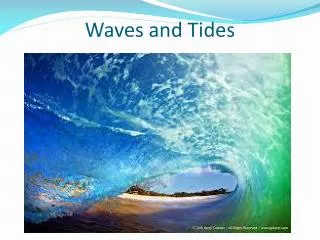
This course covers essential topics like navigation, tides, differences in waters, equipment requirements, and planning for inland and coastal boating. It also touches on regulations, charts, tides, and more.

E N D
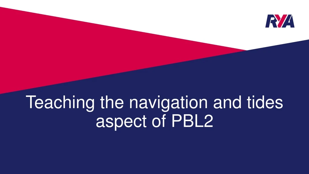
Teaching the navigation and tides aspect of PBL2 • What needs to be covered on a PBL2 course? • How do we achieve this • How do we cover this on a PBI course?
Section B - Advice to Inland drivers about coastal waters • What are the main differences between operating craft on an inland lake or river compared to out at sea or in a harbour? • Where can we find relevant information for different locations? • Are there any different regulations we need to follow? • What extra equipment, if any, do we need to carry onboard for a day trip at sea? • What extra planning, if any, do we need to do for a day trip at sea? • This is all the aspects from section C – therefore we teach them the same theory as a coastal course
How do we achieve this on a level 2 course? Start the course with an intro to the decisions you make every time you go boating - • Show them a weather forecast • Show them the tides for the day • Show them a chart of the local area they will be operating in today • Collectively make the decision that it is a good idea to go boating today • Discuss what they will need to wear • Discuss what to take afloat with them – water, sun cream, hats
How do we achieve this on a level 2 course? • Cover through course and highlight after col regs session as extra rules to follow • point out where to find out info • Not a legal requirement • May be a byelaw • Can you afford to fix somebody else's boat? • Local registration schemes • RYA Safetrx replaces CG66
How do we achieve this on a level 2 course?Understands Charts, Chart symbols, Buoyage systems • Introduce the chart early in the course – keep it basic – colours, current location, landmarks • Identify buoyage when afloat • Give more detailed session later in course • Use Start Powerboating as a guide on what level of detail to cover
How do we achieve this on a level 2 course?Understands Tidal Heights and tidal Streams • Introduce the concept of tides right from the beginning of a course • Don’t introduce mechanics of tides at this point – its too complicated • Show the tide info for the day – tide goes up and down so must go side to side • Show them visual things as the day progresses while afloat to see the change in tide
Look out the window for some clues The tide will probably come in during the next 6 hours!
Look again later in the day, it might of changed The tide is likely to go out in the next few hours
How do we achieve this on a level 2 course?Understands Tidal Heights and Tidal Streams • Give them a more detailed session later in course following up on intro at start of course • Introduce Springs & Neaps – what we see and how often they occur. • Do not get bogged down in details of moon/sun cycle – this isn’t a Dayskipper course • Don’t teach tidal curves or rules of 1/12’s – its complicated and they won’t remember it They need to know – • Is it deep enough to launch my boat? • Use apps/easy tide website etc to get information and calculate height etc as well as local tide tables • How does tidal stream effect us at sea?
How do we achieve this on a level 2 course? Understands Pilotage and Passage Planning • Point out that it is a requirement to have a plan – SOLAS V regs • Introduce bearing and distance, Lat/Long, speed/time/distance • Where to get pilotage info from – Almanac & internet • Show how to prepare a plan – keep it simple • Get them to do it • Follow it afloat
How do we achieve this on a level 2 course? Can use steering and hand bearing compasses • Follow the plan they produced • Take turns to helm and navigate • Use both compasses – take a 3 point fix at anchor • Get all students involved
Where should we go? • What does syllabus require? • Achievable in short distance between two buoys • What would be nice to do? • Visit another harbour • Go for lunch somewhere else • What do the rules allow? • 3 navigable miles from centres launching/departure point unless have RYA HQ permission to operate further in order to cover all of the syllabus
How much detail? • Keep it simple • Record and use bearing and distance • Use colour • Use the GPS log for distance rather than a stop watch – its simpler and more accurate • Don’t buoy hop to every buoy in a straight line – navigate to turning points but note what you should pass on the way to avoid suprises • Record tide times and vhf channels
How do we do it with no navigation features? • Get a useable chart of the area • Do a 3 point fix out at sea following other exercises • Navigate home from this point • Discuss passage planning and pilotage in other areas in the classroom
How do we achieve this on a lake? • ‘Knowledge of’ and ‘Understands’ part of syllabus section C as normal ‘Can use a steering or hand bearing compass' • Use a map of the lake from google or similar to create a route – • Map out the positions of any permanent buoys – a GPS might help • Get students to plan a route using these buoys • Follow this route afloat using a steering or hand bearing compass to navigate
How long do we spend teaching section C? • 80% of PBL2 should be practical – its not a classroom course • 14 hours teaching time over 2 days gives approx 2 ½ hours to cover all theory sections of the course – section B and C • Approx 1 hour to deliver section C ‘knowledge of’ and ‘understands section – • Tidal heights and streams – 15 mins • Intro to charts, bearings, distance, position - 20 mins • Pilotage and passage planning – 25mins (including making a plan to follow afloat)
Key Points for delivery • Remember PBL2 is an entry level course – keep it simple • PBL2 is a practical course – not a navigation theory course • Essential Navigation, Dayskipper theory and Intermediate PB courses build on the basic skills and knowledge covered on PBL2 – don’t teach it on this course, upsell the next course • Demonstrate and teach good practice and seamanship – • Use navigation channels correctly, cross them safely and at correct places, • Do not buoy hop down the wrong side against the flow of traffic even if quiet • Follow local regulations correctly – speed limits etc • Do a radio check before departure