Download
1 / 16
160 likes | 320 Views
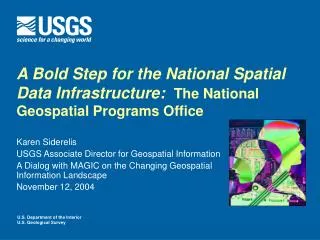
A Bold Step for the National Spatial Data Infrastructure : The National Geospatial Programs Office. Ivan B. DeLoatch Staff Director, FGDC Coordination Group Meeting September 21, 2004. U.S. Department of the Interior U.S. Geological Survey. Goals for the NSDI.

E N D
A Bold Step for the National Spatial Data Infrastructure:The National Geospatial Programs Office Ivan B. DeLoatch Staff Director, FGDC Coordination Group Meeting September 21, 2004 U.S. Department of the Interior U.S. Geological Survey
Goals for the NSDI • Rich data holdings in many hands • Skilled expertise of many entities • Data continually acquired in many ways • Great advances in many technologies • Endless potential for many uses • Essential partnerships in many communities
Strategic Alignment of USGS Programs • Visible, national geospatial programs • Early adopter of GIS technology • Major producer and user of geospatial data • Time to bring it all together
A Bold Step • National Geospatial Programs Office • Align national geospatial activities and responsibilities • Federal Geographic Data Committee • Geospatial One Stop • The National Map • Interior Enterprise GIS • Reaffirm the direction of individual activities • Expand partnership offices • Assess USGS geospatial products and services • Geographic Research Focus
Within the Next 90 Days • Develop and deliver plan for the National Geospatial Programs Office • Contribute to completion of the NSDI Future Directions Initiative • Ensure the two plans complement one another • Seek partner involvement at every stage
NSDI Future Directions • Forging partnerships with purpose • Making Framework real • Communicating the message
Vision of The National Map • Seamless, continuously maintained, nationally consistent set of base geographic data • Developed and maintained through partnerships • National framework for science, land and resource management, recreation, policy making, and homeland security • Available over the Internet • Source for revised topographic maps
Connecting the Components • Integrated base data – The National Map • Coordination, standards, policy – Federal Geographic Data Committee • Discovery and access – Geospatial One Stop Coordination& Standards Consistent & Current Content Data Discovery & Access
NGPO Directions • Unify and simplify • Act as one • Achieve management excellence • Use portfolio management • Include partners in all aspects
Some Next Steps • Teams with Partners • Coordination Mechanisms • Emphasis in NSDI Future Directions • Umbrella for various steering and advisory committees • Technology Integration • Enterprise architecture • Modernization blueprint • Systems integration plan • Partnership Offices • Emphasis in NSDI Future Directions • USGS partnership offices with broader NSDI focus • IPAs with state and local entities • Expand the Competitive Cooperative Agreements Program
Some More Next Steps • Measuring Geospatial Investments • Define issues • Identify opportunities • Consider pilot • Communications Strategy for NGPO • Internal stakeholders • Other Federal Agencies • External stakeholders • Congress • Unified NSDI Web Presence • Single, visible source of NSDI message and data access • Consider enterprise portal solution • Reinforce that NGPO and its components serve the NSDI
NGPO Points of Contact • Federal Geographic Data Committee – Ivan DeLoatch • Geospatial One Stop – Mark DeMulder • The National Map – Hank Garie • Interior Enterprise GIS – Bob Pierce • Cross-cutting Partnerships – Stan Ponce • Partnership Offices – Jean, Chris, Dick, Steve…… • USGS Regional GIOs – Dru Burks, Cheryl Morris, Stephen King • General NGPO Issues – Karen Siderelis
Engaging Customers and Partners • National meetings • Focus groups and teams • Peer reviews and reports • Listening sessions • Tentative first session - October 4, 2004 • Email input • geocustomer@usgs.gov
Framing Your Questions • What do you see as the opportunities for the new NGPO? • What requirements need to be addressed from the Feds perspective? • What opportunities do you see for technical, programmatic and institutional integration?
USGS Commitments • Listen to you • Work in an integrated fashion • Implement partnerships with purpose • Emphasize standards and data models • Push for incentives
“…a new cross-cutting collaborative role is required to coordinate and leverage geospatial data investments.” Zsolt Nagy, President-elect NSGIC Testimony at Congressional Hearing June 23, 2004