Download
1 / 27
270 likes | 383 Views
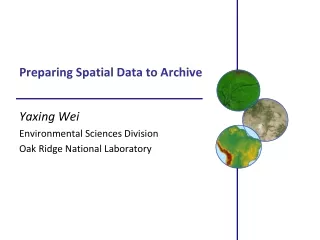
Preparing Spatial Data to Archive. Yaxing Wei & Suresh K.S. Vannan Environmental Sciences Division Oak Ridge National Laboratory. Spatial Data. Any data with location information Feature data: “ object ” with location and other properties

E N D
Preparing Spatial Data to Archive Yaxing Wei& Suresh K.S. Vannan Environmental Sciences Division Oak Ridge National Laboratory
Spatial Data • Any data with location information • Feature data: “object” with location and other properties • AmeriFlux sites/instruments, rivers, ecoregion boundaries • Coverage data: “phenomenon” spanning spatial extent / temporal period • AmeriFlux site GPP time series (1-D) • one scene of MODIS LAI (2-D) • global 1°monthly model output NEE (3-D) • …. From Microsoft GTOPO30 Elevation
Critical Things for Spatial Data Where: spatial information Spatial Reference System: datum and projection Spatial extent/resolution/boundary When: temporal information Calendar Time units & extent/resolution/boundary What: data content Data format: structure & organization Units, scale, missing value, …
Bottom Line These critical things have to be PROVIDED and CORRECT, even if they are provided in human-understandable ways!
Spatial Reference System (SRS) Datum: a system which allows the location of latitudes and longitudes (and heights) to be identified onto the surface of the Earth Sphere / Spheroid Projection: define a way to flatten the Earth surface SRID: code representing pre-defined popular SRS, e.g. EPSG:4326 http://spatialreference.org
Spatial Example (1) Where is an AmeriFlux site located? Valles Caldera Mixed Conifer / US-Vcm Latitude: 35.8884 Longitude: -106.5321 Elevation: 3003m Precision: on the order of 10 meters Datum: shape and center of the earth NAD83 (e.g. USGS NHD) or WGS84 (e.g. GPS) Do I care? Not if 1-2 meters difference doesn’t matter Vertical datum
Spatial Example (2) Where do my data represent? Regular gridded data: all grid cells have consistent size (e.g. NACP regional TBM output) Define your SRS Sphere-based GCS (radius of the earth: 6370997m) Provide X/Y spatial resolution: size of a grid cell X: 1-degree, Y: 1-degree Provide spatial extent: outer boundary of all cells West: -170, South: 10, East: -50, North: 84
Spatial Example (2) Con’t Where do my data represent? Irregular gridded data (e.g. 10242 Spherical Geodesic Grid) Define your SRS Provide coordinates for each vertex of each polygon Provide coordinates for the center of each polygon
Spatial Example (3) SRS for Daymet data 1-km daily surface weather and climatological data Projection: Lambert Conformal Conic projection units: meters datum (spheroid): WGS_84 1st standard parallel: 25 deg N 2nd standard parallel: 60 deg N Central meridian: -100 deg (W) Latitude of origin: 42.5 deg N false easting: 0 false northing: 0 Minimum Temperature
Temporal Example (1) What calendar does a model use? julian: one leap year in every 4 years gregorian: leap year if either (i) it is divisible by 4 but not by 100 or (ii) it is divisible by 400 proleptic_gregorian: gregorian calendar extended to dates before 1582-10-15 365_day: no leap year, Feb. always has 28 days 360_day: 30 days for each month 366_day: all leap years • gregorian is the internationally used civil calendar • MsTMIP project chose proleptic_gregorian calendar
Temporal Example (2) Specify the time a measurement was made “the measurement was made at 6 in the afternoon on March 22, 2010 and it took 1 hour 20 minutes and 30 seconds” - BAD ISO 8601: representation of dates and times Time point: YYYY-MM-DDThh:mm:ss.sTZD(2010-03-22T18:00:00.00-06:00) Duration: P[n]Y[n]M[n]DT[n]H[n]M[n]S (PT1H20M30S)
Bad Practice (1) • Global Maps Of Atmospheric Nitrogen Deposition, 1860, 1993, and 2050
Bad Practice (2) • Precision • Spatial Reference Norfolk - UK More than 200 people - nearly all of them adults - live in each house and apartment in the southernmost corner of the city's West Ghent neighborhood. At least that's according to the latest census figures, which show an astonishing population growth rate of 8,300 percent within the handful of blocks south of Redgate Avenue.
Bad Practice (3) Time in Daymet Time information was messed up in the alpha release of Daymet data Daymet has data for 365 days in every year, so we thought it used the “365_day” calendar No! It has leap years. It removed December 31st instead of Feb 29th in leap years. We reset its calendar to “gregorian”
A Not-so-Good Practice Circum-Arctic Map of Permafrost and Ground Ice Conditions It provides a 25km by 25km gridded map in BINARY format along with a header file and SRS definition in readme Header: nrows 721 ncols 721 nbits 8 byteorder I ulxmap -9024309 ulymap 9024309 xdim 25067.525 ydim 25067.525 SRS Definition: Projection: Lambert AzimuthalUnits: metersSpheroid: definedMajor Axis: 6371228.00000Minor Axis: 6371228.000longitude of center of projection: 0latitude of center of projection: 90false easting (meters): 0.00000false northing (meters): 0.00000
Make a Step Forward Choose “GOOD” formats to store your spatial data and provide spatial/temporal information in STANDARD ways
“Good” Formats Open and non-proprietary Simple and commonly used More importantly, self-descriptive Interpretative metadata is included inside data • Feature Data Formats • Shapefile • KML • GML • ESRI Geodatabase • Coverage Data Formats • GeoTIFF • netCDF v3/v4 • HDF-EOS
Standard Ways for Interpretative Metadata Climate and Forecast (CF) Metadata Convention CF Standard Names CF Convention Spatial/temporal coordinates Cell boundaries/shape/methods Missing data Data units ….. Many more, just google “cf metadata”
NetCDF + CF Convention NetCDF + CF: perfect combination for climate change and earth system model data The NetCDF classic model provides a clean way to organize multi-dimensional data The NetCDF enhanced model is suitable for more complex data NetCDF v4 supports internal compression NetCDF is supported by many tools: Matlab, IDL, Ferret, Python, NCO, Panoply, … CF makes data analysis can be automated
Specify Spatial Info in NetCDF (1) Define SRS short lambert_conformal_conic; :grid_mapping_name = "lambert_conformal_conic"; :longitude_of_central_meridian = -100.0; // double :latitude_of_projection_origin = 42.5; // double :false_easting = 0.0; // double :false_northing = 0.0; // double :standard_parallel = 25.0, 60.0; // double
Specify Spatial Info in NetCDF (2) Provide cell center coordinates in Geographic Lat/Lon SRS and native SRS (if different) double x(x=162); :units = "m"; :long_name = "x coordinate of grid cell"; :standard_name = "projection_x_coordinate"; double y(y=227); :units = "m"; :long_name = "y coordinate of grid cell"; :standard_name = "projection_y_coordinate”; double lat(y=227, x=162); :units = "degrees_north"; :long_name = "latitude coordinate"; :standard_name = "latitude"; double lon(y=227, x=162); :units = "degrees_east"; :long_name = "longitude coordinate"; :standard_name = "longitude”;
Specify Spatial Info in NetCDF (3) Specify cell boundaries Left-right boundary Bottom-top boundary double lat_bnds(lat=360, nv=2); :units = "degrees_north"; double lon_bnds(lon=720, nv=2); :units = "degrees_east"; double lat(lat=360); :bounds = "lat_bnds"; :units = "degrees_north"; double lon(lon=720); :bounds = "lon_bnds"; :units = "degrees_east";
Specify Temporal Info in NetCDF Specify calendar and time coordinate Specify time step boundaries 2008 Daymet Daily Average Vapor Pressure Calendar: gregorian Time coordinate units: days since 1980-01-01T00:00:00Z Time coordinate values: 10227.5, 10228.5, 10229.5, 10230.5, 10231.5, …, 10590.5, 10591.5 (Dec 30th noon) Time step boundaries: 10227,10228; 10228,10229; …; 10590,10591; 10591,10592 (start,end of Dec 30th)
Cell Methods To describe the characteristic of a variable that is represented by grid cell values NARR dswrf: 3-hourly average, average across a 32km by 32km region NARR precip: 3-hourly accumulated, average across a 32km by 32km region cell_methods “time: mean area: mean” “time: sum area: mean” point Sum maximum median mid_range minimum mean mode standard_deviation variance
Missing Data Use _FillValue, missing_value, valid_min, valid_max, and valid_range to indicate what values in a variable are considered to be valid or what values shall be ignored. float nbp(time=20, lat=74, lon=120); :_FillValue = -99999.0f; // float
Data Units UDUNITS Support conversion of unit specifications Support arithmetic manipulation of units conversion of values between compatible scales of measurement Follow the rules and computers can then do a lot of work for you and others. Units for Gross Primary Productivity (GPP) kg m-2 s-1 Kg/m2/month kgC m-2 s-1
Summary Provide spatial and temporal information completely and accurately Choose good formats to organize the data content and make them self-descriptive Provide interpretative metadata in standard ways You will be returned a lot by doing this Your data will be easily understood by not only users but also computers A lot of data visualization and analysis can be automated Your data can be ingested into many existing Web services to provide on-demand data distribution to users Value of your data can be preserved longer into the future