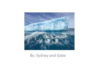
Marine Weather Forecast for Antarctica 2011
190 likes | 288 Views
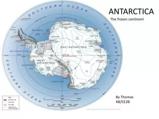
Detailed marine weather forecast for 2011 for the South Shetland Islands in Antarctica. Includes information on wind, wave heights, and weather patterns for the upcoming days.

Marine Weather Forecast for Antarctica 2011
E N D
Presentation Transcript
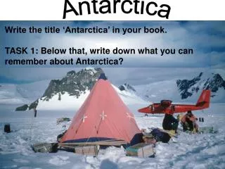
Antarctica Forecasts2011 Frances Achorn/OAB Wednesday, January 05, 2011
Agenda • Forecast overview • What’s different for 2011 • Graphics • Text • GFE • Procedures • Examples
Forecast Overview • NOAA National Marine Fisheries Service, Antarctic Ecosystem Research Division has requested forecasts to support their 25th annual U.S. Antarctic Marine Living Resources (AMLR) cruise. • The forecast will be twice daily (15Z and 03Z) from Jan 8 through approx Mar 18, but no later than Mar 30. • The forecast will consist of a 5 day text forecast, a 48 hour surface chart, a 48 hour wind/wave chart and an automated satellite picture.
What’s Different for 2011 - Graphics • NMF does not require the ice chart this year. • The ice edge will be automatically added to the wind/wave VGF during its creation.
What’s Different for 2011 - Text • The EDIT_ANTARCTIC_FCST.CSH script will update the previous forecast’s dates and times and add or remove periods as appropriate. • To accommodate AMLR’s South Area, text forecasts will extend 0.5 deg further south to 64.5S. Antarctic_Zones.vgf has been updated to reflect this. • Text forecasts will more closely follow a typical offshore format. • One synopsis will cover the entire forecast and days 3-5 will contain warnings, winds and waves. • BE AS BRIEF AS POSSIBLE ON DAYS 3-5! The extended period is meant to be an outlook only. Try to keep it as short as possible, perhaps even limiting each day to 2 lines of text.
What’s Different for 2011 - Text • Text forecasts will be done in local time: Chilean Summer Time (CLST): • 03Z = 00:00 CLST • 09Z = 06:00 CLST • 15Z = 12:00 CLST • 21Z = 18:00 CLST • The first period will be either 1200 to 1800 CLST (this afternoon) or 0000 to 0600 CLST (tonight). • 12 hour text periods will span 0600 to 1800 CLST (day) or 1800 CLST to 0600 CLST (night). • 24 hour text periods will span 0600 to 0600 CLST.
What’s Different for 2011 - GFE • OAB has been working on a GFE option for producing the text. • This will not be a day 1 capability, as some additional development and training will be needed. • At the very least, it should provide us with a good first guess that can then be modified by hand.
Procedures • SOPs have been consolidated and updated for 2011. They contain all this information in much greater, step-by-step detail. • Graphics: • Load data • Use ANTARCTICDATA.spf or your own SPF converted with antarctic_spf.csh • Create VGFs from the model • Move labels for readability • Add fronts • No isopleths are on the VGFs! They are added during launch.
Procedures • Text: • Update the forecast with EDIT_ANTARCTIC_FCST.CSH. • Be brief! • Launch: • Read the prompts • Be careful to choose the same model/cycle you used to create the VGFs! • Look at the preview carefully! • Check the resulting email in the sigopc email account.
SPECIAL MARINE FORECAST NWS OCEAN PREDICTION CENTER WASHINGTON DC 1200 PM CLST WED JAN 5 2011 MARINE WEATHER FOR THE SOUTH SHETLAND ISLANDS...ANTARCTICA FROM 64.5S TO 60S BETWEEN 63W AND 53W. SEAS GIVEN AS SIGNIFICANT WAVE HEIGHT...WHICH IS THE AVERAGE HEIGHT OF THE HIGHEST 1/3 OF THE WAVES. INDIVIDUAL WAVES MAY BE MORE THAN TWICE THE SIGNIFICANT WAVE HEIGHT. DAY FORECASTS: 06:00 - 18:00 CLST/09:00 - 21:00 UTC NIGHT FORECASTS: 18:00 - 06:00 CLST/21:00 - 09:00 UTC .SYNOPSIS...A SERIES OF LOW PRES SYSTEMS WILL CROSS THE FORECAST AREA OVER THE NEXT FEW DAYS. A HIGH PRES RIDGE WILL APPROACH OVER THE WEEKEND...AND PERSIST OVER THE REGION EARLY NEXT WEEK. $$ N AND W OF THE SHETLAND ISLANDS TO 63W AND NORTH TO 60S- .THIS AFTERNOON...SW TO W WINDS 15 TO 20 KT. SEAS 6 TO 9 FT. SCATTERED SNOW SHOWERS. .TONIGHT...W WINDS 10 TO 15 KT...BECOMING NW 20 TO 25 KT AFTER MIDNIGHT. SEAS 7 TO 10 FT. .THU...NW WINDS 25 TO 30 KT...BECOMING W IN THE AFTERNOON. SEAS 10 TO 15 FT. SCATTERED SNOW SHOWERS. .THU NIGHT...W WINDS 20 TO 25 KT. SEAS 11 TO 16 FT. .FRI...W TO NW WINDS 20 TO 25 KT...DIMINISHING TO 15 TO 20 KT LATE. SEAS 10 TO 15 FT...SUBSIDING TO 7 TO 10 FT LATE. .SAT...SW TO W WINDS 20 TO 25 KT...DIMINISHING TO 15 TO 20 KT LATE. SEAS 6 TO 9 FT. .SUN...SW TO W WINDS 20 TO 25 KT...DIMINISHING TO 15 TO 20 KT LATE. SEAS 6 TO 9 FT. $$ S AND E OF THE SHETLAND ISLANDS TO 53W AND SOUTH TO 64S- .THIS AFTERNOON...E OF 58W...S TO SW WINDS 15 TO 20 KT. W OF 58W...W TO NW WINDS 10 KT. SEAS 4 TO 6 FT. SCATTERED SNOW SHOWERS. .TONIGHT...W WINDS 10 TO 15 KT...BECOMING N TO NW AFTER MIDNIGHT. SEAS 4 TO 6 FT. .THU...E OF 58W...N TO NW WINDS 15 TO 20 KT. W OF 58W...NE WINDS 10 KT...BECOMING SW TO W 15 TO 20 KT IN THE AFTERNOON. SEAS 5 TO 7 FT. SCATTERED SNOW SHOWERS. .THU NIGHT...W WINDS 20 TO 25 KT...INCREASING TO 25 TO 30 KT AFTER MIDNIGHT. SEAS 7 TO 10 FT. .FRI...W WINDS 25 TO 30 KT...BECOMING W TO NW 20 TO 25 KT LATE. SEAS 6 TO 9 FT. .SAT...W WINDS 20 TO 25 KT. SEAS 4 TO 6 FT. .SUN...SW WINDS 20 TO 25 KT...DIMINISHING TO 15 TO 20 KT LATE. SEAS 4 TO 6 FT. $$ .FORECASTER ACHORN. OCEAN PREDICTION CENTER. Examples - Text