Download
1 / 53
530 likes | 557 Views
Learn about the stages of tropical cyclone development, hurricane categories, and their impact on marine safety. Reference key publications for in-depth knowledge.

E N D
REFERENCES * These are just of few of the references available covering Tropical Cyclones, their effects on the Marine Industry and Marine Safety. * • Mariner’s Guide for Hurricane Awareness in the North Atlantic Basin (NOAA) • American Practical Navigator (Bowditch) • Port Heavy Weather Guide • Hurricane Havens Handbook for the North Atlantic (U.S. Navy)
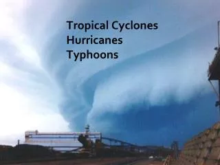
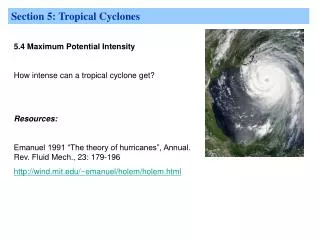
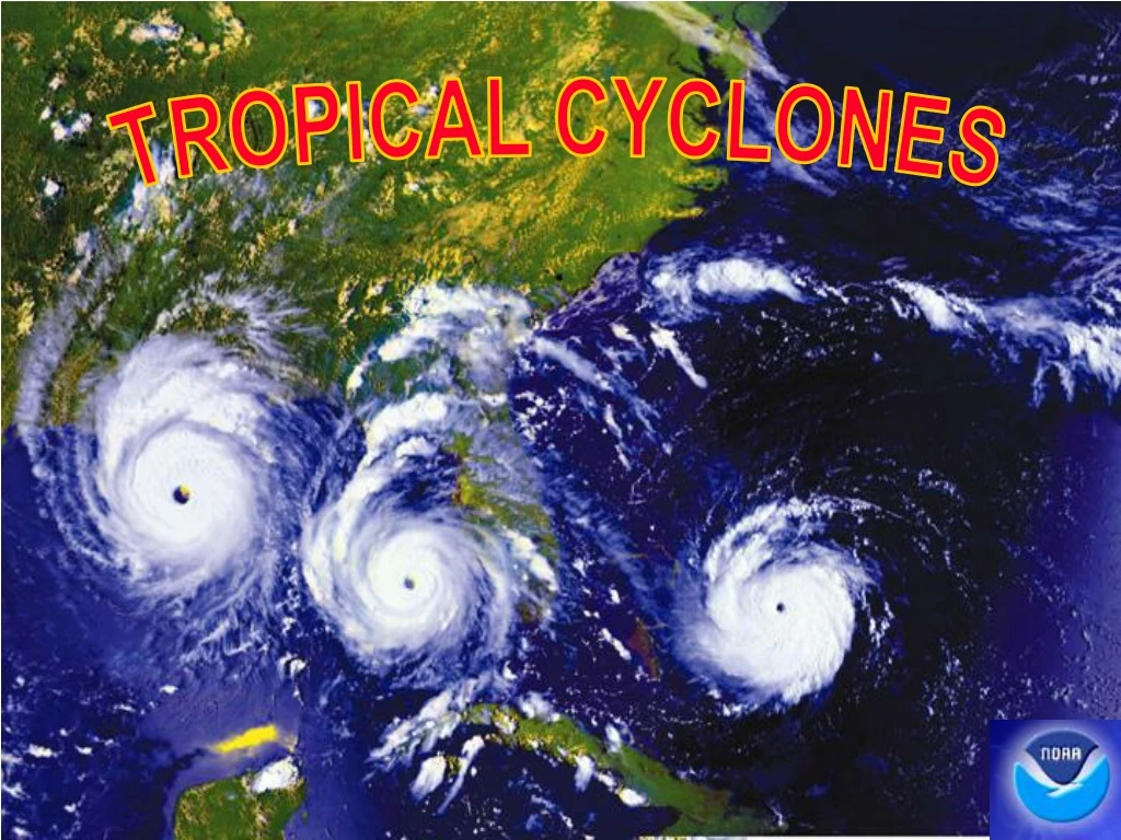
TROPICAL CYCLONE DEFINED! • A warm core, non-frontal, synoptic scale system with cyclonically rotating windscharacterized by a rapid decrease in pressure and increase in winds toward the center of the storm. Cyclones develop over tropical or subtropical waters and have a definite organized circulation.
How do they develop? Favorable environmental conditions that must be in place before a tropical cyclone can form: • Warm ocean waters (at least 80°F / 27°C). • An atmosphere which cools fast with height (potentially unstable). • Moist air near the mid-level of the troposphere (16,000 ft / 4,900 m). • Generally a minimum distance of at least 300 miles (480 km) from the equator. • A pre-existing near-surface disturbance. • Little vertical wind shear between the surface and the upper troposphere. (Vertical wind shear is the change in wind speed with height.) • Outflow aloft/exhaust
STAGES OF DEVELOPMENT • Tropical Depression(TD): A tropical cyclone with windspeeds up to 33knots.Identified by the letters “TD” and suffixed by a number (TD-01: the first tropical depression of the current calendar year.....TD-02, the second, etc...) • Tropical Storm (TS): A tropical cyclone with wind speeds 34 to 63knots. Identified by names in alphabetical order consistent with formation date/time. (TS Arthur, Bertha...). • Hurricane: A tropical cyclone with wind speeds greater than 63 knots.Identified by the same name it had as a TS.
TROPICAL (EASTERLY) WAVE No significant winds or seas No defined near surface circulation Identified by areas of Convergence (thunderstorms)
TROPICAL DEPRESSION(Formative Stage) Winds < 34 kts Tropical wave develops a weak cyclonic circulation Identified by thickening clusters of thunderstorms on satellite Central pressure falls rapidlybelow 1002mb if system intensifies
TROPICAL STORM(Immature to Mature Stage) Winds 34 - 63 kts Closed formationexpands withspiral bands becoming better organized Increasing sea state makes navigation near the center increasingly difficult and dangerous
HURRICANE / TYPHOON / WILLY-WILLY(Mature Stage) Winds> 63 kts DANGEROUSLY HIGH SEASnavigation severely impaired Radius of strong winds may exceed 350 NM Gale Force Winds extend out further in right front quadrant (typically 120 NM)
TROPICAL CYCLONEStages of Development • 1. Tropical Easterly Wave 3. Tropical Storm • 2. Tropical Depression 4. Hurricane
Most damaging aspects of a hurricane: AT SEA: HIGH SEAS HIGH WINDS INPORT: STORM SURGE TORNADO/SVR TSTMS HIGH WINDS
HURRICANE CATEGORIES Saffir- Simpson Scale • Category 1 (Minimal) - Winds 64 to 82 knots, storm surge 4 to 5 ft above normal. No real damage to building Structures. Low lying coastal areas flooded, minor damage to piers. Examples Irene 1999 and Allison 1995 • Category 2 (Moderate) - Winds 83 to 95 knots, storm surge 6 to 8 ft above normal. Minor damage to structures, poorly constructed buildings major damage. Coastal and low lying escape routes flooded over, considerable pier damage. Examples: Bonnie 1998, Georges (FL & LA) 1998 and Gloria 1985 • Category 3 (Extensive) - Winds 96 to 113 knots, storm surge 9 to 12 ft above normal. Major damage to structures, poorly constructed building destroyed. Serious flooding along the coast, extensive flooding may extend inland 8 miles. Examples: Keith 2000, Fran 1996, Opal 1995, Alicia 1983 and Betsy 1965
HURRICANE CATEGORIEScont. Category 4(Extreme) Winds 114 to 135 knots, storm surge 13 to 18 ft above normal. Extensive roofing and window damage, complete destruction of mobile homes. Areas above 10 ft flooded inland up to 6 miles, major erosion of beaches, massive evacuation of coastal areas. (ANDREW 1992)
HURRICANE CATEGORIEScont. Category 5(Catastrophic) Winds above 135 knots, storm surge greater than 18ft above normal. Complete failure of roof structures and very severe window and door damage, some complete buildings fail. Major damage to structures lower than 15 ft above sea level, massive evacuations of residential units within 10 miles of the coast. (CAMILLE 1969) AUG 16, 1969
Richelieu Apartments The Power of a Category 5“Hurricane Camille” BEFORE! AFTER! The Mansion
TROPICAL CYCLONEFORMATION, LOCATION • The map below shows where the seven basins noted for TC development are located and typical tracks for each. It also has the average number of tropical storms, and hurricanes, created in each basin.
TROPICAL CYCLONE FORMATION CONT. 2005 ATLANTIC TROPICAL CYCLONE NAMES Arlene Bret Cindy Dennis Emily Franklin Gert Harvey Irene Jose Katrina Lee Maria Nate Ophelia Philippe Rita Stan Tammy Vince Wilma Hurricane Season Atlantic 01 June - 30 November Eastern Pacific 15 May - 30 November Western Pacific Year round
Distribution of Surface Winds • Winds are very light in the eye, and increase rapidly in the eyewall. • Fastest winds are found in the eyewall. • Gale-force winds can extend 250-400nm from the center of the storm. Hurricane Andrew Strong CAT 4
TROPICAL CYCLONECHARACTERISTICS • Feeder Bands(curved lines of convection) spiral inward to the Eye Wall. Some of the most violent weather (tornadoes/severe thunderstorms) occur in these areas • “Pumping Action”announces the approach of, and passing of the Tropical Cyclone
TROPICAL CYCLONECHARACTERISTICS, CLOUDS Clouds • Most significant clouds are heavy Cumulus and Cumulonimbus • Spiral bands of CU/CB inward toward outer edge of eye • Cirrus changing to Cirrostratus and lowering, good indicator of approaching TC for the mariner • Cloud sequence similar to approaching warm front
1020 1015 1010 1005 MILLIBARS 1000 995 990 985 980 975 970 18Z 21Z 15Z 18Z 21Z 00Z 00Z 15Z 03Z 06Z 09Z 03Z 06Z 09Z 18AUG15Z 19AUG 12Z 20AUG 12Z TROPICAL CYCLONECHARACTERISTICS, ISOBARS/PRESSURE BAROGRAPH TRACEHurricane Bob 1991 Newport, RI Isobars nearly symmetrical or elliptical in shape Tightest isobaric gradient to right of storms line of movement Central pressures well below average (890 – 940 mb not uncommon) Barograph trace often shows “V” as eye passes (not something a ship wishes to see).
Hurricane Isabel Track Guidance 1800 UTC 10 Sep 2003
NOT-SO EXCELLENT! “HURRICANE KATE” 29 SEP 2003
BIG IMPROVEMENTS IN TC TRACK FORECASTS OVER RECENT DECADE, ESPECIALLY BEYOND 2 DAYS
UNDERWAY • A wise mariner needs to know what to do if warnings are in error (or plotted incorrectly), or they get caught unaware, and end up in the vicinity of a tropical cyclone at sea!
MONITOR THE STORM National Hurricane Center issues warnings every 6 hours 0300Z, 0900Z, 1500Z, 2100Z • NAVTEX • SafetyNet • Annotated on weather facsimile charts • Private weather routing companies • E-mail List servers from the National Hurricane Center
WARNING’S • Upon Receipt of Warning: 1.Plot the current and forecast 24 hour storm positions and forecast radius of 35 kt winds. 2. Using a compass extend the radius of the forecast 24 hour 35 kt wind area by 100 NM. 100 NM 135 NM CURRENT POSITION 24 HR FORECAST POSITION
WARNING’S, cont. 3.Draw tangents relative to the direction of the storm from the 35 kt radius (current position) to the outermost radius at the 24 hr forecast position. Avoid theDANGER AREA TANGENT 100 NM DANGER AREA 100 NM TANGENT CURRENT POSITION 24 HR FORECAST POSITION
WARNING’S, cont. 4. Use the same procedure for the 48 and 72 hr forecast positions, however, use 200 and 300 NM radii/respectively. Avoid theDANGER AREA. 300 NM 200 NM DANGER AREA 100 NM DANGER AREA 300 NM 200 NM DANGER AREA 100 NM 72 Hr Current 48 Hr 24 Hr
Meteorological elements are not uniformly distributed throughout a tropical Storm is divided into left/right semicircles and quadrants, relative to the direction of motion Usually strongest winds are on right side in N.H. (added to motion) TROPICAL CYCLONE EVASION
TROPICAL CYCLONE EVASION cont. • Storm’s location relative • to own ship’s position: • Dangeroussemi-circle: • Wind greater due to wind • augmented by the forward • motion of the storm. • “Less Dangerous” semi-circle: • Wind decreased by forward • motion of the storm. Winds and seas force vessel into path of storm. Winds blow vessel away from storm track.
TROPICAL CYCLONE EVASION cont. • Ship in the “Dangerous” (right) semi-circle: • 1. Maneuver ship so relative wind is from 045 degrees to starboard. • 2. Continually hold course with respect to relative wind, making best way possible. 045 DEG REL
TROPICAL CYCLONE EVASION cont. • Ship in the “Less Dangerous” (left) semi-circle: • 1. Maneuver ship so that relative wind is from 135 degrees to starboard. • 2. Hold course with respect to relative wind, and make best SOA. 135 DEG REL
TROPICAL CYCLONE EVASION cont. 157 DEG REL BEHIND CENTER (ON STORM TRACK) Avoid center by best practical course (storm may recurve). AHEAD OF CENTER (ON STORM TRACK) Maneuver ship so that relative wind is 157 degrees relative, hold course and speed.
TROPICAL CYCLONE EVASION cont. • DO NOT CROSS THE “T”unless the ship is > 300 NM ahead of the storm and crossing right to left. 300 NM +
TROPICAL CYCLONE EVASION cont. Never cross the “T”:Do not plan to cross the track of a hurricane. NEVER LEFT TO RIGHT! Respect the negative effects that heavy weather places on vessel speed/handling. Sudden accelerations in hurricane motion can ultimately place a vessel in conditions not originally expected, resulting in disaster! Adjustments to course & speed in order to remain clear of the danger area in a hurricane are the most prudent navigation decisions a mariner can make in these instances. If it becomes necessary to cross the “T” right to left, ensure you are at least300NM from the center. Follow the 1 – 2 – 3 Rule
TROPICAL CYCLONE EVASION cont. • Monitor warnings and advisories to prevent an encounter. • Forecast Track Tendencies:Comparison of the most recent NHC forecast track with forecast tracks from the past 24 hours can be useful for determining a trend in the forecast motion of a hurricane. • For instance, a comparison of forecast tracks issued every 6 hours over the last 24 hours, may show a noticeable shift right or left (with respect to storm motion) in the forecast track of a hurricane. This information may provide some indication as to how the forecast & actual hurricane track are trending and provide more guidance in navigation planning for avoidance, particularly in the 2-3 day forecast range & beyond.
TROPICAL CYCLONE EVASION cont. Assess your options:Plan Ahead. Never leave yourself with only a single navigation option when attempting to avoid a hurricane. Sea room to maneuver is not a significant factor when operating in the open waters of the North Atlantic, but becomes extremely important in the confined waters of the Western Caribbean Sea/Gulf of Mexico. More often than not, early decisions to leave restricted maneuver areas are the most sensible choice.
MONITORING THE STORM NHC Warnings/Bulletins Local Radio / TV stations Port Authority / Coast Guard • Internet
CONDITIONS OF READINESS CONDITION 5-Destructive force winds (35 kts or as specified ) are possible within 96 hours. CONDITION 4- Destructive force winds are possible within 72 hours. Whiskey CONDITION 3- Destructive force winds are possible within 48 hours. X-Ray CONDITION 2- Destructive force winds are anticipatedwithin 24 hours. Yankee CONDITION 1- Destructive force winds are anticipated within 12 hours. Zulu These are the most common conditions of readiness.
Stay Inport orRide it out at Sea? Factors to consider! • The decision to leave port for hurricane avoidance must be made very early, and must be balanced with a number of other factors - Storm Intensity, Size, Strength, and Speed. - Port Facilities, Berthing & Shelter Requirements - 24 hours prior to onset of gale force winds. - Probability of Hit (angle of approach) - Vessel, size, speed, engineering status - Time window to clear last vessel - Vessel Route (safe, heavy seas, etc...) * Early decisions to leave port in an attempt to avoid hurricanes are crucial.*
Ports Evaluated in Hurricane Havens Handbook for the North Atlantic(U.S. Navy) 1 - BOSTON 2 - NEWPORT 3 - NEW LONDON 4 - NEW YORK CITY 5 - PHILADELPHIA 6 - NORFOLK 7 - MOREHEAD CITY 8 - CHARLESTON 9 - SAVANNAH 10 - KINGS BAY 11 - MAYPORT 12 - PORT EVERGLADES 13 - KEY WEST 14 - TAMPA 15 - PENSACOLA 16 - GULFPORT 17 - NEW ORLEANS 18 - PORT ARTHUR 19 - GUANTANAMO BAY 20 - ROOSEVELT ROADS 21 - BERMUDA 1 4 1 2 3 16 8 5 10 6 7 9 21 11 12 14 18 15 17 13 19 20
TROPICAL CYCLONE DISSIPATION Recurvature: Tropical storm curves towards the NNE-E. Usually accelerating and decreasing in strength, often increasing in size. Speed is difficult to forecast. Frictional forces of land: Often becoming extra-tropical as storm merges with frontal zone. Unfavorable atmospheric/oceanographic influences: Includes, but not limited to, upper level shearing, dry air intrusion in mid levels, cooler sea surface temperatures, upwelling behind other tropical systems, etc… “Floyd” “Charley”