Download
1 / 27
270 likes | 460 Views
Ensemble Forecasting and You The very basics. Richard H. Grumm National Weather Service State College PA 16803. The big WHY.

E N D
Ensemble Forecasting and YouThe very basics Richard H. Grumm National Weather Service State College PA 16803
The big WHY Figure 2-1. The fundamental problem with numerical weather prediction include the uncertainty with the initial data and resulting initial conditions, the forecast methods used to produce the forecast, and the resulting forecast. The smaller oval about the initial conditions reflects inexact knowledge and the larger ellipse about the forecast shows the error growth. Thus we know more about the intial condition state than the forecast state.
NWP has a basic Premise Xt = M(xo) + f Which states that our model (M) starts with some initial state (xo) and external forcing factors (f) which integrated over time produce a forecast (Xt ) which is how in Figure I-1 the initial conditions provide a forecast. The predictability at a time (t) is a function of the propagation of errors.
Errors as a Function of scaleHorizontal Scale Error doubling rate da ys Figure 2-2. The error growth in days verses the horizontal scale (km) of weather phenomena. The general issue is that error rates double faster for finer scale weather phenomena. Scale of feature or l in km
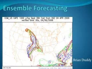
When it comes to convection…we predict this or that but get this! Figure 2-3. Example of high resolution forecasts of simulate radar from 3 NCEP 4km NAM forecasts valid at 0300 UTC 27 September and the verifying radar.
Models Are not perfect • But we often think they are • We often use them like they are • But they are not • We need to think probabilistically.
Tough Forecast when precipitation type is an issue which model had snow? Which member had sleet? Figure 2—3.1 Simple pie chart showing the probability by precipitation based on the ensemble forecast system with 21 members during a mixed precipitation event. Values expressed as percentages.
Ensembles • Facilitate dealing with uncertainty • We need to know where the uncertainty is • High low confidence forecast • Low high confidence forecast • We need to convey uncertainty to users • And accept it ourselves
Forecast Guidance We use • NCEP • Global Forecast System 27km • North American Meso-Model 12km • Nested 4km NAM • SREF 16km 21 members • GEFS 55 km 21 members • NAEFS CMCE and GEFS • EC/UK • HRRR 3km
Model Resolution • 6Δrule (4Δ to 6Δ) • model grids to sense a wave or feature! • 120 km frontal band needs about 20 km resolution to fully resolve feature! • 12 km supercell ~ 2km model to resolve! • Models may not resolve so parameterize things • We often fail to account for this predictability issue
120 km wave or frontal bandmore points the more of the wave we sense
Things we forget when using models • Initial conditions matter • Model resolution and physics matter • But our fundamental problem remains • Synoptic Probabilistic forecasting Xt = M(xo) + f
Synoptic part • Need to know patterns for event types • The standardized anomalies help identify key parameters in the pattern • Tie in ensembles to get probabilistic feel.
GEFS and GFS Forecasts • Use on POPS, Winds and PW to keep short. • What is a big 12, 24 or 48 hour QPF amount in the NCEP GEFS? • Look at some POP probabilities • Then the pattern
Probabilities in Pattern • Confidence in significant pattern • Potential here for heavy rain and strong winds • Impressive high PW surge with strong winds • Confidence in high QPF potential
Synoptic Probabilistic Forecasting • Need to know patterns for event types • Need to know the potential of the pattern verifying requires Ensemble prediction system data • Ensemble probabilities close the loop.
Wrapping up here…Ensembles help us Characterize Uncertainty to make better forecasts Figure 2-1. The fundamental problem with numerical weather prediction include the uncertainty with the initial data and resulting initial conditions, the forecast methods used to produce the forecast, and the resulting forecast. The smaller oval about the initial conditions reflects inexact knowledge and the larger ellipse about the forecast shows the error growth. Thus we know more about the intial condition state than the forecast state.
Leverage patterns and probabilities • Know key synoptic patterns and parameters • Leverage Synoptic Probabilistic forecasting • Requires ensembles because….. Xt = M(xo) + f