Download
1 / 27
280 likes | 514 Views
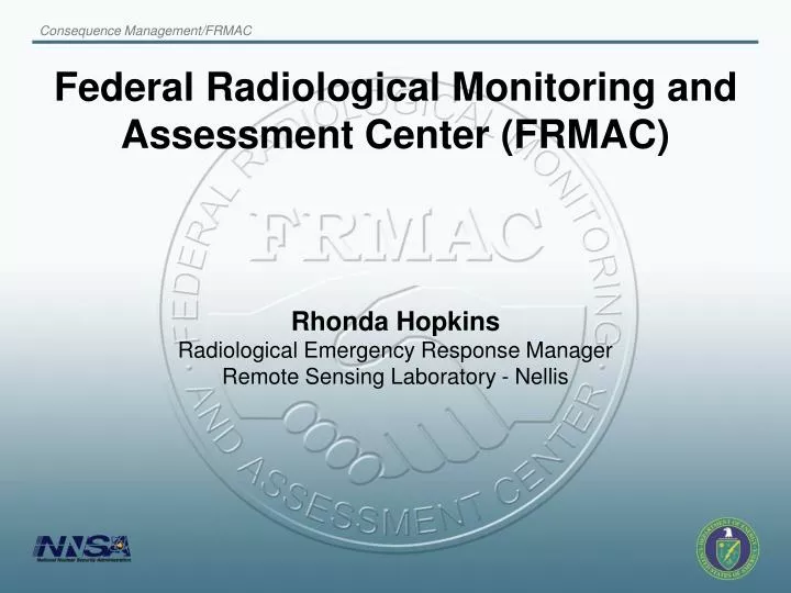
Federal Radiological Monitoring and Assessment Center (FRMAC). Rhonda Hopkins Radiological Emergency Response Manager Remote Sensing Laboratory - Nellis. Purpose of FRMAC. Assist the states in their mission to protect the health and well being of their citizens:

E N D
Federal Radiological Monitoring and Assessment Center (FRMAC) Rhonda Hopkins Radiological Emergency Response Manager Remote Sensing Laboratory - Nellis
Purpose of FRMAC • Assist the states in their mission to protect the health and well being of their citizens: • Provide initial prediction based on source term estimate • Verify and validate prediction based on ground monitoring data and fixed wing surveys • Comprehensive characterization of environmental and public impacts based on ground monitoring, sampling and analysis, and rotary-wing survey data
Federal Response • Regardless of the Coordinating Agency • DOE coordinates radiological monitoring and assessment activities for the emergency and intermediate phases • EPA coordinates the intermediate to long-term activities for radiological monitoring and assessment • Advisory Team (EPA, CDC, FDA, USDA) • Provides PARs to the State / Local / Tribal representatives • FRMAC (Multi-Agency) • Coordinates monitoring, analysis, and assessment • Provides data products to the State / Local / Tribal representatives
Coordinated Radiological Emergency Response Gather facts Use Protective Action Guidelines and facts to make projections RAP, CMHT, CMRT I, CMRT II, Augmentation, FRMAC Make protective action recommendations Shelter-in-Place Evacuate Return Recovery State and Local Governments Coordinating Agency and Advisory Team
CM Home Team • Bridge Line Coordinator • GIS Scientist • Assessment Scientist • Position filled by scientists from the National Labs • RSL scientist from CMRT II may also assist initially • NARAC Support Personnel
CMHT Capabilities • CM Web • Provides access to maps and other data products • Early Data Entry via RAMS • Allows responders to report field data related to radiation in real time to CMHT • Bridge line (up to 20 callers per line) • BLC monitors bridge line 24/7 and makes all necessary provisions for technical and logistical discussions • States, EPA, Advisory Team, and NARAC notified
8 8 5 1 6 7 2 3 7 2 4 2 Radiological Assistance Program • Advise on radiological issues • First responder - arrives in 4-6 hours • Assist with radioactive material recovery • Assist with the characterization of radiological incident • A link to other DOE assets for assistance
The first 15 min – 1 hour • Initial NARAC / IMAAC predictive model • Estimates based on information available • Source term • Wind direction and speed • Used by the state to make decisions on public safety • Based on EPA Protective Action Guidelines • Available through the CMWeb (account access required)
What to expect within 2 – 4 hours • Additional NARAC / IMMAC models • Information refined to include • Different isotopic mixes, affected population, expected dose levels • Applications • Refine protective action • Available through the NARAC / CM Web Site • CMHT stood-up and available to assist • RAP Team en-route or arriving on scene
AMS Fixed Wing • Beechcraft King Air B-200 • Twin-engine turbo prop • IFR (all weather) rated • 260 knots (300 mph) • Range 1,130 nm (1,300 sm) • Max endurance 5 hrs (without refueling) • Four-person crew • Pilot and co-pilot • Scientist/Health physicist • Technician/Technologist
AMS Rotary Wing • Bell-412 • Twin-Pac turbo shaft engine • IFR (all weather) rated • 120 knots (140 mph) • Range 360 nm (410 sm) • Max Endurance 3 hrs (without refueling) • Three-person crew • Pilot and co-pilot • Technician/Technologist • Ground Support • Scientist/Health physicist • Data Analyst • Aircraft mechanic
Mission Parameters • Radiological Mapping Phase • Rapid Overview – Emergency Response • Altitude: 500 feet • Spacing: 0.5 mile • Speed: 80 knots • Helicopter • Small Area (<25 mi2) – Detailed Survey • Altitude: 150-300 feet • Line Spacing: 250-500 feet • Speed: 70 knots On-Call Response Phase • Large Area (>25 mi2) • Altitude: 500-1,000 feet • Spacing: 1-5 miles • Speed: 140 knots • Fixed-wing Aircraft
Consequence Management Response Team I • On –Duty Responders - 26 • Equipment – 3200 pounds • Operations – 24 hours • Initial capabilities • Assessment • Geographical Information Systems • Health & Safety • Monitoring & Sampling • three field teams • Logistics
Consequence Management Response Team II • Additional responders - 38 • 24-hour/day operation for several weeks • augmented monitoring, sampling and assessment • Additional equipment – 23,000 lbs. • twenty field teams • Laboratory Analysis • sample receipt • prepare samples for transport to labs • Training for additional responders
Augmentation • Augments CMRT I & II and is staffed through the national laboratories and the RAP regions • Their main focus is sampling activities in the affected areas, dose assessment, and clean up • An additional 42 responders mobilizing within 24 hours of activation • Regionally deployed to the affected area
Paperless FRMAC • Emergency Response Organization • Unified Command • State / County EOC • Other Federal agencies
Data Products Cycle Set 3. The model is compared with a few initial field measurements to make an initial estimate of the amount released Set 1. An initial automated plot shows downwind location only with no estimate of health effects Set 2. Revised event data used to produce quality assured reach-back plots Automated Web-Initiated or via Emergency Call; Only know release time and location Example revised data: Updated source location, detailed weather Source scaled to initial set of measurements Cycle of new products based on updated sets of measure-ments Set 4. A health-effects plot is developed based on a source term estimated from field measurements Later sets: We develop Relocation and Food-Ingestion plots Set 5. We use more extensive sets of field measurements to improve the accuracy of the source term calculation
FRMAC Integration • FRMAC would like the states, locals, and tribes to co-locate and to assist in integration / coordination of operations • FRMAC uses liaisons at EOC’s and in Unified Command to facilitate information flow • Other Federal agencies integrate into FRMAC • EPA - FDA • CDC - USDA • DHS - Other Federal agencies as needed
Advisory Team • Provides coordinated advice and recommendations on environment, food and health matters to the Federal, state, local and tribal governments. • Representatives from: • EPA - FDA • CDC - USDA • DHS - Other Federal agencies as needed
Environmental Protection Agency • Assist with non-radiological hazards • Such as chemical spills, hazardous materials fires, accidental hazmat releases due to radiological event • Coordinate off-site cleanup activities • with NRC • with appropriate jurisdiction • Eventually close FRMAC in time and transition to EPA-only or other monitoring program
Transfer from DOE to EPA • At a mutually agreeable time • After consultation with DHS, the JFO Coordination Group, state, local, and tribal officials • The following conditions are to be met before transfer: • Immediate emergency condition is stabilized • Offsite release of radioactive material has ceased • Offsite radiological conditions have been characterized • Initial long-range monitoring plan has been developed • Other Federal agencies will commit required resources
CM / FRMAC Contact Information Colleen O’Laughlin NNSA / NSO - 702-295-0648 olaughlin@nv.doe.gov FRMAC Program Information http://www.nv.doe.gov/nationalsecurity/homelandsecurity/ frmac/default.htm Emergency Response Numbers (24-hr) NNSA / HQ – 202-586-8100 NARAC – 925-422-7627
Manuals • FRMAC Operations Manual – Dec. 2005 • This manual describes the Federal Radiological Monitoring and Assessment Center’s (FRMAC) response activities in a major radiological emergency • FRMAC Assessment Manuals (3 volumes) – April 2003 • These manuals provide the scientific basis and methods for assessment calculations • FRMAC Monitoring Manuals (2 volumes) – Dec. 2005 • These manuals provide the monitoring and sampling methods for a radiological response
Manuals (cont) • FRMAC Laboratory Analysis Manual – Dec. 2005 • This manual provide general guidance relating to sample tracking and analysis • FRMAC Health and Safety Manual – May 2001 • The manual describes how radiological health and safety plans will be implemented for FRMAC Link:http://www.nv.doe.gov/nationalsecurity/homelandsecurity/default.htm
Other Federal Manuals • U.S. EPA. EPA Manual of Protective Action Guides and Protective Actions for Nuclear Incidents, May 1992 (currently in revision) • U.S. Food and Drug Administration. Accidental Radioactive Contamination of Human Food and Animal Feeds, August 13, 1998 • RTM-96 Response Technical Manual, NUREG/BR-0150, Vol. 1, Rev. 4, March 1996 • Nuclear Weapon Accident Response Procedures (NARP) Manual, DoD 3150.8, February 2005